Congestion Pricing - Links to Congestion Pricing Home
Photo collage: temporary lane closure, road marking installation, cone with mounted warning light, and drum separated work zones.
Office of Operations 21st Century Operations Using 21st Century Technologies

Minnesota Urban Partnership Maps

Image Map 1 and Image Map 2
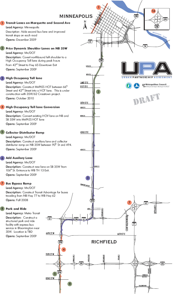
Map Image 1 is a map showing the northern portion of the Minnesota Urban Partnership project.

Image Map 1. This is a map image showing the northern portion of the Minnesota Urban Partnership project.
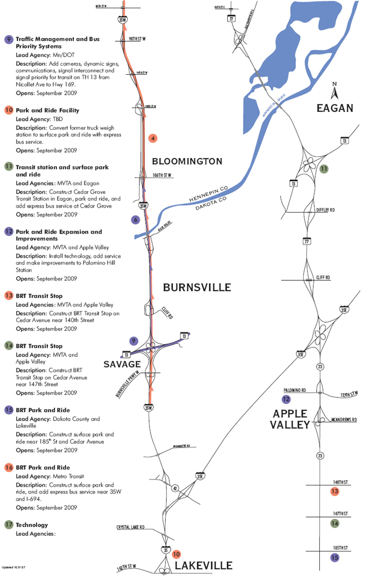
Map Image 2 is a map showing the southern portion of the Minnesota Urban Partnership project.

Image Map 2. This is a map image showing the southern portion of the Minnesota Urban Partnership project.

Office of Operations