Construction of e-Permit/VWS Model Sites: Project Summary Report
Laurel, Kentucky and Unicoi, Tennessee
Chapter 1. Introduction
In response to increasing commercial traffic volumes, staffing cuts, and the expansion of roadside enforcement personnel roles and responsibilities, States are seeking new ways to monitor and enforce truck size and weight regulations to safely manage the transportation of goods by commercial vehicles.
Known limitations of fixed weigh station-based screening and enforcement activities (e.g., ability of overweight vehicles to use routes around the fixed sites to bypass enforcement resources, high-deployment and ongoing maintenance costs, required physical footprint of a fixed facility, land costs) also provide strong motivation for States to consider new approaches to roadside compliance verification and enforcement. To address these and other issues, States are increasingly turning to "virtual weigh stations" (VWS). A VWS provides screening and monitoring capabilities like that found at fixed weigh stations but does not require continuous human staffing and can be deployed at a lower cost than a fixed site. Numerous States already have deployed virtual weigh stations as part of their roadside enforcement programs.
For this project, the Federal Highway Administration's (FHWA) Office of Freight Management and Operations and the Federal Motor Carrier Safety Administration's (FMCSA) Technology Division deployed two VWS 'Model Sites' that meet the specifications contained in the Architecture for Electronic Permitting (e‑Permit)/Virtual Weigh Stations.1 The sites are located on U.S. 25 in Laurel County, Kentucky and on Interstate 26 in Unicoi County, Tennessee. These sites are intended to demonstrate the functionality and viability of VWS and advance the "Smart Roadside Initiative" (SRI) concept developed by FHWA and FMCSA.2
The project was completed in two Phases. Phase I, Planning and Build-Up, began in the fall of 2013 and was completed in July 2014. Phase II, Implementation, began in August 2014. Site installation and performance testing was completed in early 2016. The final portion of Phase II, Site Maintenance and Support, will extend through April 30, 2019.
The purpose of this document is to provide an overview of the project, highlight project successes, issues, and resolutions, and demonstrate how each deployment was successfully implemented throughout all Phases of the project.
The content in this summary report (task 6) largely follows the Task structure used to develop this project and is organized as follows:
- Chapter 2 (Task 1). Provides a brief overview of the project plan and project management approach.
- Chapter 3 (Task 2). Includes an inventory and assessment of current conditions at each of the target sites.
- Chapter 4 (Task 3). Describes the test and implementation plan for the model sites.
- Chapter 5 (Task 4). Summarizes site construction and implementation.
- Chapter 6 (Task 5). Analyzes site performance and provides recommendations and responses to an independent analysis conducted by Oak Ridge National Laboratories (ORNL).
- Chapter 7 (Task 7). Explains the continuing support for this project and next steps.
References to documents with additional information developed under each of the Tasks are included at the end of relevant chapters. These documents are available upon request from FHWA.
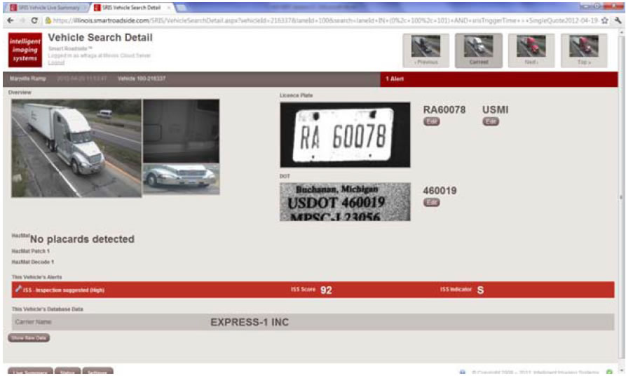 Figure 1. Screenshot. Vehicle search detail screen.
(Source: FHWA.)
Figure 1. Screenshot. Vehicle search detail screen.
(Source: FHWA.)