Collaboration Across the Road Weather Enterprise: The Pathfinder Project
APPENDIX C. EXAMPLES OF SHARED IMPACT MESSAGES
The following example is from Wyoming, using the December 24-25 winter event.
NWSCHAT LOG FOR DECEMBER 23, 2014
Wyoming Department of Transportation (WYDOT) Meteorologist: It's looking more and more like there will be significant travel concerns across much of the state on Thursday. We should think about having a conference call some time tomorrow (Wed) to discuss greatest impact areas on I-80 for Pathfinder purposes. It looks like WYDOT will have plenty of space on Dynamic Message Signs (DMS) tomorrow for some weather-text.
National Weather Service (NWS) Riverton, Wyoming (RIW)-office (name protected): Sounds good on this end. Looks very interesting!
NWS-Cheyenne, Wyoming (CYS)-office (name protected): Hi WYDOT, will pass on to rest of crew for tomorrow.
WYDOT Meteorologist: Okay, thank you. I'll probably be in contact with everyone to coordinate more formal conversation tomorrow.
NWS-Salt Lake City, Utah (SLC)-office (name protected): Sounds good here at SLC.
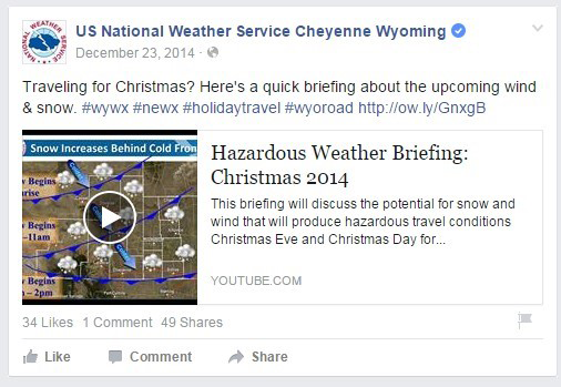
Figure 13. Photo. National Weather Service Image Shared via Facebook, 12/23/14.
(Source: National Weather Service Cheyenne Wyoming Facebook Page)
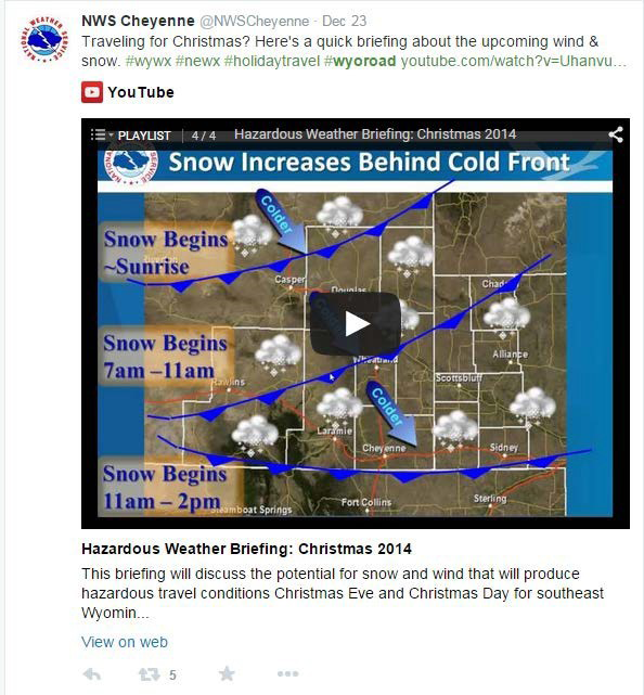
Figure 14. Photo. National Weather Service Image Shared via Twitter, 12/23/14.
(Source: National Weather Service Cheyenne Twitter Account)
NWSCHAT LOG FOR DECEMBER 24, 2014
WYDOT Meteorologist: Okay, I'm adding a little more stress to the blowing snow and low visibility potential for road conditions. TMC currently has DMS signs updated for all of I-80, but also in sections where there are watches/warnings for I-25 and I-90. Those signs will stay up until road conditions start deteriorating. Let's hope people pay attention and get all their traveling in before tomorrow.
NWS-RIW-office (name protected):Absolutely! It sounds like we're all on the same page.
NWS-SLC-office (name protected): WYDOT, for Uinta Co., we are expecting the most significant impacts to occur in the 4 p.m. – 8 p.m. window Thursday evening/night, with and behind the backdoor front. Impacts will likely begin to materialize tomorrow morning with the initial frontal passage, but not to the same extent. Have issued a YouTube briefing discussing travel impacts and storm total snow graphics to go alone with the Winter Storm Warning in place. Please let us know if you would like us to add additional messaging regarding I-80. Thanks!
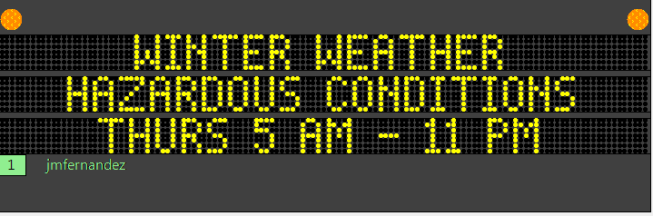
Figure 15. Photo. Wyoming Department of Transportation Traffic Management Center
Dynamic Message Sign Updated 12/24/25.
(Source: Wyoming Department of Transportation)
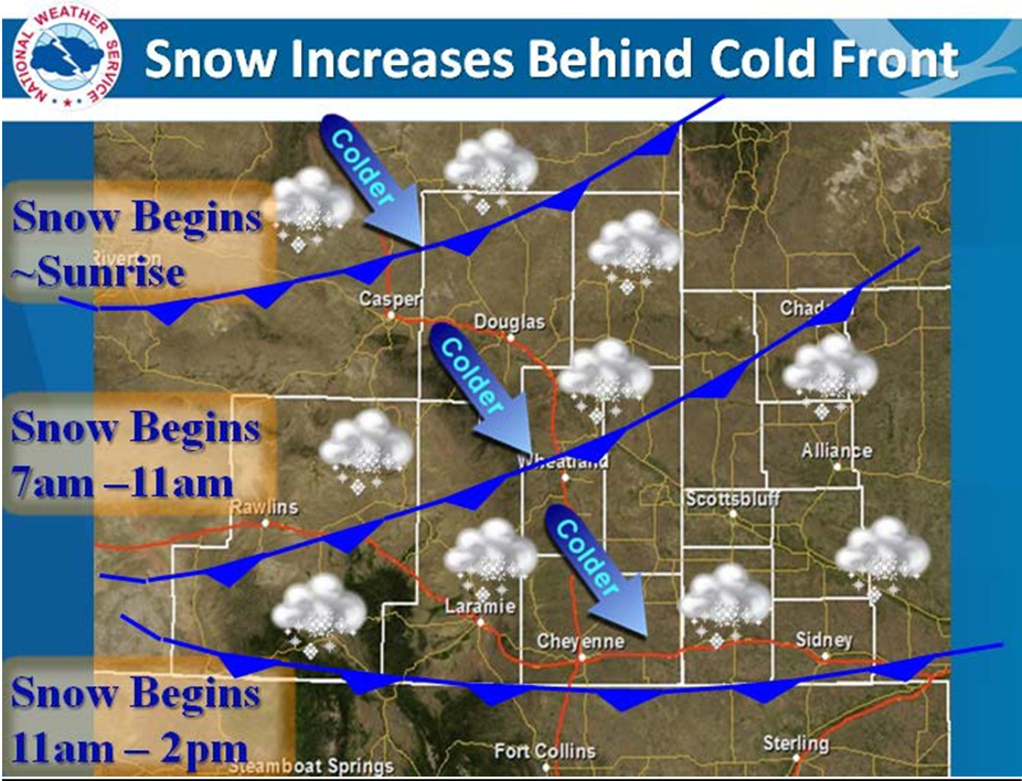
Figure 16. Photo. National Weather Service Graphic (1) for Expected Christmas Event.
(Source: National Weather Service)
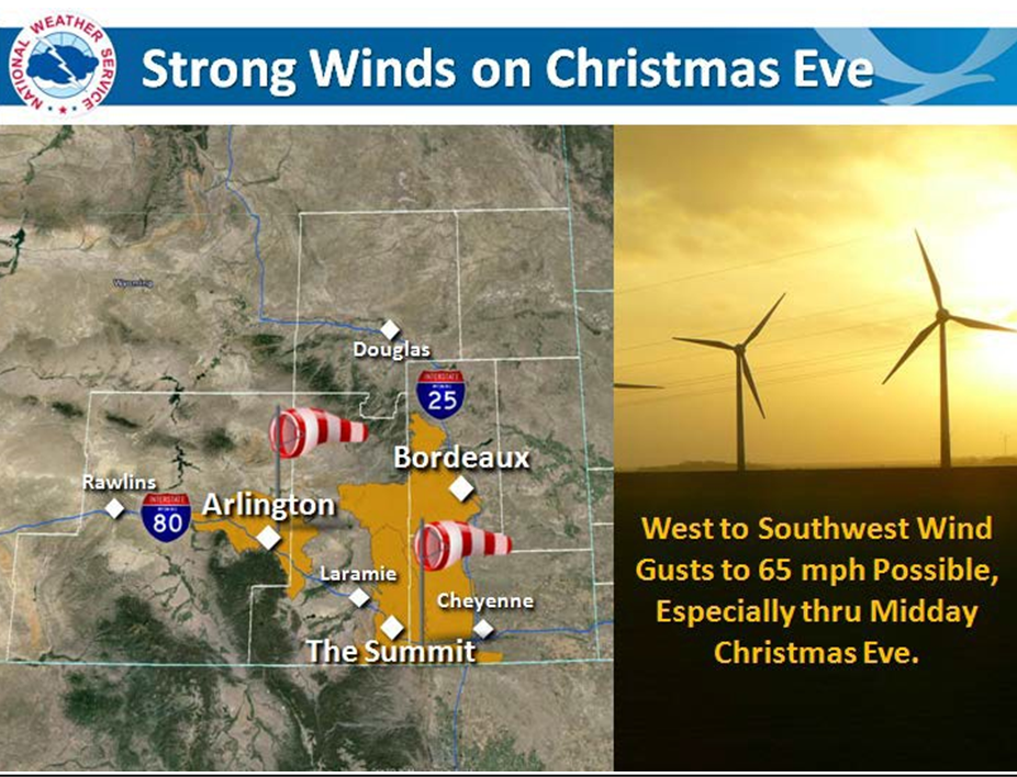
Figure 17. Photo. National Weather Service Graphic (2) for Expected Christmas Event.
(Source: National Weather Service)
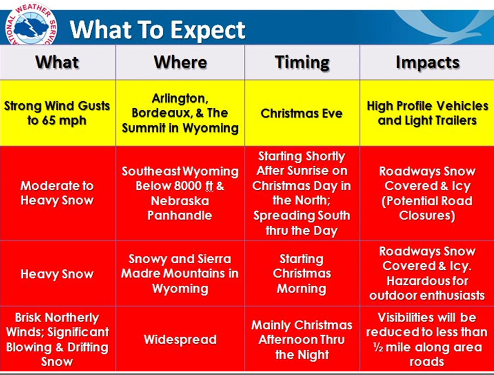
Figure 18. Chart. National Weather Service Graphic (3) for Expected Christmas Event.
(Source: National Weather Service)
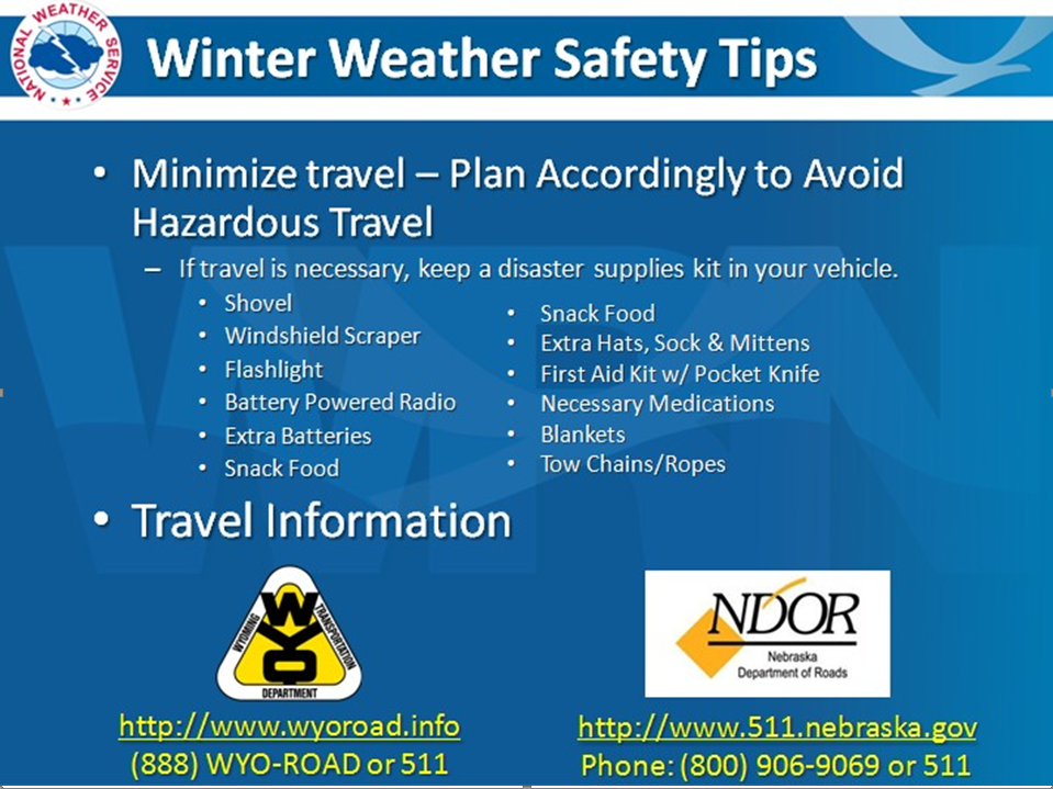
Figure 19. Photo. National Weather Service Graphic (4) for Expected Christmas Winter
Event.
(Source: National Weather Service)