
Freeway Management and Operations Handbook
Chapter 12 – Freeway Management
During Emergencies and Evacuations
Page 2 of 2
12.3.3 Public Outreach
Positive public response to evacuation warnings is essential for the successful, safe, and efficient evacuation of an area. Prior to hurricane season, public awareness campaigns remind the public to prepare for hurricanes. As a hurricane approaches, the appropriate notification procedures and messages must be used to convince the public that evacuation is in their best interest. Several effective methods to promote public awareness include: (11)
- Educational campaigns;
- Public service announcements;
- Brochures illustrating designated evacuation routes;
- Internet
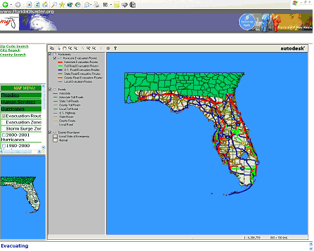
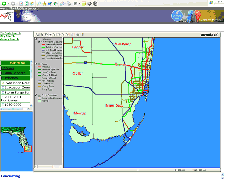
With respect to the Internet, several states publish their Hurricane Evacuation Routes on their DOT and other agency web sites (Figure 12-1), along with additional disaster-related information and links (e.g., evacuation decision-making criteria, preparedness information and checklists, real-time weather and traffic conditions, shelter sites and hotels, home and business protection).
12.3.4 Area of Impact / Analyses
Hurricane evacuation studies (HES) were initiated in the 1980's by the Federal Emergency Management Agency (FEMA) to integrate key aspects of hurricane evacuation planning and to assist in disaster preparedness. A HES typically consists of the analyses noted below (13); and though it is focused on hurricanes, the general principles are applicable to all emergency evacuations:
- Hazards Analysis: The primary objective of the hazards analysis is to determine the probable worst-case effects from the various intensities of hurricanes that could strike the region. The study identifies "worst-case effects" (i.e., the peak storm surges, high wind speeds, inland flooding, and wave effects) that can be expected at all locations within the study area, regardless of the point of hurricane landfall.
- Vulnerability Analysis: The purpose of the vulnerability analysis is to identify the areas, populations, and facilities that are potentially vulnerable to flooding and extraordinary wind damage under a variety of hurricane threats. The vulnerable population is comprised of all persons residing within the area subject to storm surge and the residents of mobile homes located above expected flood levels.
- Behavioral Analysis: In preparing hurricane evacuation plans, assumptions must be made regarding the manner in which the population in and around the vulnerable area will react to the threat, including the percentage that will evacuate, the probable destinations, the number of vehicles that will be used (including the number that may be motor homes or towing boats / campers), the evacuation response of tourists, and the percentage of evacuees who would require public assistance for emergency transportation. These assumptions are necessary for shelter planning, transportation modeling, and guidance in evacuation decision-making and public awareness efforts.
- Shelter Analysis: The purposes of the shelter analysis are to estimate the number of evacuees that will seek public shelter and the number of shelter spaces available, and to provide information for use in determining evacuation clearance times in the transportation analysis.
- Transportation Analysis: The primary purpose of
the transportation analysis is to calculate the clearance times needed
to conduct a safe and timely evacuation for a range of hurricane threats.
Other purposes are to define the evacuation roadway network and to evaluate
traffic control measures/highway improvements for improved traffic flow.
Some of the considerations and issues are noted below:
- In choosing roadways for the hurricane evacuation network, care should be taken to designate only those roads that are not expected to flood from rainfall or storm surge while the evacuation is in progress. Other desirable characteristics are little or no adjacent tree coverage, substantial shoulder width and surface, and current designation as an evacuation route in an existing evacuation plan.
- Clearance times – which vary depending upon storm scenario, behavioral response, and (if appropriate) tourist occupancy level – are an important product of the analysis. Clearance time is normally estimated for each county. It begins when the first evacuating vehicle enters the roadway network, prior to an evacuation order or advisory, ends when the last vehicle reaches an assumed point of safety, and includes the time spent traveling along the roadway network and waiting due to traffic congestion (queuing delay time).
- The movement of evacuating vehicles during a hurricane evacuation requires extensive traffic control efforts to make maximum use of roadway capacity and to expedite safe escape from hurricane hazards. The transportation analysis should reveal critical roadway segments and intersections and recommend specific traffic control measures and/or roadway modifications to help alleviate the anticipated problems in these areas.
12.3.4.1 Transportation Modeling Methodology
One of the means of planning and preparing for evacuations involves the use of computer modeling. The traffic models noted in Chapter 4 (e.g., CORSIM, INTEGRATION, PARAMICS, VISSIM, TRANSIMS, DYNASMART) can be used for a variety of emergency / evacuation / reentry scenarios by changing the appropriate network and traffic flow parameters. Additionally, specialty models for emergency management have been developed as summarized below: (8)
- The most widely applied flooding model for evacuation analysis is the Sea, Lake and Overland Surges from Hurricanes (SLOSH) model. Developed by the National Weather Service to predict hurricane storm surge for a given set of conditions, it is also used to plan evacuation routes and locate emergency shelters based on estimates of which geographic could be flooded in certain storm scenarios. SLOSH is used by weather experts at NOAA.
- Hurricane and Evacuation (HURREVAC) program. HURREVAC is a decision support system for emergency management officials. It uses geographic information system (GIS) information to correlate demographic data with shelter locations and their proximity to evacuation routes to estimate the effect of strategic-level evacuation decisions. (Note: Additional information on HURREVAC can be found at http://hurricanes.noaa.gov/prepare/hurrevac.htm [Link no longer active])
- The Oak Ridge Evacuation Modeling System (OREMS) – developed by the Center for Transportation Analysis at the Oak Ridge National Laboratory (ORNL) using the CORridor SIMulation (CORSIM) platform – OREMS was developed to simulate traffic flow during various defense-oriented emergency evacuations. The model can be used to estimate clearance times, identify operational traffic characteristics, and other information such as evacuation routes and times necessary to develop evacuation plans. It also allows users to experiment with alternate routes, destinations, traffic control and management strategies, and evacuees' response rates.
- The Evacuation Traffic Information System (ETIS) is a secure, web-based, Geographic Information Systems tool developed to assist the Evacuation Liaison Team, state emergency managers, and state traffic engineers. It enables them to share information with each other, and to provide information on the anticipated traffic levels and patterns. (At this time, it is only available to officials within the hurricane community.) The main page of the ETIS displays a map of the U.S. from Texas to Maryland, and shows information on counties that have called an evacuation, the evacuation participation rate and type (i.e., voluntary or mandatory evacuation), expected congestion levels on primary evacuation routes, and road closures. Tables accessible through the system give the anticipated state-to-state traffic volumes and likely destinations of the evacuees.
12.3.5 Traffic Management Plans
12.3.5.1 Contraflow Lanes
Contraflow, or reverse laning as it is also commonly known, involves the reversal of traffic flow in one or more of the inbound lanes (or shoulders) for use in the outbound direction with the goal of increasing capacity. Four different variants of contraflow may be used as shown schematically in Figure 12-2. Because it offers the largest increase in capacity, the most common contraflow strategy is to reverse all inbound lanes to the outbound direction.
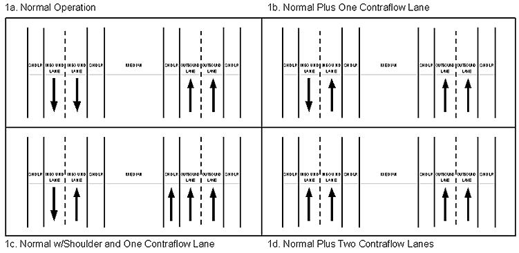
Figure 12-2: Contraflow Operational Scenarios (Reference 8) D
Though not as widely used, single-lane contraflow strategies are also possible, such as one lane reversed and one lane with inbound flow for emergency/service vehicle entry only; and one lane reversed and one lane with normal flow for inbound traffic entry. The main advantage of this strategy is its ability to maintain a lane for inbound law enforcement personnel and emergency service vehicles, critical for clearing incidents. It can also permit access for people that want to move against the evacuation traffic. One of the major drawbacks of single-lane reversals is that it raises the potential for head-on accidents.
Another strategy to improve capacity is to use the outbound left shoulder as an additional outbound lane. The capacity increase depends on the width and condition of the shoulder. Two additional concerns associated with the use of shoulders are pavement suitability and bridge widths. Shoulders are typically designed with a thinner pavement cross-section and greater cross-slope. They may not be able to withstand prolonged traffic loading and thus provide an inadequate riding surface. Cross-section width can be a problem on bridges. Many freeway bridges, particularly older ones, have been constructed with narrow shoulders. If shoulders were used as outbound lanes, these locations would create bottlenecks causing additional congestion as vehicles merge back into the through lanes.
Contraflow sections typically start with a median crossover or traffic control configuration that redirects or splits a portion of the outbound traffic stream into the inbound lanes. The specific location of these crossover points is usually a function of roadway geometry, the approximate beginning of congestion during evacuations, and the proximity of the location to other evacuation routes.
Contraflow section termini designs also vary by location. One of the controlling criteria for the location of a termination point is the prevention of merging congestion. This can be accomplished in several different ways:
- The method that is most common, particularly for shorter segments, is to permanently split the traffic flows. In this type of design one of the streams of traffic is diverted onto a separate roadway, while the other continues travel on the original route.
- The other common type of contraflow termini design is the attrition-merge. In this design, traffic in the normal and reverse flow lanes is reduced by allowing vehicles to exit to secondary routes at points along the contraflow segment. Through a process of exit attrition, it is assumed that traffic would be reduced to a level at the end of the segment that would allow a merging of the traffic streams without causing bottleneck congestion.
Cross-over designs should also address the placement and location of traffic control devices in the vicinity of the crossover, the use of highway advisory radio (HAR) and dynamic message signs (DMS) to guide evacuees, and the specific numbers and locations of police vehicles at the beginning and termination points and along the ramps of the segment. Another possibility is the installation of drop-gate barricades at the upstream end of on-ramps to assist in the control and diversion of in-bound traffic flow
Other management and operational issues associated with contraflow lanes for evacuations include:
- Use of contraflow for reentry of evacuated individuals following the emergency
- Time and labor required to set up, initiate, and enforce contraflow operations (e.g., traffic control devices and barricades must be erected and weighted down, inbound lanes must be cleared of vehicles over their length, and law enforcement and DOT field personnel must be positioned at their assigned locations). Set up time depends on the length of the segment, the number of interchanges involved, and the number ramps and merge points that may require control.
- Criteria affecting decisions as to if and when to initiate contraflow operations (e.g., storm characteristics (size, intensity, track) and potential risks; traffic volume; set up time; and time of day)
- Factors for determining when to shutdown the evacuation (e.g., the arrival of tropical storm force winds, and the need to evacuate DOT and enforcement personnel; decrease in evacuation traffic volumes; time-of-day /nightfall).
- Who has the authority to start and end contraflow operations (refer to discussions in Chapter 2). In most states, this authority resides with the Governor, although that responsibility falls on enforcement and/or transportation officials in a few states.
As an example of the effectiveness and benefits of contraflow operations, Reference 14 "Best Practices for Road Weather Management, Version 2.0" provides the following excerpt. From a cases study entitled "South Carolina Hurricane Evacuation Operations". "On Tuesday, September 14th the Governor issued a voluntary evacuation order at 7:00 AM followed by a mandatory evacuation order at noon. In response, over 350,000 people evacuated on Tuesday, and roughly 160,000 departed on Wednesday. The timing of evacuation orders, the public's response to the orders, the lack of lane reversal operations, and unmanned traffic signals in small towns contributed to severe congestion on Interstate 26 between Charleston and Columbia. Travel time, which is normally 2½ hours, ranged from 14 to 18 hours during the evacuation. The maximum per lane volume on the interstate was 1,445 vehicles per hour. The Governor ordered contraflow operations to minimize travel times during reentry. Traffic and emergency managers quickly developed a contraflow plan to accommodate reentry traffic in reversed westbound lanes. DMS and HAR were deployed to notify travelers of closures and alternate routes. As a result of contraflow, the maximum volume during reentry was 2,082 vehicles per hour per lane—a 44 percent increase over evacuation volumes. Contraflow operations and dissemination of traveler information significantly improved mobility by increasing roadway capacity and traffic volumes."
12.3.5.2 High Occupancy Vehicle Lane Usage
During an evacuation, officials may opt to allow high occupancy vehicle (HOV) lanes to be opened to all traffic regardless of occupancy restrictions (11, 15). Several issues need to be examined when considering this option. Bottlenecks may form at the terminus of the HOV lane – particularly if the lane merges into the general purpose lane (forcing a merge) as compared to removing the restriction from the lane – which may reduce capacity and offset any potential benefits. Confusion may result because not all motorists may be familiar with HOV facilities. Public awareness prior to evacuation is needed to ease confusion. Furthermore, dropping occupancy limitations sets precedents for similar actions in the future and this may not be desired.
An alternative to lifting occupancy requirements on HOV lanes would be to encourage normal HOV lane usage during evacuations. This might encourage people to travel in groups. Furthermore, "evacuation buses" could be provided to get people to leave their personal vehicles behind, reducing demand on the evacuation route. The ability of such buses to use the HOV lanes to bypass evacuation congestion might provide strong incentives for their usage.
12.3.5.3 Work Zones
Since the need for maintenance and construction during the hurricane season is unavoidable, some DOTs have made attempts to avoid conflicts by adding special provisions in construction contracts to accommodate evacuation traffic through work zones. The most common way to do this has been to add clauses that require a contractor to cease all construction activities once an evacuation is declared, clear all equipment, and open all lanes of traffic including those under construction. Other options to maintain capacity through work zones on evacuation routes have included limiting the construction season, distance, performance time, and/or phase sequencing of projects. These types of contraction provisions can potentially increase the cost and/or duration of projects, since they may require a contractor to work in shorter segments or use non-standard construction practices. (8)
12.3.5.4 Traveler Information
During emergency situations (e.g., major evacuations, response and recovery operations, national security emergencies), traffic and traveler information requirements reach a critical point. In addition to providing information on the locations of evacuation routes, roadway configurations (e.g., use of shoulders, contra-flow, available exits and entrances), traffic flow conditions / congestion on available routes, etc.; the traveler information should also include real time information on locations and availability of lodging and shelter, and services such as gas stations, rest area locations, and restaurants and food stores.
12.3.5.5 Contingencies for Continued Operations
Another element of any traffic management plan is contingencies for the continued operation of freeway management systems and regional information sharing networks; such as redundant / emergency communications (e.g., satellite telephones); power, continuity of operations and essential functions in the event that the TMC becomes inoperable. Of course, the most desirable scenario is to locate and design the TMC such that it can continue to operate during severe weather conditions and other emergencies (e.g., back up power, overnight accommodations for staff, located outside a flood plain, seismically isolated). As this may not always be the case, it is important to develop a "Continuity of Operations Plan" (COOP).
Presidential Decision Directive 67 requires that all Federal Departments and agencies have a viable Continuity of Operations Plan (COOP) capability, which details how their essential functions will be performed during an emergency or any situation that may disrupt normal operations and leave office facilities damaged or inaccessible. Objectives of a COOP include: (1)
- Ensuring the continuous performance of an agency's essential functions / operations during an emergency
- Protecting essential facilities, equipment, records, and other assets
- Reducing or mitigating disruptions to operations
- Reducing the loss of life, minimizing damage and losses
- Achieving a timely and orderly recovery from an emergency and resumption of full service to customers
Elements of a viable COOP include:
- Plans and Procedures, such as procedures for employee advisories, alerts, and COOP activations
- Identification of Essential Functions. This includes determining which functions must be continued under all circumstances, prioritizing those functions, and identifying the associated staffing and resource requirements (including mission critical data and systems)
- Delegations of Authority. Identify authorities for making policy determinations and decisions during emergencies – both within the various levels of the agency, and as participants of interagency emergency response teams, identify the circumstances under which these delegated authorities are exercised (become effective and terminate), identify the authority of designated successors
- Orders of Succession for key positions and titles within the agency, including the conditions under which succession will take place and method of notification. It is recommended that successors be geographically dispersed, and that they receive appropriate orientation.
- Alternate Facilities – Identify alternate operating facilities, and prepare personnel for the possibility of sudden relocation of essential functions and / or contingency staff to these facilities. Such alternate facilities should be capable of supporting critical operations in a threat-free environment.
- Interoperable Communications – In order for agency operations to be successful at an alternative facility, critical communication systems must be available with a degree of redundancy. These communications systems must support connectivity to internal organizations and systems, and to other organizations and the public.
- Vital Records and Databases – Plans must also provide for the identification, protections, and ready availability of electronic and hardcopy documents, references, record, and information systems needed to support essential functions under any type of emergency.
- Tests, Training and Exercises
12.3.6 Training / Exercises
A regional emergency / evacuation exercise sufficient in scope to test
all major elements of the emergency and evacuation plans should be conducted
periodically. The participants should include state, regional, and local
agencies that have emergency preparedness responsibilities. The scope
could range from only tabletop communications to full activation of field
personnel and emergency operations centers. Regardless of the scale, the
goal of the exercise should be to test the effectiveness of each emergency
management plan, including safe, efficient, and effective evacuations.
The exercise should test the ability of emergency management officials
to identify the appropriate emergency scenario as it develops, including
those of neighboring communities. Official's responses should be tested
in the areas of emergency decision making, communications, public warnings,
manpower/equipment deployment, resource allocation, timing of evacuation
order or advisory, shelter activation, emergency transportation, damage
assessment and traffic control. Communications and emergency power systems
should be fully tested, long-term if possible. Monitors should be stationed
at each emergency operations center and, if appropriate, in the field
to evaluate response activity.
A post-exercise review should be conducted to evaluate the effectiveness
of each plan. Officials who participated in the exercise should also contribute
to the review. Monitors should be asked to critique the activity to which
they were assigned. A critique report should be published that documents
the exercise methodology, identifies problem areas, and recommends improvements.
Areas where future preparedness training would be beneficial should also
be identified.
12.3.7 Military Deployment Coordination
Military deployment strategy has transformed from the Cold War forward-deployed force to a capabilities-based power projection force located largely in the United States. Strategic and mobility readiness are the keys to the military's ability to project power. Smaller forces may be deployed by air, while larger forces would typically be deployed by sea. Movements by sea require that a large number of vehicles and equipment be moved from military installations to the point of embarkation by either railroad or by convoys on public roads. These convoys need to arrive at a particular location at a specified time. The mission, threat, number of troops, terrain, highway network, and time available set the specific planning factors and influence how the convoy will be operated and managed.
During the past several years, FHWA has been working closely with the Military Traffic Management Command Transportation Engineering Agency (MTMCTEA) in an initiative to support military mobilization. The principal objective of this initiative is to ensure that states have adequate coordination procedures to support military deployments while, at the same time, managing civilian traffic during national emergencies – in essence, to meet military deployment needs such that these movements do not become a major impediment.
During a national security emergency involving a military deployment, state DOT's must coordinate with both the FHWA and military transportation organizations. Supporting roles might include:
- Issuing the correct permits (e.g., overweight, oversize vehicles) for convoy vehicles using the State roadway system. (Note – DOD policy states that no vehicle movement that exceeds legal limitations or regulations, or that subjects highway users to unusual hazards, will be made without permission from the State, local, and / or toll authority.)
- Providing operational information to the military about work zone restrictions / closures, incidents, conditions at public rest areas / refueling locations, etc., that may impact convoy timeliness.
- Assessing and monitoring traffic flow conditions and operations on the designated routes.
State and local deployment planning require an understanding of coordination and communication protocols. It is important to know who will be calling from the military, and whom the state agency would contact within the military establishment to coordinate a response. A guide is being developed, with a final version expected in 2004.
12.3.8 Terrorism and Homeland Security
As discussed in previous sections, freeway management strategies and supporting ITS technologies are clearly applicable to emergencies and evacuation. The events of September 11, 2001 raised the consciousness of the transportation community along with the consciousness of others, about the need for better critical infrastructure protection and crisis management, disaster planning and prevention, as well as effective detection and response, particularly in the case of deliberate terrorist attacks. Freeway management operations and the supporting ITS technologies have an important role to play in advancing the surface transportation aspects of Homeland Security. As an example of this new concern, ITS America in their supplement to their 10-Year Vision (4) added a "Security" goal, joining the goals of safety, efficiency / economy, mobility / access, and energy / environment.
Weapons of mass destruction in the hands of terrorists introduce new considerations to "emergency management" and disaster planning such as the following:
- People are the intended target.
- Advance warnings are unlikely.
- Multiple simultaneous attacks are possible.
- Emergency responders may be targets.
- The weapons may introduce serious and long-lasting hazards.
- The weapons may introduce large-scale damage or contamination to critical equipment and facilities.
- Public reaction is unpredictable.
The introduction of WMD also signals the need for some modifications to the existing set of agency roles and responsibilities (5):
- Law enforcement and national security agencies will play a larger role in a terrorist incident. State DOT personnel will need to understand the different relationships inherent during and after a terrorist WMD incident.
- If an incident occurs on or near a highway, state DOT personnel may be first or early responders. Therefore, basic training may be needed in identifying possible signs and consequences of terrorist incidents for appropriate actions including the consideration of their own safety.
- Specific traffic control regimes may be needed to evacuate people or to establish emergency access. Preplanning strategies, signage and equipment may be appropriate together with capitalizing on Intelligent Transportation Systems (ITS) and traveler information resources.
- Some resources may become unavailable for use if contaminated. Having procedures and equipment in place for decontamination becomes more important. Medical treatment and facilities could be overwhelmed quickly.
- Response resources may be required far beyond those originally anticipated; especially where a WMD is used that initially leaves few distinguishing marks. State DOT response resources need to be available but may also need to be protected as the consequences spread.
- Addressing public concerns is critical. Panic and uncontrolled flight are possible, and controls may need to be quickly put into effect. A comprehensive public information strategy is necessary. Where highways are concerned, state DOT personnel will be expected to provide information, (e.g., through variable message signs) to motorists evacuating an area.
ITS provides tools and enhanced opportunities to help safeguard the transportation system against a variety of threats, both natural and human caused, help the transportation system and its operators react swiftly and responsively in case of disruptions, and materially help agencies with primary responsibility to respond – for example (from the perspective of an FMS), providing surveillance of transportation facilities, including bridges and tunnels, and operations / management centers; and safeguarding ITS systems and data against inadvertent or deliberate interference or misuse. The goal is a "transportation system that is prepared for and well-protected against attacks, that responds rapidly and effectively to natural and human-caused threats and disasters, that supports appropriate transportation, emergency management, and public safety agencies, that ensures the ability to move people and goods even in times of crisis, and that can be quickly and efficiently restored to full capability (4).
Information and communication systems are potentially vulnerable to hacking, deliberate overloading, denial of service, and other technology-driven interference, in addition to physical attack. The potential for this kind of interference increases as transportation systems come to depend more on information processing and dissemination, software, and communications. This growing dependence on technology to manage and operate the freeway network creates a critical need for:
- Protecting the availability, integrity, and confidentiality of data
- Reducing the vulnerability of systems and services and ensuring the continuity of operations
- Guarding against the effects of cascading and escalating failures in multiple interconnected systems.
Two guides have been recently developed in the aftermath of 9-11. They can be downloaded from the website of AASHTO's security task force at http://security.transportation.org/?siteid=65 [Link no longer active]. Each is briefly discussed below.
12.3.8.1 Guide to Updating Highway Emergency Response Plans for Terrorist Incidents
This Guide (Reference 5) focuses the need for updating emergency response plans in light of emerging terrorist threats using weapons of mass destruction (WMD). It offers specific process guidance, in a checklist format, as to how state DOTs can update their emergency response plans. It also describes generic highway emergency response strategies typically used by state DOTs that may be utilized for emergency response to terrorist incidents.
The guide provides checklists designed to help state DOTs focus on where modifications and updates may be required in their plans and procedures. The checklists are divided into two broad topic areas:
- Internal arrangements: These checklists focus on the DOT's internal organization and preparedness for a response to a terrorist incident. This topic area focuses on modifications to the DOT's organization, responsibilities, procedures, communications, equipment, training and other critical areas.
- External relationships: These checklists focus on the state DOT's role within the larger emergency management framework of a state. This topic area focuses on issues that the state DOT may wish to take up with the other major players in the state emergency planning process.
The Internal Arrangements and External Relationships categories are then broken down further into relevant topics:
- Planning, training and exercising
- Roles and responsibilities
- First response
- Concept of operations
- System surveillance and management
- Agency communications
- Public information.
The checklist covers numerous pages, and even a summary is beyond the scope of this Handbook. Nevertheless, there are a few program modification considerations and process suggestions worth noting from the relatively narrow perspective of freeway management and operations, as summarized in Table 12-3.
|
12.3.8.2 Guide to Highway Vulnerability Assessment for Critical Asset Identification and Protection
This Guide (16) was developed as a tool for State Departments of Transportation (DOTs) to:
- Assess the vulnerabilities of their physical assets such as bridges, tunnels, roadways, and inspection and traffic operation facilities, among others;
- Develop possible countermeasures to deter, detect, and delay the consequences of terrorist threats to such assets;
- Estimate the capital and operating costs of such countermeasures; and
- Improve security operational planning for better protection against future acts of terrorism.
The Guide provides six steps for conducting a vulnerability assessment of highway transportation assets. These six steps provide a straightforward method for examining critical assets and identifying cost-effective countermeasures to guard against terrorism. For each step, the objective is clearly stated, the practice of that step by other state and federal agencies is referenced, a detailed approach is described, and illustrative examples are provided.
Table 12-4 summarizes the six steps for conducting a vulnerability assessment of highway transportation assets. These six steps represent an integrated and iterative approach to vulnerability assessment. This approach depends upon the formation of a dedicated, multidisciplinary team with ready access to a range of resources – from databases to personnel – as well as a commitment from senior State DOT officials to examine critical assets carefully and identify cost-effective countermeasures to provide better protection against the threats of terrorism involving the use of weapons of mass destruction (WMD).
Step 1 – Critical Assets Identification
Step 2 – Vulnerability Assessment: Identify and evaluate critical assets in terms of their susceptibility to and the consequences of terrorist attacks
Step 3 – Consequence Assessment: Identify assets which, if attacked, produce the greatest risks for undesirable outcomes given a specific set of circumstances and conditions
Step 4 – Countermeasures
Step 5 – Cost Estimation
Step 6 – Security Operational Planning
|
Potential Countermeasures (Reference 16)
|
12.4 Examples
12.4.1 Northridge, CA Earthquake
On Monday, January 17, 1994, at 4:30 a.m., an earthquake of a magnitude of 6.8 shook Los Angeles, California. While the actual earthquake (and its subsequent aftershocks) lasted only about 1 minute, it damaged 114,000 residential and commercial structures spread over 2,100 square miles, took 72 lives, and significantly impaired the Los Angeles regional transportation system, generating a year's worth of highway work in a single event. The Federal Emergency Management Agency (FEMA) reported the Northridge earthquake as one of the largest and most costly federal disasters with initial cost estimates of total damages at $25 billion.
Among the agencies cooperating in response to the Northridge destruction was Caltrans. Caltrans led the successful reconstruction effort and made two key decisions quickly after the earthquake: to rebuild the damaged freeways, and to retain traveler mobility and keep traffic flowing as smoothly as possible during the rebuilding efforts. Reference 17 is a case study of how this costly disaster became a model of incident management. Some of the key points are summarized below.
12.4.1.1 Restoring Regional Mobility
During the first week following the Northridge earthquake, many businesses and schools were closed, which significantly decreased the demand on the freeway network. Many people also stayed at home that week to repair their own earthquake damage. The first week after the earthquake, people began to return to their jobs and traffic volumes were steadily increasing.
Early rough estimates indicated that repairs would take from 6 months to a year. While contract incentives made it likely that the freeway repair might be expedited, Caltrans knew that mitigation measures had to be implemented quickly to balance capacity and demand. Two primary measures were implemented to reduce strain on the highway network – alternate route and detours, and freeway demand reduction measures. For example:
- The use of local streets proved to be the most effective way to handle freeway detours. The damaged freeway segments were far enough apart that detour routes could be designed for each site exclusively without overlapping detour routes and related congestion at other damage locations. For the initial detour routes, Caltrans and the LADOT re-timed traffic signal at 300 intersections and installed 1,000 directional signs and 7,500 parking signs.
- In some corridors, separate detours were implemented for high occupancy vehicles (HOVs – 2 or more persons per vehicle) and single occupancy vehicles (SOVs).
- Caltrans developed a transportation management plan (TMP) to handle traffic until the damaged freeway sections were reopened. They also implemented an Emergency Detour Management Center with emergency communications equipment, helicopter surveillance, and traffic performance acquisition data as well as enhanced tow service, construction zone speeding enforcements, and park and ride lots.
- The Freeway Service Patrol was extended with 13 additional roving tow trucks in the earthquake-affected areas. Following the Northridge earthquake (January 17–May 1994), 90 percent, or about 15,000, of all assists made by the FSP were on beats covering the damaged freeway areas.
- Following the earthquake, a $12.6 million design/build contract was put into place to install new traffic monitoring and commuter information equipment to areas that were affected by freeway damage but were not covered by the existing traffic operations equipment. This included additional DMS, HAR, CCTV, and detector stations.
- The media played a large role in disseminating detour information in the days and weeks following the Northridge earthquake. Daily press conferences were held by members of Caltrans and FHWA to discuss the progress of the rebuilding efforts, the status of detours in the area and how advice for commuters to avoid earthquake damage. Newspaper inserts and brochures were also used to inform travelers of other options.
In order to completely restore regional mobility, transportation agencies understood that highway detours would not be enough. The Los Angeles region would have to begin to utilize alternate transportation modes (like transit, HOV, and telecommuting), which would be difficult in the auto-dependent region. Transit agencies reacted quickly to the potential demand increases, extending service and decreasing service headways in an effort to provide mobility options to commuters. In some cases, fares were reduced. Three new park-and-ride lots also were created at strategic locations to encourage carpools and transit use.
12.4.1.2 Rebuilding
Rebuilding the Los Angeles regional freeway network required a sustained effort by Caltrans and unprecedented cooperation between local, state, and Federal Government agencies. Through demolition, construction bidding, and reconstruction, the agencies involved exercised innovative solutions to existing "red tape" problems to restore the highway network.
Caltrans used emergency contracting procedures to immediately begin debris removal and demolition activities. Caltrans was able to mobilize a demolition contractor and crew at each of the four major damage locations. The demolition of damaged highway infrastructure started on January 17, 1994, and operated around the clock until completion, using non-competitive bid contractors in all but one case.
In the first days following the earthquake, Caltrans and FHWA discussed bidding, and eventually signed a memorandum of understanding (MOU) on January 26, 1994, which outlined the following three bidding procedures:
- A+B Bidding is a "cost-plus-time" bidding procedure that selects the lowest bidder based on a combination of the contract bid items (A) and the amount time (B) needed to complete the project or a critical portion of the project. A+B Bidding is used to motivate the contractor to minimize the overall time on high priority and high usage projects. This encourages contractors to finish early by offering bonuses (incentives) for early completion and assessing fines (disincentives) for late completion.
- Invitational bidding was another procedure used to expedite contract administration by FHWA and Caltrans. This concept was used for those projects that had high user delay costs and an urgent need for early completion. These projects were expected to have short time frames for Caltrans to prepare the bid packages, greatly expedited advertising periods for the contractors to submit bids, and one-day bid openings and awards. Limiting the number of bidders on these critical projects allowed Caltrans to provide packages to the contractors quickly and answer questions.
- Design-build construction is another contracting mechanism that allows initial construction to begin before final drawings for design are approved. Following the Northridge earthquake, Caltrans had 70 design engineers in place and ready to being work on plans for the damaged freeway sections. Contractors submitted technical proposals for construction work, and those proposals that met the minimum technical guidelines were allowed to participate in the price proposal section of the bidding.
In a report published after a review of transportation decisions made in response to the earthquake, the Transportation Research Circular (published by the Transportation Research Board and the National Research Council) reported several mobility findings:
- Providing immediate transportation solutions took precedence over the opportunity to change motorist behavior.
- Stabilization of traffic conditions took several weeks to several months.
- Where sufficient alternate routes existed, motorists continued driving; where convenient detours were not available, transit options became much more attractive.
- Availability of accurate traffic data was critical in developing emergency detours.
- Areas with well-developed traffic management centers were able to accommodate sudden traffic changes more easily.
12.4.2 September 11, 2001
The Terrorist attacks of September 11, 2001 exacted a terrible toll on the United States and fundamentally changed the way of life in America. Surface transportation has changed and continues to change in response to the attack. Agencies that own and operate surface transportation systems must understand the relevant lessons from the 9/11 experience and respond accordingly so that we as a nation are well prepared should we be attached again.
Case studies have been developed documenting the actions taken by transportation agencies in response to the September 11 attacks on New York City and Washington D.C. An article in the September 2002 issue of ITE Journal (19) synthesized the findings from both studies. The highlights are summarized below
12.4.2.1 Advance Preparations and Planning
A coordination structure: The coordination of local, state and federal agencies responding to an emergency is an essential part of a pre-existing disaster plan. The Incident Command System (ICS) is a management tool used to handle emergencies and can be adapted to the specific needs of a community region.
Emergency response plans: Public agencies (in both New York and surrounding states) have detailed emergency response plans that are practiced routinely. These plans coordinate decision making both internally and externally in conjunction with the New York City Office of Emergency Management (OEM) (a multi-jurisdictional agency created in 1993).
Jointly staffed facilities: Agencies placed personnel at OEM to receive and pass-on commands to their agency's emergency response center. At agency emergency response centers, key players gathered to make decisions and relay them back to OEM and TRANSCOM. To aid in transportation operations decision-making during emergencies, TRANSCOM disseminated (both internally and externally the decision of its 16 transportation and public safety agencies so that they could make informed decisions.
Working relationships: Key decision makers had experience in working with OEM, other transportation agencies and the public. These relationships helped support OEM on September 11, and, in general, gave the agencies and the public a level of confidence.
Individual initiative: Human creativity and teamwork become critical when the unpredictable happens. Every emergency, different in its complexity, requires personnel to make quick decisions that may have dramatic consequences on the safety of people in the area. The quality of the agency's staff, their ability to work together and their preparedness at all levels of the organization to handle difficult, changing situations is vital to a successful response.
Practice in a realistic environment: Practice in an emergency command center environment is a key element in smooth response to a disaster. An official at New Jersey Transit noted the importance of practicing for emergencies, and the recognized need to train not just the first string, but also the second and third string of employees, because disasters do not always occur during business hours. On September 11, a number of key transportation staff members were either lost or injured and the responsibility for decision-making fell to others. One field staff noted that "there was no one to talk to at headquarters; it was gone".
12.4.2.2 Institutional Coordination
Established interagency relationships: The existence of well-established interagency relationships among the many transportation and emergency personnel in New York was an important factor in managing the situation. Through coordination entities such as TRANSCOM and the OEM, agencies built effective working relationships that proved to be a major sustaining factor during and after the crisis.
Internal command centers: Each agency, in addition to its participation in the multi-agency task forces, had set up an internal emergency command center. At the emergency command center, decision-makers were able to communicate with key individuals, both internal and external to the organization.
Coordination across agencies and jurisdictions: Coordination between transportation agencies and their counterparts in public safety and law enforcement was generally good, with just a few exceptions (e.g., the failure to coordinate the release of 260,000 federal employees and lack of notification regarding the intent to release employees caused an unexpected rush of commuters just as the region's transportation network was winding down from the morning peak period service pattern.)
12.4.2.3 Communication
Multiple communication technologies: Immediate communication with agency field staff in NYC was difficult because landlines were damaged and cellular communication systems were overloaded. Two-way radios helped field personnel communicate during the evacuation; however, field personnel without radio communication were out of touch.
Voice and data communication: New technologies
provided communication alternatives that proved successful in the emergency.
Internal e-mail, for example helped agencies communicate decisions with
their staff. Blackberry Pagers (interactive pagers with e-mail capabilities)
that rely on data communication technology were a successful form of communication
according to several transportation agencies.
Mobile communication assets: Agency communication
centers were also successful in supporting both internal agency decision-making
and external communication. Both NYC Transit and New Jersey Transit had
mobile communication centers (transit buses equipped with satellite and
computer technology), which were used as commend posts for communication
and decision-making.
12.4.2.4 The Role of Advanced Technologies and Operations
ITS technologies and the associated operations have a major impact: The following highlights a few specific examples of ITS technologies and operations that aided both agencies and travelers on September 11:
- Dynamic message signs and HAR were used to communicate real-time traveler information, along with Web sites advising travelers of road closings and transit disruptions. Both customers and facility operators benefited in having traffic diverted before it reached the bridges or tunnels. After TRANSCOM alerted I-95 Corridor Coalition member agencies of problems in the New York City region, these agencies used HAR and variable message signs (VMS) on I-95 as far south as Delaware and as far north as New Haven to alert travelers to avoid New York City.
- CCTV surveillance was found to be very valuable for assessing the progress and effect of traffic management operations.
- Signal system timing was reset for heavy evening rush. For example, in Washington and in neighboring Montgomery County, computerized traffic signal systems enabled these jurisdictions to handle the "early rush hour" as District workers self-evacuated. Additionally, signals were adjusted to facilitate emergency responders en-route to the Pentagon
- Ramp meters were also reset for heavy evening rush (but became a non-issue as they are only located on routes that were quickly closed to non-emergency vehicles);
- High occupancy vehicle (HOV) lanes were immediately opened to all traffic;
- Construction work zone lane closures were suspended;
- Transportation management centers served as focal points, and proved successful in communicating and disseminating agency decisions both internally and with the public.
- Traffic along key sections of the roadway system including bridges leading to Manhattan was measured, and the information was used to help determine changes in the hours of the lower Manhattan crossings SOV ban.
12.4.2.5 Redundancy and Resiliency
Redundancy in multiple critical systems: Redundancy, the ability to invoke backup for critical systems that fail, either partially or entirely, is imperative to consider in emergency response. The backup systems invoked for use in an emergency are determined by the nature and scope of the emergency itself.
Redundancy in the transportation network: The redundancy of the transportation system in New York helped evacuate Lower Manhattan on September 11 and restore mobility. The automobile is only one of many transportation options. On September 11, when the tunnels, bridges roadways and subways were temporarily closed, local MTA buses continued running above Canal Street, water ferries were pressed into expanded service and people walked. The MTA was able to restore subway service by early afternoon on September 11 because of the redundancy in its subway tunnels.
Staff redundancy: The need for redundancy in staffing was highlighted when several key transportation decision makers were lost or temporarily missing in the attack. Critical decisions were made by personnel in the field who, at times were cut off from communication with headquarters.
Communication redundancy: The communication system was severely disrupted on September 11. NYC Transit was able to use its separate system to provide landline telephone service to local, state and federal emergency agencies when Verizon's network was disabled. Having the option to use various technologies including two-way radio, Internet, pagers, e-mail, voice and cell phone technologies allowed agencies to adapt to the constantly changing landscape.
Redundant utilities: Redundant mobile generators allowed for restoration of power to emergency control centers and allowed agencies to begin flood prevention efforts to preserve communications and subway tunnels from extensive water damage.
Redundant control centers: Redundant control centers helped enormously. Even though the NYC Mayor's OEM Command Center was destroyed when Seven World Trade Center collapsed, nearly every other major agency in NYC had an emergency control center that swung into action immediately. Moreover, a temporary OEM had to be re-located three times on September 11.
12.4.3 Closing
In closing, Reference 19 identifies the following five lessons learned that should be considered in future planning for emergencies and management thereof:1. Pre-existing relationships among agencies and personnel are key to emergency management success. Such relationships help transcend the different response approaches used by transportation, military, and law enforcement agencies.
2. Preparedness planning is another crucial element, and must include the development of an emergency response plan and training for all shifts of workers. Planning helps establish relationships and define roles and responsibilities. Training field personnel as well as managers is vital, for they often must make critical decisions with little or no input from senior staff.
3. Redundancy must be built into institutions and physical systems, including personnel, communications, utilities, and control centers. A new approach to redundancy is needed – a backup is not adequate if it is also exposed to failure in an emergency. The transportation infrastructure facilitates emergency response and evacuation, so an alternative network is critical, as are remote backup operations and emergency management facilities.
4. Multiple technical communication methods help ensure proper institutional communication. Redundancy and resiliency in communications is critical. Systems that depend on cell phones or landlines can be unreliable; an emergency response system should include both alternative technologies and redundant network connectivity.
5. Advanced technologies play an important role in communications and decision making. Traffic management centers, closed-circuit TV, sensor systems, dynamic message signs, advanced traffic control systems, Web sites, and geographic information systems were all identified as useful in aiding internal and external communication. Timely decision-making requires effective communication of accurate information. In the aftermath of disaster, ITS enabled facility managers to: make informed decisions, improve regional transportation management, and enhance communication with the public.
12.5 References
1. FHWA Office of Operations / Emergency Management Web Site http://www.ops.fhwa.dot.gov/eto_tim_pse/index.htm
2. Federal Emergency Management Agency (FEMA) Web Site www.fema.gov ; and the website of AASHTO's security task force at http://security.transportation.org/?siteid=65.
3. Regional Evacuation Concept of Operations; State of Florida
4. "Homeland Security and ITS – Using Intelligent Transportation Systems to Improve and Support Homeland Security; Supplement to the National ITS Program Plan; ITS America; September 2002
5. "A Guide to Updating Highway Emergency Response Plans for Terrorist Incidents"; Prepared for the AASHTO Security Task force; PB Farradyne; May 2002
6. "Manual on Uniform Traffic Control Devices" (MUTCD) 2000, Millenium Edition, Institute of Transportation Engineers, Washington, D.C., 2001.
7. "Emergency Management Guide for Business and Industry; Available from the FEMA website
8. Wolshon, B. et al; "National Review of Hurricane Plans and Policies"; LSU Hurricane Center; 2001
9. Department of Homeland Security (DHS) Website www.dhs.gov
11. Ullman, G.L., N.D. Trout and T. Urbanik II. Synthesis of Traffic Management for Major Emergencies. Research Report 1231-1. Texas Transportation Institute, Texas A&M University, College Station, 1991.
12. Florida Division of Emergency Management's (FDEM) web site www.floridadisaster.org/index.htm
13. Guidelines for Hurricane Evacuation Studies; US Army Corps of Engineers
14. "Best Practices for Road Weather Management – Version 2"; FHWA; 2002
15. Wohlschlaeger, S.D. and G.L. Ullman. Catalog of Transportation Management Activities for Major Emergencies. Research Report 1231-2. Texas Transportation Institute, Texas A&M University, College Station, 1991.
16. "A Guide to Highway Vulnerability Assessment for Critical Asset Identification and Protection", Prepared for AASHTO Security Task Force, SAIC, May 2002
17. "Effects of Catastrophic Events on Transportation System Management and Operations: Northridge Earthquake – January 17, 1994"; U.S. Department of Transportation, John A. Volpe National Transportation Systems Center, Cambridge, Massachusetts, April 22, 2002
18. Pierce, V.; "Surface Transportation security Lessons Learned form 9/11"; ITE Journal; September 2002.
19. Volpe Center, "Highlights" July / August 2002, "Improving Regional Transportation Planning for Catastrophic Events (FHWA)"