
Description of I-40 Alternate Routes
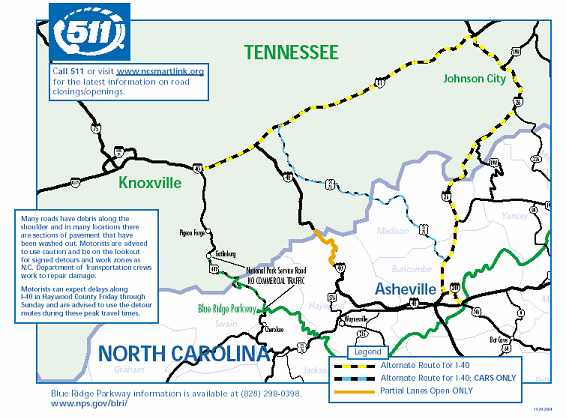
Description
Map of Tennessee-North Carolina area containing Interstate 40.
Legend shows map markings for alternate route for I-40, alternate route for I-40 for cars only, and partial lanes open only.
Text on map reads:
- Call 511 or visit www.ncsmartlink.org for the latest information on road closings/openings.
- Many roads have debris along the shoulder and in many locations there are sections of pavement that have been washed out. Motorists are advised to use caution and be on the lookout for signed detours and work zones as NC Department of Transportation crews work to repair damage.
Motorists can expect delays along I-40 in Haywood County Friday through Sunday and are advised to use the detour routes during these peak travel times.
- Blue Ridge Parkway information is available at (828) 298-0398. www.nps.gov/biri/.