Description of Slide 59. South Detour Travel Time, Monday 2005 vs 2006, EB Bay Bridge Closed
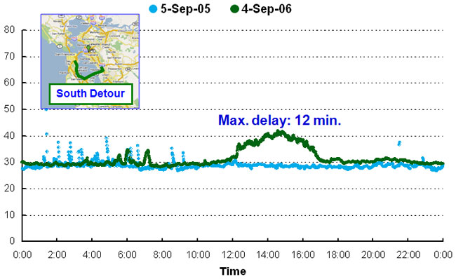
Graph showing south detour travel time for a 24-hour period on Monday, September 5, 2005, and Monday, September 4, 2006, with the eastbound Bay Bridge closed. An inset map of the south detour route is shown, from south of San Francisco and over San Francisco Bay to south of Oakland.
The graph shows an increase in travel time from 30 minutes in 2005 and 2006 at 12:01 A.M. to 34 minutes in 2005 at 4 A.M. and 42 minutes in 2006 at 3 P.M. Maximum delay is shown as 12 minutes.