Description of Slide 54. North Detour Travel Time, Saturday 2005 vs 2006, EB Bay Bridge Closed
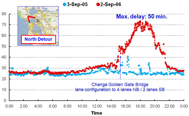
Graph showing north detour travel time for a 24-hour period on Saturday, September 3, 2005, and Saturday, September 2, 2006, with the eastbound Bay Bridge closed. An inset map of the north detour route is shown, from north of San Francisco to Marin County and to north of Oakland.
The graph shows an increase in travel time from 25 minutes in 2005 and 2006 at 12:01 A.M. to 40 minutes in 2005 at 4 P.M. and 75 minutes in 2006 at 6 P.M. and decreasing to 25 minutes in 2005 and 2006 at 11:59 P.M. At 3 P.M. in 2005 and 2005, a change is shown in the Golden Gate Bridge lane configuration to four lanes northbound and two lanes southbound. Maximum delay is shown as 50 minutes.