
Best Practices for Road Weather Management Version 2.0
Title:
Blowing Hot and Cold: Nebraska's Use of Satellite-Transmitted Weather Information to Manage its Highway Network
Abstract:
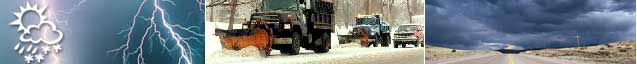
This article reports on Nebraska's use of satellite-transmitted weather information to manage its highway network. Since 1997, Nebraska's Department of Roads has made use of Data Transmission Network Corporation's (DTN) Weather Services information to help determine weather-related highway closings, heavy-weather sites and areas that need snow-plowing. DTN Weather Services is based in Omaha, Nebraska. The company provides satellite-transmitted weather information from sources including NOAA to both businesses and the public sector. DTN's weather information is delivered in several ways. It can be presented with large monitors at rest areas on interstate highways and others with significant traffic, or sent via pagers carried by customers, or made available to DTN's new StormSentry PC. DTN's information includes temperature and precipitation outlooks for 24 hours, plus 90-day forecasts; hourly updated regional weather maps with temperatures, wind speeds and directions dew points, relative humidity, sky conditions and barometric pressure.
Source(s):
ITS International, Nov/Dec 1999 issue. For a copy of this resource, please direct your request to WeatherFeedback@dot.gov.
Date: 1999
Author:
King
Keywords:
Forecast/Prediction
Weather information
PDF files can be viewed with the Acrobat® Reader®.
