Planning for Transportation Systems Management and Operations within Subareas – A Desk ReferenceCHAPTER 1. INTRODUCTIONOVERVIEW OF DESK REFERENCEOver the past decade, transportation agencies have increasingly integrated transportation systems management and operations (TSMO) in planning at the statewide and metropolitan levels. Using an objectives-driven, performance-based approach, State departments of transportation (DOTs) and metropolitan planning organizations (MPOs) around the country are working with local jurisdictions, transit agencies, law enforcement, toll authorities, and other partners to manage traffic congestion, improve system reliability, increase safety, and enhance multi-modal options using operations solutions. Rather than relying solely on new road, parking, and transit capacity, this approach recognizes that TSMO strategies (e.g,. enhanced incident management, traffic signal coordination, transit signal priority (TSP), and traveler information) can often be low in cost, highly effective, and implemented in concert with infrastructure to enhance transportation system performance.
A subarea is a defined portion of a region, such as a local municipality (city or county), a downtown or central business district, an activity center, or a neighborhood. Transportation planning for a subarea addresses more details than area-wide or regional planning and generally incorporates broader planning context. Subarea plans typically provide a greater level of detail in the analysis and recommendations unique to the obstacles and opportunities in that area.
More recently, transportation and planning agencies are increasingly witnessing the presence of connected-vehicle and smart-city technologies, which pose new challenges to management and operations but also offer unique opportunities. Again using an objectives-driven, performance- based approach, transportation agencies and MPOs are beginning to work with automobile manufacturers, telecommunications providers, software and sharing-economy service providers, and other private-sector partners to collect, integrate, and synthesize rich vehicle and device-derived data to manage subarea mobility and livability goals. Planning for operations involves identifying operations objectives and performance measures, which guide the identification, prioritization, and selection of investments, programs, and strategies. The result is implementation of programs, projects, and collaborative efforts to better manage and operate transportation systems and services to preserve capacity and improve the security, safety, and reliability of the transportation system. Today, many State DOTs and MPOs have adopted policies to improve transportation operations by managing travel demand and applying transportation management techniques before they take the steps toward considering additional capacity. While many statewide and regional policies and programs are advancing implementation of effective TSMO strategies, more benefits will occur when TSMO is considered and applied strategically at a smaller scale where many critical implementation decisions are made. Transportation planning within subareas presents new opportunities for agencies to plan for operations both at a more refined geographic scale and at a level where specific, actionable plans can be developed. The availability of connected- vehicle and smart-city technologies expands subarea transportation planning opportunities even further. Transportation Systems Management and Operations is...? "... [a set of] integrated strategies to optimize the performance of existing infrastructure through the implementation of multimodal and intermodal, cross-jurisdictional systems, services, and projects designed to preserve capacity and improve security, safety, and reliability of the transportation system." It "includes - (i) actions, such as traffic detection and surveillance, corridor management, freeway management, arterial management, active transportation and demand management, work zone management, emergency management, traveler information services, congestion pricing, parking management, automated enforcement, traffic control, commercial vehicle operations, freight management, and coordination of highway, rail, transit, bicycle, and pedestrian operations; and (ii) coordination of the implementation of regional transportation system management and operations investments (e.g., traffic incident management, traveler information services, emergency management, roadway weather management, intelligent transportation systems, communication networks, and information sharing systems) requiring agreements, integration, and interoperability to achieve targeted system performance, reliability, safety, and customer service levels." Source: 23 United States Code Section 101(a)(30). Increasingly, transportation agencies recognize the value of the subarea approach instead of looking at individual transportation projects on a piecemeal or single-facility basis. A subarea approach takes a broader view of the interconnected factors that influence travel to, from, and within a subarea and enables more creative and collaborative approaches to addressing subarea transportation problems. Traditional transportation planning focuses on improving the performance of transportation facilities. Performance metrics can include speed, throughput, lane capacity, safety, etc. Transportation planners and operators view transportation infrastructure as an interconnected network of facilities and services. Subarea planning-in a transportation context-also focuses on improving performance, but of a specific place. Planners and operators view the subarea as an interconnected but geographically limited and bounded amalgam of facilities and services. Performance metrics are more holistic in subareas and range from objective "hard" measures such as the volume, speed, and safety of goods and people moving in a subarea to the broader measures of performance such as congestion, emissions, energy consumption, and land. Qualitative or "soft" performance measures are more subjective and include such elements as "mobility" and "livability," which are impacted by innumerable factors beyond the physical; e.g., zoning, parking, delivery, and shared-service policies. Managing mobility in a subarea requires understanding, measuring, and leveraging many factors and is but one aspect of subarea planning, which is an approach used today by most government planning agencies across the United States to improve mobility.1 The advent of connected-vehicle and smart-city technologies, and their associated data, has great potential to improve the ability of planning agencies to better manage subareas. This desk reference describes an approach for TSMO planning within a subarea context that incorporates the metropolitan planning concept of looking beyond a single factor (i.e., a transportation facility or particular land use, parking, or other policy) to focus more holistically on the performance of the subarea's transportation system from a user's perspective. Transportation agencies and stakeholders, including planners, often begin subarea studies from an investments perspective to address traffic level-of-service (LOS) and other infrastructure related issues. This approach results in proposals for expensive capital investments, which often cost more than the available resources can support. Moreover, while TSMO may be a priority from a statewide or regional perspective, TSMO strategies often are applied at a broad scale (i.e., via a statewide incident management program, regional ridesharing program, or traveler information systems) without connecting these programs to a specific subarea's needs or targeting them to a subarea's unique challenges and conditions. This desk reference equips subarea planning and operations professionals with the knowledge and tools necessary to effectively plan for and implement TSMO in a subarea context. Its purpose is to support transportation planners and operations staff in planning for and applying TSMO activities within subareas to achieve more reliable, efficient, and livable outcomes from their existing and planned transportation infrastructure. Utilizing a planning-for-operations approach at a subarea level can help operators focus on issues (e.g., mobility, livability, reliability, and safety) from a more holistic perspective and reveal cost-effective demand management and operations solutions that may not otherwise have been fully considered. This desk reference describes planning for TSMO within subareas so that readers can tailor and apply this approach in a variety of subarea contexts. This desk reference is founded upon three themes for success that encompass all TSMO planning efforts:
This desk reference connects readers to other tools and resources developed by the Federal Highway Administration (FHWA) and partners to support a more in-depth understanding of several topics introduced in this document. It draws upon concepts, such as integrated corridor management (ICM), active transportation demand management (ATDM), and principles of metropolitan planning, that are increasingly focusing attention on collaboration across multi modal system operators and planners to address subarea conditions. Quick reference sheets provide examples of subarea operations objectives, performance measures, and management and operations strategies that can be applied as readers move forward in applying the components of planning for and implementing TSMO within subareas. This desk reference is a companion to the FHWA document, Planning for Transportation Systems Management and Operations within Corridors Desk Reference, which is a resource that addresses the specific needs of organizations planning for TSMO in corridors.2 WHO SHOULD USE THIS DESK REFERENCE?This desk reference is intended for the transportation planning or operations professional looking to address specific questions on planning for TSMO within subareas as well as the professional who wants to gain a comprehensive understanding of how to successfully improve travel and goods movement within a subarea. This desk reference brings together planning and operations approaches, practices, and lessons learned that have been developed over the past 10 years and provides consolidated assistance on planning for TSMO within subareas. Several sections serve as launching points to related FHWA documents that provide more in-depth information and tools. A GUIDE TO NAVIGATING THIS DESK REFERENCEThe desk reference is organized into six chapters: Chapter 1: Introduction Briefly introduces TSMO within subareas and planning for TSMO in a variety of subarea contexts. It helps readers identify the need for TSMO planning at the subarea level. Related technical assistance materials:
Chapter 2: Planning for Transportation Systems Management and Operations Planning Within Subareas Makes the case for TSMO planning to achieve a coordinated, strategic implementation and ongoing use of TSMO strategies. It provides an overview of the planning context for TSMO within subareas and describes examples of current practice. Related technical assistance materials:
Chapter 3: Approach to Subarea Planning for TSMO Lays out a common sense approach to planning for TSMO within a subarea for a variety of subarea contexts. It takes the reader from building a team for the effort to selecting TSMO strategies that will best achieve, from a transportation perspective, subareas operations objectives. It provides easy-to-use quick reference sheets for a range of operational objectives relevant to subareas, including travel time to, from, and within a subarea; traffic signal management; transit priority; bicycle and pedestrian accessibility; efficiency; and the broader concepts of mobility and livability. Related technical assistance materials:
Chapter 4: Moving to Implementation: Transportation Systems Management and Operations within Subareas Offers information on how to progress from plans for TSMO to implementing, monitoring, and maintaining TSMO strategies. This includes obtaining funding for TSMO, agreeing upon organizational roles and responsibilities, applying systems engineering, and regularly evaluating the effectiveness of the implemented strategies in relation to the subarea objectives. Related technical assistance materials:
Chapter 5: Toolbox for Effective Transportation Systems Management and Operations Planning Introduces several tools to help ensure effective planning for TSMO within subareas, including scenario planning, analysis tools, and benefit-cost analysis. Related technical assistance materials: Chapter 6: Taking Action Describes key actions that readers can take to jump start their efforts to advance TSMO within a subarea. TRANSPORTATION SYSTEMS MANAGEMENT AND OPERATIONS WITHIN SUBAREASWhat is Transportation Systems Management and Operations?Transportation systems management and operations, or TSMO, encompasses a broad set of strategies that aim to optimize the safe, efficient, and reliable use of existing and planned transportation infrastructure for all modes and geographical areas, including subareas. TSMO is undertaken from a systems perspective, which means that these strategies are coordinated with related strategies and across multiple jurisdictions, agencies, and modes. TSMO strategies range from regional traffic signal systems management to shared-use mobility initiatives (see Table 1 on page 9 for an expanded list of strategies). TSMO includes efforts to operate the multi-modal transportation system and activities to manage travel demand. TSMO proactively addresses a variety of transportation system user needs by:
TSMO strategies are supported by both institutional and technology-based activities. For example, TSMO is enabled by memoranda of agreement among agencies, operational policies and procedures, and shared resources (e.g., interoperable communications systems, centralized traffic signal operations, and closed circuit television video sharing). What are the Benefits of Transportation Systems Management and Operations?18TSMO strategies have allowed transportation agencies to address transportation issues in the near- term, with lower-cost solutions. TSMO strategies deliver a variety of benefits and, particularly for subareas, are evaluated based on broader transportation objectives. These include:
Sample of Transportation Systems Management and Operations Strategies Relevant to SubareasMany TSMO strategies are applicable and effective at the subarea level. Table 1 lists TSMO strategies that agencies can consider when looking to improve the operation of their subareas.
TSMO = transportation systems management and operations.
Transportation Systems Management and Operations within Subareas: Understanding the Subarea Contexts19
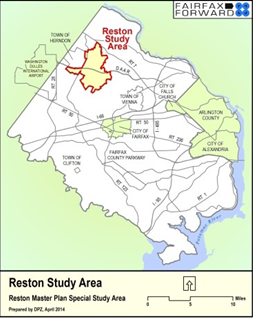
Reston, VA, is a planned community in the western suburbs of the Washington, DC, area. With the expansion of the Metrorail system to include three new stations in Reston along the new Silver Line, Fairfax County undertook the Reston Master Plan Special Study to identify changes to the County's comprehensive plan to help guide future development in Reston and adjoining areas along the Dulles Airport Access and Toll Road. Phase I of the study focused on transit station areas and included recommendations focused on transit- oriented development and promotion of mixed use, walkable development, including development of a street grid, multi-modal enhancements, and transportation demand management strategies. Phase I focused on the remainder of Reston, including the contexts of residential neighborhoods, village centers (e.g., commercial and mixed use centers), convenience centers (e.g., generally more automobile-oriented commercial land uses), and other commercial areas. When developing strategies for TSMO within subareas, it is critical to understand the context of the subarea, including:
A subarea generally includes multiple modes of travel, mixed land uses, arterials, streets and substreets, transit, paratransit and ride-share services, bicycle and pedestrian connections, park-and-ride lots, and other rideshare services. Different types of subareas are found in urban, suburban, and rural contexts. Some subarea plans include multiple localized contexts (e.g., urban center, transit station area, and lower- density residential areas). For instance, a subarea plan could be conducted on a citywide or countywide scale, or at the level of some other subunit of a metropolitan region, and would include a diverse array of contexts. To optimize performance of the transportation system within a subarea and meet its users' needs, TSMO should reflect the unique form, use, and needs of the subarea. Some typical types of contexts are listed below:
These are just a few examples of ways in which subarea contexts can differ. It is also important to consider that the context may change throughout a subarea, and the different segments may warrant different TSMO strategies. While at a smaller scale than a region, a subarea will typically have multiple agencies responsible for different components of transportation system operations, including traffic signals, transit services, and traveler information systems, as well as an array of partners and stakeholders involved in event management, parking management, law enforcement, and other functions that affect mobility, safety, and other aspects of transportation system performance. Consequently, involving a wide range of agencies with responsibilities for mobility in a subarea is critical to taking a successful approach to TSMO. Who Performs Transportation Systems Management and Operations within Subareas?California Department of Transportation (Caltrans) Place Types20 Many States and communities define subarea contexts in their own unique ways. For instance, in its Smart Mobility Framework (SMF), Caltrans has defined seven "place types" that are used to create distinct contexts for transportation investments and operational performance, including urban centers, close-in compact communities, compact communities, suburban communities, rural and agricultural lands, protected lands, and special use areas. These different contexts are used to define appropriate sets of strategies, encompassing both infrastructure investments and operational strategies. For instance, Caltrans notes that reliability is a key objective guiding investment and operations in urban centers, which provides people with the ability to conveniently use walk, bike, and high-capacity transit modes and supports street and intersection operations that focus on providing predictable travel times with traffic and incident management. Conversely, rural and agricultural lands have fewer modal options due to their more limited activity areas. The lead agencies in managing and operating the transportation system components in subareas are typically the owners or operators of the facilities (i.e., State and local DOTs, roadway authorities, parking authorities, transit agencies, taxi authorities, and shared-use service providers), but many other partners are involved in and affect transportation system operations within local areas, and these relationships are critical for optimum subarea management. For example, effective TIM involves coordination among several different groups, including responders from a variety of disciplines (e.g., law enforcement, fire and rescue, parking, towing, and recovery agencies), as well as the DOT or transportation management center (TMC). Implementation of TSP requires coordination among transit agencies that operate services and DOTs that are responsible for arterial and city roadway operations. Work zone management involves coordinating alternate routes among agencies and their contractors involved in construction and infrastructure renewal, other transportation agencies and services that use a facility or connect to a facility, as well as TMC and public relations staff who provide information to the public. Transportation demand management (TDM) programs often work directly with employers to promote travel options to their employees and may include efforts to support customized travel planning in communities, support for school-based programs to support bicycling and walking, and other options. At a subarea level, local governments play a key part in transportation system operations through their roles in traffic signal operations, parking management and enforcement, and maintenance. However, it is important to recognize the role of State DOTs, regional planning agencies, and transit agencies in TSMO programs that will affect subareas. For example, the Denver Regional Council of Governments provides engineering support to cities and counties in the region for signal retiming. The National Capital Region's Transportation Planning Board manages the Washington region's Commuter Connections program, which provides regional marketing and services (e.g., guaranteed ride home program and ridematching); these services support and complement local programs operated by counties, which work directly with employers to support telecommuting, ridesharing, transit, walking, biking, and other options.21 Over the past decade, and more recently over the last few years with the advent of connected vehicle and smart city technologies, TSMO has benefited from rapidly advancing technology (e.g., better data and data analytics). These have facilitated an increased emphasis on cost effective transportation solutions and improvements in mobility management and livability. TSMO now appears to be headed into an era where State DOTs and regional planning agencies are elevating TSMO as a top priority and systematically increasing their operational capabilities. MPOs are consistently planning and programming for TSMO and spearheading regional collaboration for TSMO. Local governments, with responsibility for operating traffic signals, transit services, road maintenance, and snow removal; local police forces; and other services play an increasingly important role as TSMO strategies become part of subarea plans. Again, the significant advances in vehicle and infrastructure technology and communication systems (e.g., connected vehicles and smart city systems) promises to shift the paradigm of how infrastructure, people, vehicles, and operators interact to change the way safe, efficient, and reliable transportation and mobility in subareas is provided. A wide range of transportation-related agencies often play a role in how transportation is managed and how it operates in subareas, including:
Typically, there are many different partners that should help to inform or play a role in transportation system operations, such as:
TSMO strategies, whether or not they are implemented and operated by a single entity or agency, involve building consensus around needs, priorities, performance measures, resources, and responsibilities. As a result, the subarea planning or study process should recognize the importance of key stakeholders in the subarea who will be affected by—and whose support is needed to identify and advance—appropriate TSMO strategies in the subarea, including non traditional groups or entities (e.g., private stakeholders). Local businesses, neighborhood associations, bicycle/pedestrian advocates, and others will likely be engaged in the decision-making process. In the context of connected vehicles and smart cities, automobile makers, cellular carriers, automobile insurers, and shared-mobility service providers may need to become partners. And all will need to be informed of alternatives, benefits, and potential or perceived negative effects of TSMO strategies under consideration. Rather than optimizing individual services or facilities, effective subarea transportation operations involves optimizing transportation options from a holistic, overall system perspective. 1 U.S. Department of Transportation, Integrated Subarea Management (ICM) Knowledge and Technology Transfer (factsheet), FHWA-JPO-14-151. Available at: http://www.its.dot.gov/factsheets/pdf/ICM_KTT_V5.pdf [ Return to note 1. ] 2 Available Fall 2016 at: https://ops.fhwa.dot.gov/publications/fhwahop16037/. [ Return to note 2. ] 3 Federal Highway Administration and Federal Transit Administration, Advancing Metropolitan Planning for Operations: The Building Blocks of a Model Transportation Plan Incorporating Operations - A Desk Reference, FHWA-HOP-10-026 (Washington, DC: 2010). Available at: https://ops.fhwa.dot.gov/publications/fhwahop10026/. [ Return to note 3. ] 4 Federal Highway Administration and Federal Transit Administration, Advancing Metropolitan Planning for Operations: The Building Blocks of a Model Transportation Plan Incorporating Operations - A Desk Reference, FHWA-HOP-10-027 (Washington, DC: 2010). Available at: https://ops.fhwa.dot.gov/publications/fhwahop10027/. [ Return to note 4. ] 5 Federal Highway Administration, Performance Based Planning and Programming Guidebook, FHWA-HEP-13-041 (Washington, DC: September 2013). Available at: https://www.fhwa.dot.gov/planning/performance_based_planning/pbpp_guidebook/. [ Return to note 5. ] 6 Federal Highway Administration, Statewide Opportunities for Integrating Operations, Safety and Multimodal Planning: A Reference Manual, FHWA-HOP-10-028 (Washington, DC: June 2010). Available at: https://www.fhwa.dot.gov/planning/processes/statewide/practices/manual/index.cfm. [ Return to note 6. ] 7 Federal Highway Administration, The Collaborative Advantage: Realizing the Tangible Benefits of Regional Transportation Operations Collaboration, FHWA-HOP-08-001 (Washington, DC: August 2007). Available at: https://ops.fhwa.dot.gov/publications/benefits_guide/index.htm. [ Return to note 7. ] 8 Federal Highway Administration, Regional Transportation Operations Collaboration and Coordination: A Primer for Working Together to Improve Transportation Safety, Reliability, and Security, FHWA-OP-03-008 (Washington, DC: 2003). Available at: http://ntl.bts.gov/lib/jpodocs/repts_te/13686.html. [ Return to note 8. ] 9 Federal Highway Administration, Operations Benefit/Cost Analysis Desk Reference, FHWA-HOP-12-028 (Washington, DC: May 2012). Available at: https://ops.fhwa.dot.gov/publications/fhwahop12028/index.htm. [ Return to note 9. ] 10 Federal Highway Administration, The Role of Transportation Systems Management and Operations in Supporting Livability and Sustainability: A Primer, FHWA-HOP-12-004 (Washington, DC: January 2012). Available at: https://ops.fhwa.dot.gov/publications/fhwahop12004/. [ Return to note 10. ] 11 Federal Highway Administration, Guide for Highway Capacity and Operations Analysis of Active Transportation and Demand Management Strategies, FHWA-HOP-13-042 (Washington, DC: June 2013). Available at: https://ops.fhwa.dot.gov/publications/fhwahop13042/fhwahop13042.pdf. [ Return to note 11. ] 12 Federal Highway Administration, PlanWorks: Linking Planning and Operations, Web site. Available at: https://fhwaapps.fhwa.dot.gov/planworks/Application/Show/7. [ Return to note 12. ] 13 Federal Highway Administration, Applying a Regional ITS Architecture to Support Planning for Operations: A Primer, FHWA-HOP-12-001 (Washington, DC: February 2012). Available at: https://ops.fhwa.dot.gov/publications/fhwahop12001/index.htm. [ Return to note 13. ] 14 Federal Highway Administration, Programming for Operations: MPO Examples of Prioritizing and Funding Transportation Systems Management and Operations Strategies, FHWA-HOP-13-050 (Washington, DC: September 2013). Available at: https://ops.fhwa.dot.gov/publications/fhwahop13050/index.htm. [ Return to note 14. ] 15 Federal Highway Administration, Designing for Transportation Management and Operations: A Primer, FHWA-HOP-13-013 (Washington, DC: February 2013). Available at: https://ops.fhwa.dot.gov/publications/fhwahop13013/index.htm. [ Return to note 15. ] 16 Federal Highway Administration, The Regional Concept for Transportation Operations: A Practitioner's Guide, FHWA-HOP-11-032 (Washington, DC: July 2011). Available at: https://ops.fhwa.dot.gov/publications/fhwahop11032/index.htm. [ Return to note 16. ] 17 U.S. Department of Transportation, Federal Highway Administration Office of Operations, "The Operations Story." Presentation by Jeffrey Lindley (no date). [ Return to note 17. ] 18 U.S. Department of Transportation, Intelligent Transportation Systems Joint Program Office, Investment Opportunities for Managing Transportation Performance through Technology, January 2009. Available at: http://www.its.dot.gov/press/pdf/transportation_tech.pdf. [ Return to note 18. ] 19 California Department of Transportation, Smart Mobility 2010: A Call to Action for a New Decade, February 2010. Available at: http://www.dot.ca.gov/hq/tpp/offices/ocp/smf.html [ Return to note 19. ] 20 California Department of Transportation, Smart Mobility 2010: A Call to Action for a New Decade, February 2010. Available at: http://www.dot.ca.gov/hq/tpp/offices/ocp/smf.html [ Return to note 20. ] 21 See the National Capital Region Transportation Planning Board, Metropolitan Washington Council of Governments web page at: http://www.commuterconnections.org/. [ Return to note 21. ] | |||||||||||||||||||||||
|
United States Department of Transportation - Federal Highway Administration |
||