Rural Interstate Corridor Communications Study
Report to States
Appendix A
Appendix - State Telecommunication Information
Figure A.1: Fiber Optic Cable Installations in Louisiana (2001)
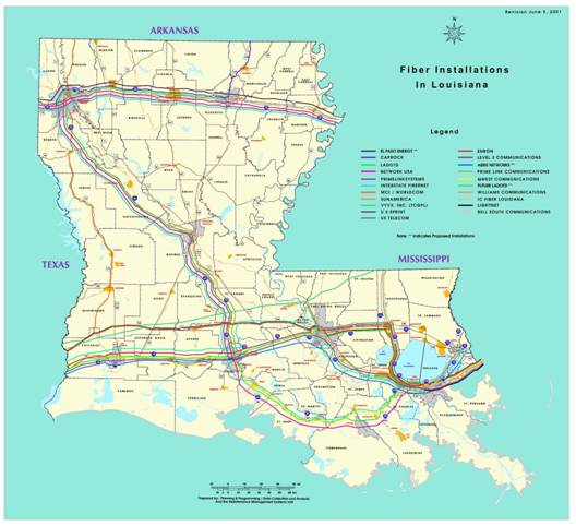
Source: LADOTD, http://www.dotd.louisiana.gov/highways/maintenance/fiberoptic/all_fiber_in_la.pdf. (Accessed on 4/11/2008.)
Figure A.2: Louisiana DOTD Fiber and Microwave Tower Locations (2001)
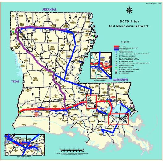
Source: LADOTD, http://www.dotd.louisiana.gov/highways/maintenance/fiberoptic/dotd_fiber_basemap.pdf. (Accessed on 4/11/2008.)
Figure A.3: Mississippi DOT Statewide Fiber Optic Infrastructure Plan
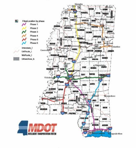
Source: Mississippi Department of Transportation.
Figure A.4: South Dakota Telecommunications Providers (January 2005)
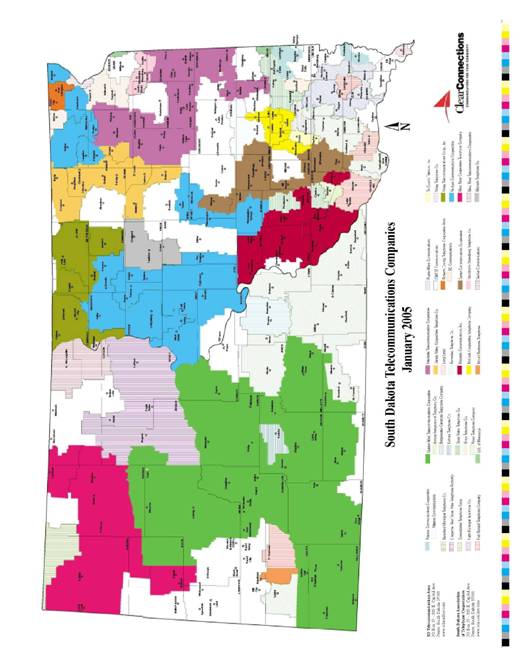
Source: South Dakota Telecommunications Association.
Figure A.5: South Dakota ITS Deployments (2007)
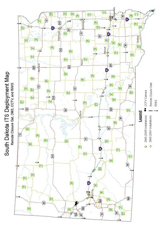
Source: South Dakota Dept. of Transportation.
Figure A.6: Wisconsin’s Fiber Optic Cable Installations (2006)
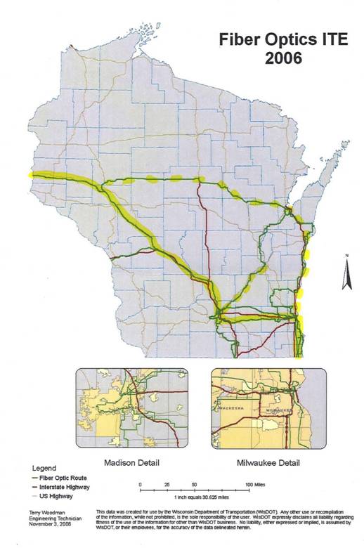
Source: Wisconsin Department of Transportation.
Figure A.7: Minnesota State Microwave System (2007)
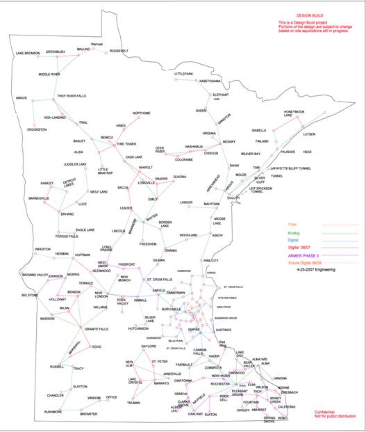
Source: Minnesota Department of Transportation.
Figure A.8: Broadband Availability in Massachusetts Map (June 2007)
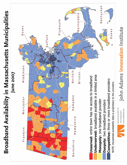
Source: John Adams Innovation Institute.
Figure A.9: Massachusetts Cable Providers Map (2005)
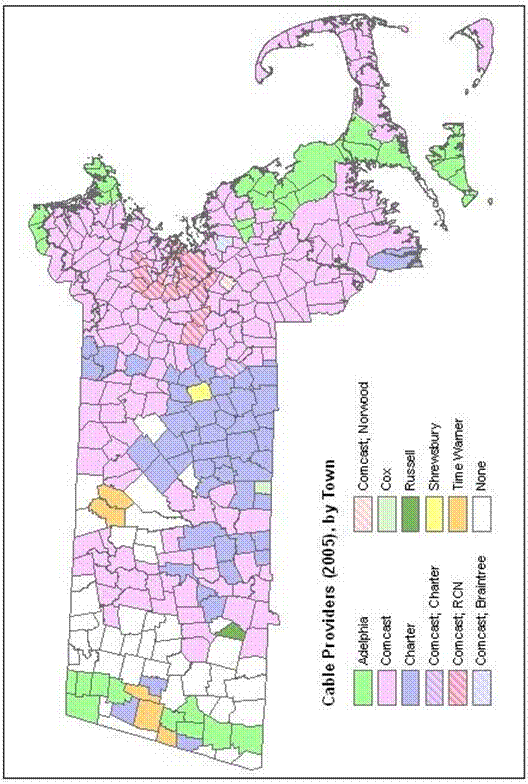
Source: MassGIS.
Figure A.10: Broadband Availability in Vermont (2006)
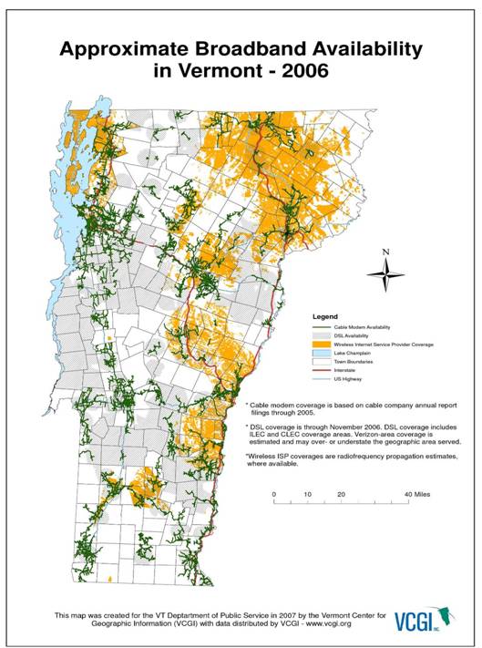
Source: Vermont Department of Public Service, http://www.publicservice.vermont.gov/cable/broadband_availability_map.html.pdf. (Accessed on 4/11/2008.)
Figure A.11: Vermont Telecommunications Providers (c.2003)
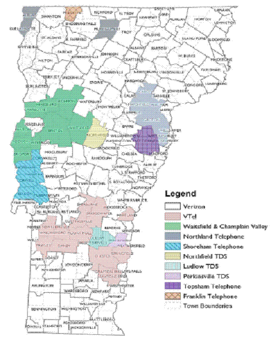
Source: Vermont Department of Public Service, http://www.publicservice.vermont.gov/images/telcoservicemap.gif. (Accessed on 4/11/2008.)
You will need the Adobe Acrobat Reader to view the PDFs on this page.