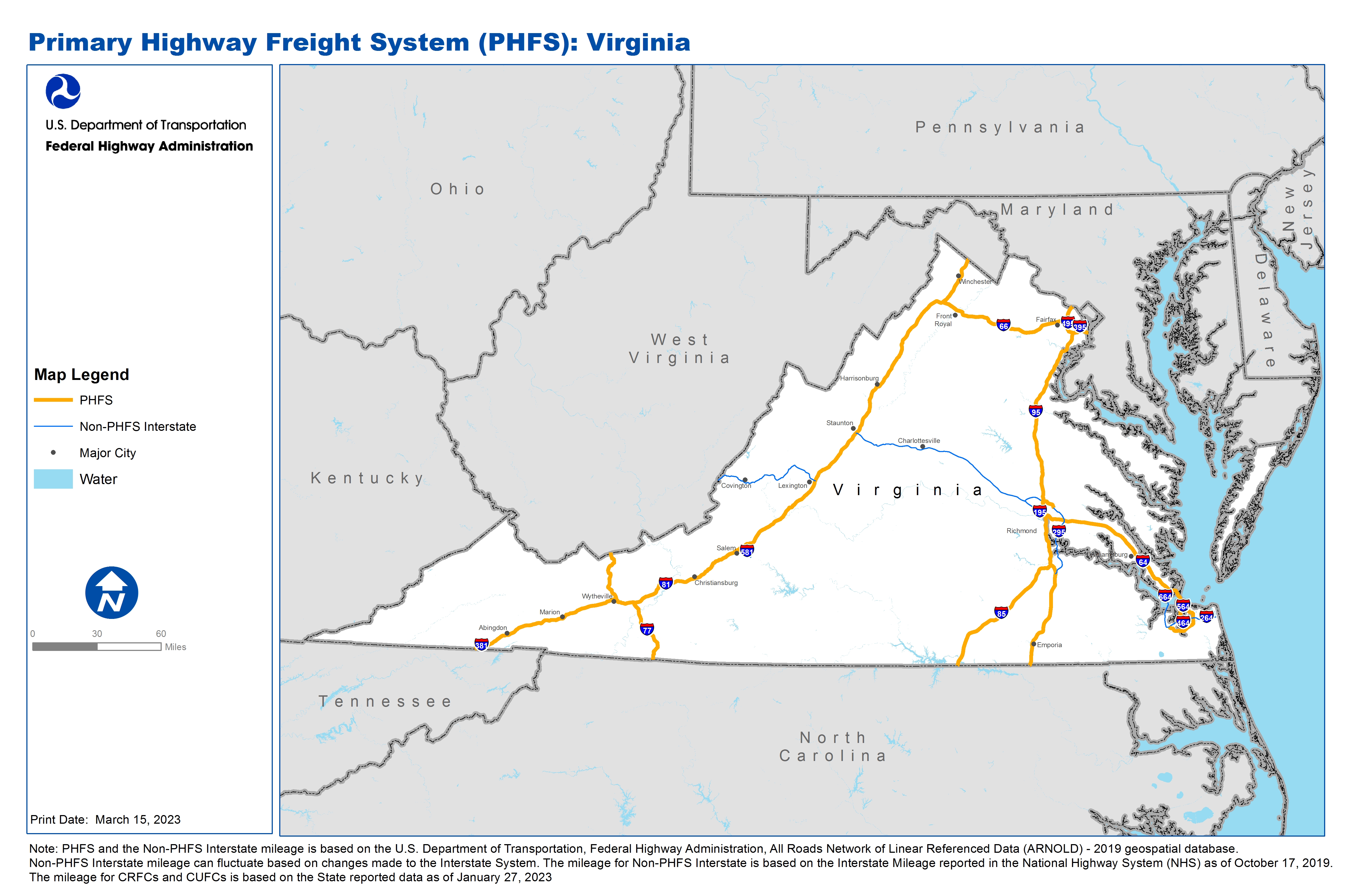
National Highway Freight Network Map and Tables for Virginia, 2022

High-Resolution Images
- JPG 3.6MB
Table of Final Primary Freight Network Routes, 2022
State |
Route No/ Facility Name |
Start Point |
End Point |
Route/Facility Description |
Length (Miles) |
|---|---|---|---|---|---|
VA |
I295 |
0.81 Miles West of I95 |
6.26 Miles East of I95 |
I295 from 0.81 Miles West of I95 to 6.26 Miles East of I95 |
7.11 |
VA |
I495 |
I95 |
VA/MD Line |
I495 from I95 to VA/MD Line |
15.40 |
VA |
I564 |
S406 |
I64 |
I564 from S406 to I64 |
0.73 |
VA |
I64 |
I264 |
I95 |
I64 from I264 to I95 |
109.12 |
VA |
I66 |
I81 |
I495 |
I66 from I81 to I495 |
64.90 |
VA |
I664 |
VA8P |
I64 |
I664 from VA8P to I64 |
5.08 |
VA |
I77 |
NC/VA Line |
I81 |
I77 from NC/VA Line to I81 |
32.24 |
VA |
I77 |
I81 |
VA/WV Line |
I77 from I81 to VA/WV Line |
27.02 |
VA |
I81 |
TN/VA Line |
VA/WV Line |
I81 from TN/VA Line to VA/WV Line |
324.28 |
VA |
I85 |
NC/VA Line |
I95 |
I85 from NC/VA Line to I95 |
68.52 |
VA |
I95 |
NC/VA Line |
VA/MD Line |
I95 from NC/VA Line to VA/MD Line |
177.32 |
VA |
S337 |
S406 |
U58 |
S337 from S406 to U58 |
4.11 |
VA |
S406 |
I564 |
S337 |
S406 from I564 to S337 |
1.74 |
VA |
VA11P - Port of Richmond - Deepwater Term. |
I95 |
Port of Richmond - Deepwater Term. |
Deep Water Rd. (Ent. to Connector), Connector Rd. (DW Rd. to Comm.), Commerce Rd (Conn. Rd to I-95) |
1.01 |
VA |
VA12R - Alexandria Intermodal - Norfolk Southern |
I95 |
Alexandria Intermodal - Norfolk Southern |
Metro Rd (entrance to Van Dorn St), Van Dorn St (Metro Rd to I-95) |
0.56 |
VA |
VA13R - Chesapeake Intermodal - Norfolk Southern |
I64 |
Chesapeake Intermodal - Norfolk Southern |
Atlantic Ave. (Entrance to S.R.168), S.R. 168 (Atlantic to I-64) |
2.08 |
VA |
VA7P - Port of Hampton Rds - Lamberts Point |
S337 |
Port of Hampton Rds - Lamberts Point |
Orapax Rd. (Entrance to Raleigh Ave.), Raleigh Ave (Orapax to S.R. 337) |
0.53 |
VA |
VA8P - Port of Hampton - Newport News Terminal |
I664 |
Port of Hampton - Newport News Terminal |
25th St. (Entrance to Huntington), Huntington Ave (25th to 26th), 26th Str. (Huntington to I- 664). 25th St. (Entrance to Huntington), Huntington (25th to 23rd), 23rd (Huntington to I- 664) |
0.91 |
PHFS Total |
|
|
|
|
842.64 |
State |
Route No/ Facility Name |
Start Point |
End Point |
Route/Facility Description |
Length (Miles) |
|---|---|---|---|---|---|
VA |
I195 |
S195 |
I64 |
I195 from S195 to I64 |
2.58 |
VA |
I264 |
I664 |
0.34 Miles West of Birdneck Rd |
I264 from I664 to 0.34 Miles West of Birdneck Rd |
24.32 |
VA |
I295 |
I95 (South) |
0.28 Miles North of U360 |
I295 from I95 (South) to 0.28 Miles North of U360 |
37.1 |
VA |
I295 |
0.29 Miles West of U1 |
I64 |
I295 from 0.29 Miles West of U1 to I64 |
8.77 |
VA |
I381 |
I81 |
S381 |
I381 from I81 to S381 |
1.39 |
VA |
I395 |
I95 (South) |
VA/DC Line |
I395 from I95 (South) to VA/DC Line |
9.67 |
VA |
I464 |
I264 |
I64 |
I464 from I264 to I64 |
5.75 |
VA |
I564 |
Admiral Taussig Blvd |
S406 |
I564 from Admiral Taussig Blvd to S406 |
1.80 |
VA |
I581 |
I81 |
U221 |
I581 from I81 to U221 |
6.55 |
VA |
I64 |
WV/VA Line |
I81 (South) |
I64 from WV/VA Line to I81 (South) |
57.45 |
VA |
I64 |
I81 (North) |
I95 |
I64 from I81 (North) to I95 |
100.4 |
VA |
I664 |
U60 |
I264 |
I664 from U60 to I264 |
15.17 |
INTERSTATE NON-PHFS Total |
|
|
|
|
270.95 |
Note: PHFS and the Non-PHFS Interstate mileage is based on the U.S. Department of Transportation, Federal Highway Administration, All Roads Network of Linear Referenced Data (ARNOLD) - 2019 geospatial database. Non-PHFS Interstate mileage can fluctuate based on changes made to the Interstate System. The mileage for Non-PHFS Interstate is based on the Interstate Mileage reported in the National Highway System (NHS) as of October 17, 2019. The mileage for CRFCs and CUFCs is based on the State reported data as of January 27, 2023
Sources
U.S. Department of Transportation, Federal Highway Administration, All Roads Network of Linear Referenced Data (ARNOLD) 2019.