National Highway Freight Network Map and Tables for Nevada, 2022

High-Resolution Images
- JPG 1.8MB
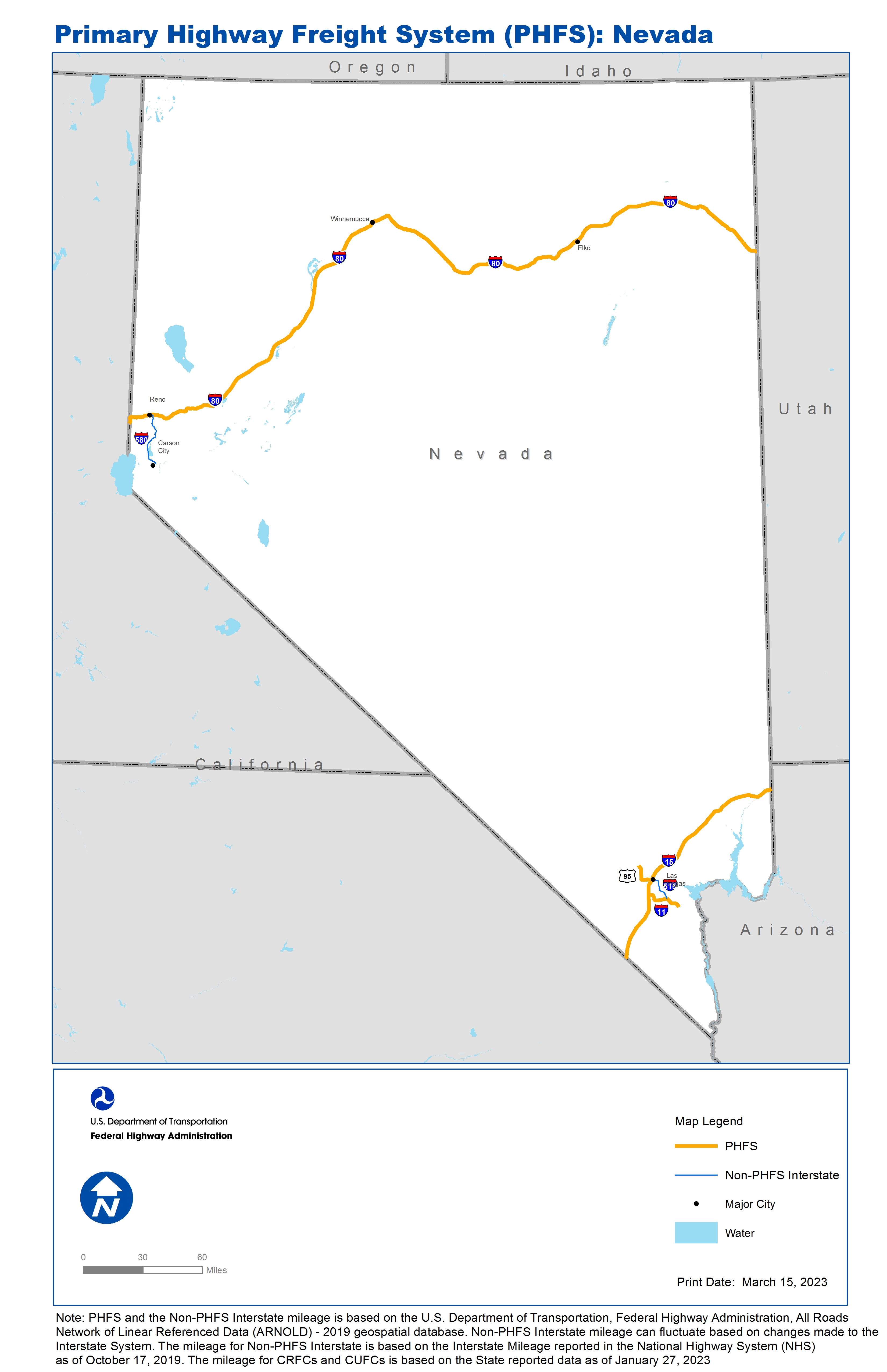
Table of National Highway Freight Network Routes, 2022
State |
Route No/ Facility Name |
Start Point |
End Point |
Route/Facility Description |
Length (Miles) |
|---|---|---|---|---|---|
NV |
I15 |
CA/NV Line |
NV/AZ Line |
I15 from CA/NV Line to NV/AZ Line |
123.75 |
NV |
I11 |
I215 |
NV/AZ Line |
I11 from I215 to NV/AZ Line |
7.49 |
NV |
I80 |
CA/NV Line |
NV/UT Line |
I80 from CA/NV Line to NV/UT Line |
410.52 |
NV |
I215 |
I15 |
I515 |
I215 from I15 to I515 |
11.17 |
NV |
U95 |
I15 |
4.49 Miles North of S573 |
U95 from I15 to 4.49 Miles North of S573 |
12.44 |
PHFS Total |
|
|
|
|
565.37 |
State |
Route No/ Facility Name |
Start Point |
End Point |
Route/Facility Description |
Length (Miles) |
|---|---|---|---|---|---|
NV |
I515 |
I215 |
I15 |
I515 from I215 to I15 |
14.44 |
NV |
I580 |
US50 |
I80 |
I580 from US50 to I80 |
30.09 |
INTERSTATE NON-PHFS Total |
44.53 |
Note: PHFS and the Non-PHFS Interstate mileage is based on the U.S. Department of Transportation, Federal Highway Administration, All Roads Network of Linear Referenced Data (ARNOLD) - 2019 geospatial database. Non-PHFS Interstate mileage can fluctuate based on changes made to the Interstate System. The mileage for Non-PHFS Interstate is based on the Interstate Mileage reported in the National Highway System (NHS) as of October 17, 2019. The mileage for CRFCs and CUFCs is based on the State reported data as of January 27, 2023
Sources
U.S. Department of Transportation, Federal Highway Administration, Freight Analysis Framework,
Version 4, 2015, Highway Performance Monitoring System 2012.