
Frequently Asked Questions
What Is a Road Weather Information System (RWIS)?
A Road Weather Information System (RWIS) is comprised of Environmental Sensor Stations (ESS) in the field, a communication system for data transfer, and central systems to collect field data from numerous ESS. These stations measure atmospheric, pavement and/or water level conditions. Central RWIS hardware and software are used to process observations from ESS to develop nowcasts or forecasts, and display or disseminate road weather information in a format that can be easily interpreted by a manager. RWIS data are used by road operators and maintainers to support decision making.
What Types and Sources of Road Weather Information are Available?
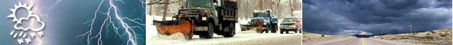
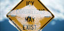
There are three types of road weather information: atmospheric data, pavement data, and water level data. Atmospheric data include air temperature and humidity, visibility distance, wind speed and direction, precipitation type and rate, cloud cover, tornado or waterspout occurrence, lightning, storm cell location and track, as well as air quality. Pavement data include pavement temperature, pavement freezing point, pavement condition (e.g., wet, icy, flooded), pavement chemical concentration, and subsurface conditions (e.g., soil temperature). Water level data include stream, river, and lake levels near roads, as well as tide levels (i.e., hurricane storm surge).
Transportation managers obtain road weather information from many sources including Road Weather Information Systems (RWIS), general weather observations and forecasts, and private sector vendors. General road weather observations are obtained from national surveillance systems to produce weather watches and warning for public safety. The National Weather Service (NWS) deploys sensor stations, balloon-borne sensors, Doppler radars, and other technologies to generate national, regional, and county forecasts. Surface weather observing systems are also deployed by the Federal Aviation Administration, the U.S. Geological Survey, the Department of Agriculture, the Forest Service, and the Environmental Protection Agency. General road weather data are also available from the National Centers for Environmental Prediction, the National Hurricane Center, local Weather Forecast Offices, and River Forecast Centers. Environmental data can also be collected from vehicle-based sensors. Some DOT's have deployed air and pavement temperature sensors on snow plows. Observation data from passenger vehicle sensors will be available in the future through the Vehicle Infrastructure Integration (VII) Initiative, which aims to deploy advanced vehicle-vehicle and vehicle-infrastructure communications.
Private vendors provide high-resolution, route-specific road weather information tailored for particular operational applications. These vendors - also known as Value Added Meteorological Services (VAMS) - add value to general road weather products by customizing forecasts specifically for transportation managers. Precipitation start and stop times are examples of tailored road weather forecasts.
Transportation managers utilize roadway warning systems, interactive telephone systems (e.g., 511), and web sites to disseminate road weather information to travelers in order to influence their decisions. This information allows travelers to make choices about travel mode, departure time, route selection, vehicle type and equipment, and driving behavior.
What is Clarus?
Clarus is not an acronym. Clarus means "clear" in Latin. The FHWA Clarus Initiative was a multi-year effort to develop and demonstrate an integrated surface transportation weather observation data management system, and to establish a partnership to create a Nationwide Surface Transportation Weather Observing and Forecasting System.
Where Can I Find Information on Road Weather Research and Development Activities?
Information on the Road Weather Research and Development Program can be found on the navigation bar under Research and Development. This page also describes research efforts conducted by Federal and state agencies, universities, organizations and international entities.
