National Highway Freight Network Map and Tables for North Dakota, 2022

High-Resolution Images
- JPG 2.2MB
Table of National Highway Freight Network Routes, 2022
State |
Route No/ Facility Name |
Start Point |
End Point |
Route/Facility Description |
Length (Miles) |
|---|---|---|---|---|---|
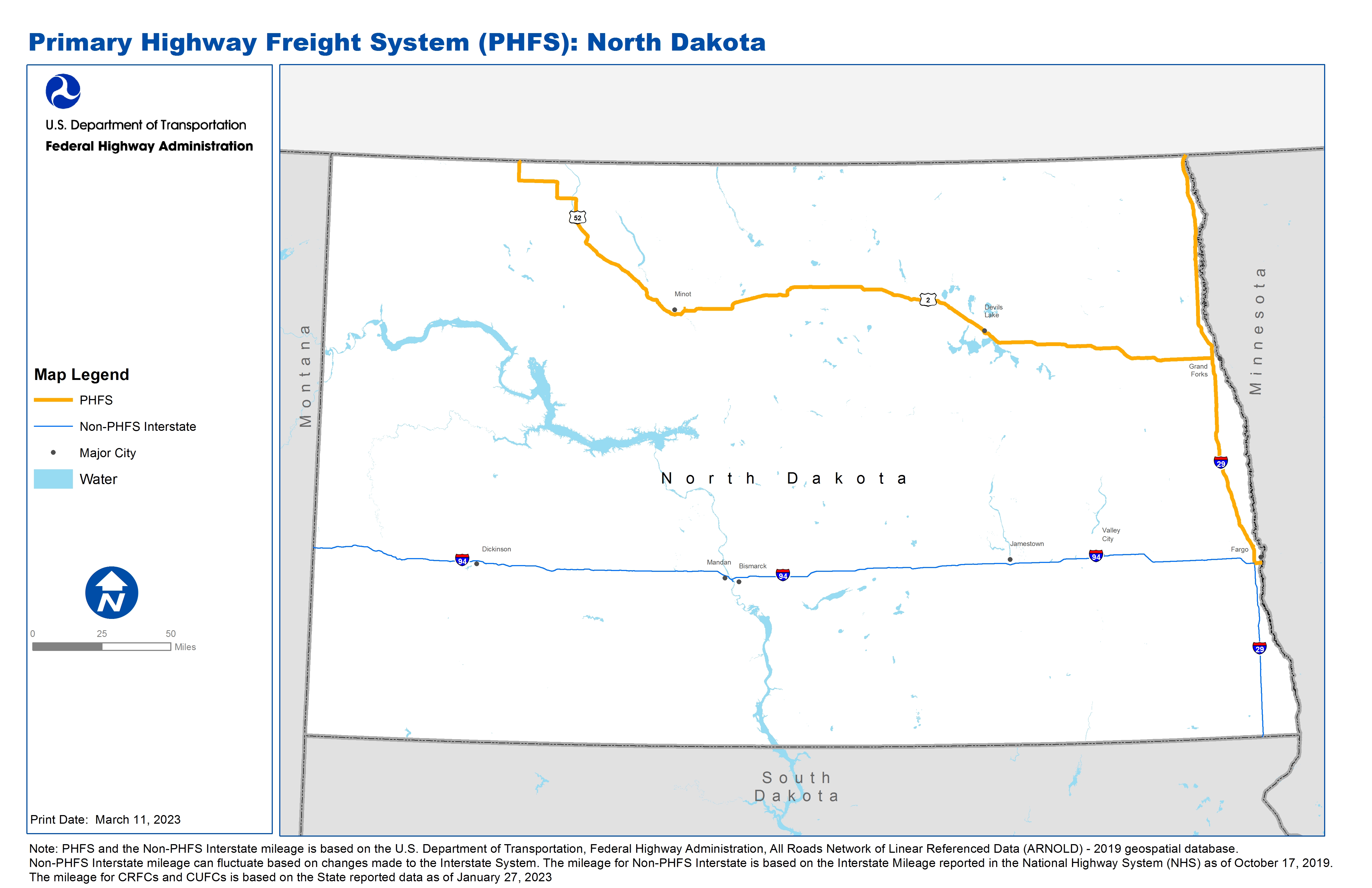
ND |
I29 |
I94 |
ND/MB Line |
I29 from I94 to ND/MB Line |
154.23 |
ND |
I94 |
I29 |
ND/MN Line |
I94 from I29 to ND/MN Line |
2.86 |
ND |
U2 |
U52 |
I29 |
U2 from U52 to I29 |
221.43 |
ND |
U52 |
U2 |
ND/SK Line |
U52 from U2 to ND/SK Line |
81.80 |
ND |
Minot Intermodal Facility |
U2 |
Minot Intermodal Facility |
55th St SE from U2 to 5th Av NE to the facility |
1.54 |
ND |
Amazon Fulfillment Center |
I29 |
Amazon Fulfillment Center |
40th Av N from I29 to Co Hwy 81 to the facility |
0.93 |
PHFS Total |
462.78 |
||||
State |
Route No/ Facility Name |
Start Point |
End Point |
Route/Facility Description |
Length (Miles) |
|---|---|---|---|---|---|
ND |
I194 |
I94 |
S810 |
I194 from I94 to S810 |
1.23 |
ND |
I29 |
SD/ND Line |
I94 |
I29 from SD/ND Line to I94 |
63.29 |
ND |
I94 |
MT/ND Line |
I29 |
I94 from MT/ND Line to I29 |
349.51 |
INTERSTATE NON-PHFS Total |
414.03 |
||||
Note: PHFS and the Non-PHFS Interstate mileage is based on the U.S. Department of Transportation, Federal Highway Administration, All Roads Network of Linear Referenced Data (ARNOLD) - 2019 geospatial database. Non-PHFS Interstate mileage can fluctuate based on changes made to the Interstate System. The mileage for Non-PHFS Interstate is based on the Interstate Mileage reported in the National Highway System (NHS) as of October 17, 2019. The mileage for CRFCs and CUFCs is based on the State reported data as of January 27, 2023