National Highway Freight Network Map and Tables for New Mexico, 2022
High-Resolution Images
- JPG 1.9MB
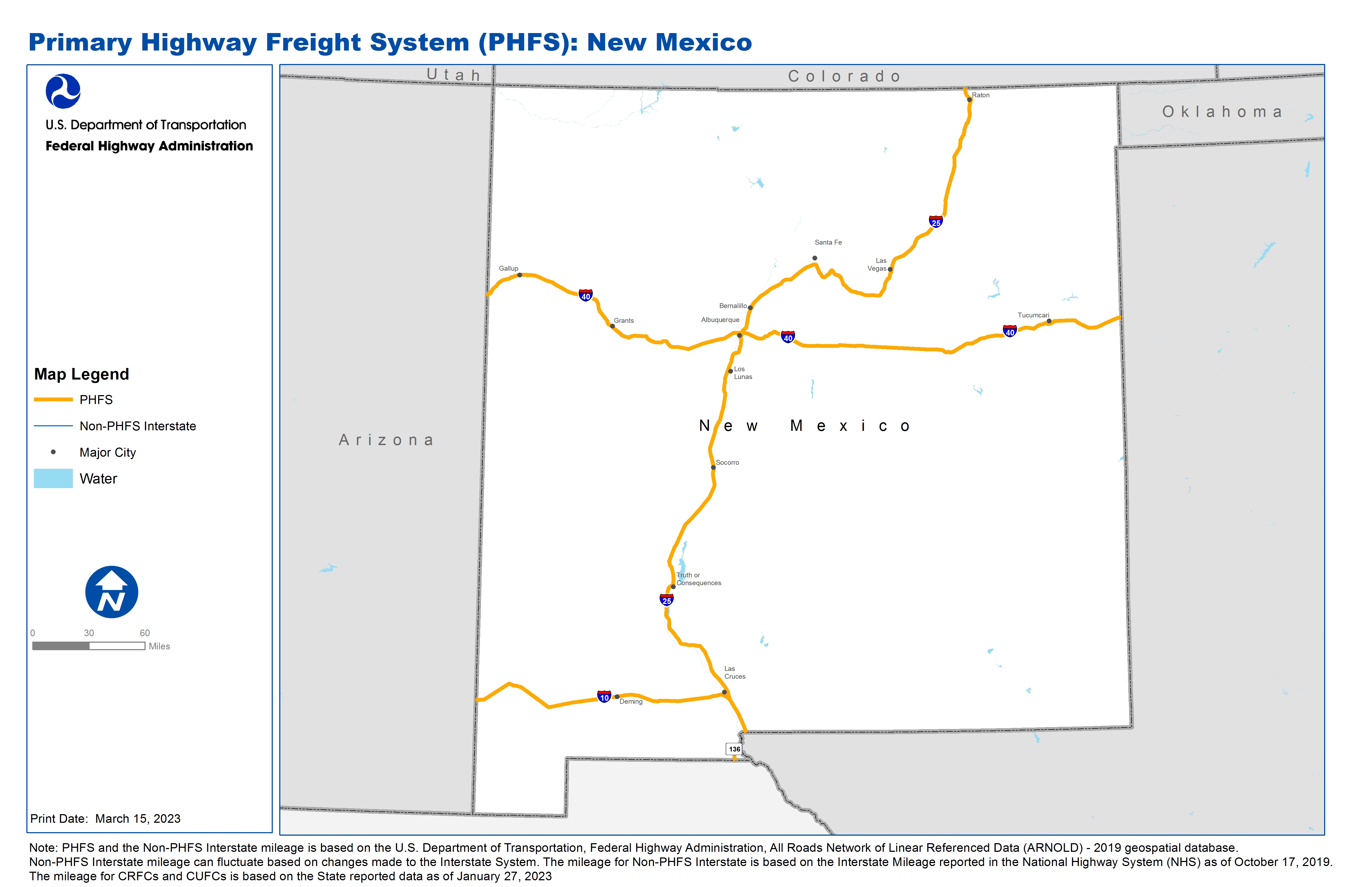
Table of National Highway Freight Network Routes, 2022
State |
Route No/ Facility Name |
Start Point |
End Point |
Route/Facility Description |
Length (Miles) |
|---|---|---|---|---|---|
NM |
I10 |
AZ/NM Line |
NM/TX Line |
I10 from AZ/NM Line to NM/TX Line |
164.34 |
NM |
I25 |
I10 |
NM/CO Line |
I25 from I10 to NM/CO Line |
461.53 |
NM |
I40 |
AZ/NM Line |
NM/TX Line |
I40 from AZ/NM Line to NM/TX Line |
373.18 |
NM |
Pete V Domenici Memorial Hwy |
MX/NM Line |
S136 |
Pete V Domenici Memorial Hwy from MX/NM Line to S136 |
2.81 |
NM |
S136 |
Pete V Domenici Memorial Hwy |
NM/TX Line |
S136 from Pete V Domenici Memorial Hwy to NM/TX Line |
6.36 |
NM |
NM1A - Albuquerque International Airport |
I25 |
Albuquerque International Airport |
Sunport Blvd from I25 to the Terminal |
0.96 |
PHFS Total |
|
|
|
|
1,009.17 |
State |
Route No/ Facility Name |
Start Point |
End Point |
Route/Facility Description |
Length (Miles) |
|---|---|---|---|---|---|
INTERSTATE NON-PHFS Total |
|
|
|
|
0 |
Note: PHFS and the Non-PHFS Interstate mileage is based on the U.S. Department of Transportation, Federal Highway Administration, All Roads Network of Linear Referenced Data (ARNOLD) - 2019 geospatial database. Non-PHFS Interstate mileage can fluctuate based on changes made to the Interstate System. The mileage for Non-PHFS Interstate is based on the Interstate Mileage reported in the National Highway System (NHS) as of October 17, 2019. The mileage for CRFCs and CUFCs is based on the State reported data as of January 27, 2023
Sources
U.S. Department of Transportation, Federal Highway Administration, Freight Analysis Framework,
Version 4, 2015, Highway Performance Monitoring System 2012.