a collage of eight photos showing a stakeholder meeting, people boarding a bus, a changeable message sign displaying the message race traffic, cars traversing a roadway where barricades delineate travel lanes, a closed-circuit television camera, a crowd of people standing near a train and traversing a pedestrian overpass, two implementation plans, and three traffic management team personnel gathered around a laptop computer

Managing Travel for Planned Special Events

Appendix K. Example Traffic Control Plans

map highlighting the street control plan for the Santa Clarita (CA) 4th of July Parade. The map shows the parade route, which roads are closed for staging, where traffic cones are placed, detour routes, and no parking areas

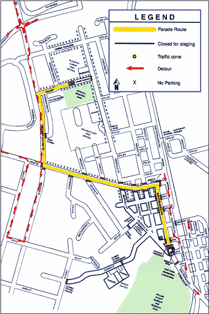
Street Control Plan, Santa Clarita (CA) 4th of July Parade
Source: www.scvleon.com/parade/


map showing an intersection control plan, Outbound Phase A, for Daytona (FL) Speedweeks. The intersection shown on the map is U.S. 92 and Midway Ave.

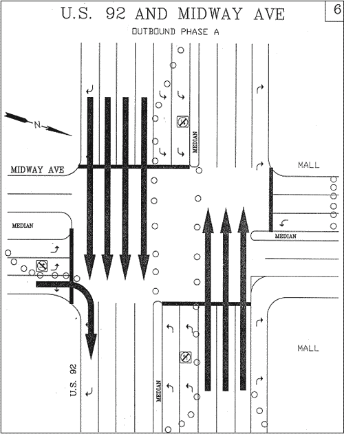
Intersection Control Plan, Daytona (FL) Speedweeks
Source: Reference 18 (Chapter 6)


map showing an ATIS Operations Plan, for freeway signs, for the 2002 NASCAR Brickyard 400 in Speedway, IN.  The map is from the Indianapolis Traffic Management Center and indicates the text of the freeway signs and where each sign is located

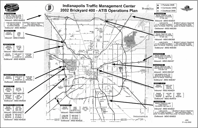
Freeway Signing Plan, NASCAR Brickyard 400 – Speedway, IN
Source: Indiana DOT


map showing the position of traffic control equipment for an Alpine Valley (WI) concert event. The map indicates where barricades and cones are located and the number of barricades and cones at each location

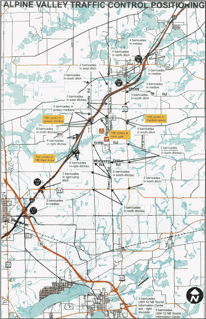
Equipment Location Plan, Alpine Valley (WI) Concert Event
Source: Wisconsin DOT


map showing equipment location for the NSW Brush Fire Parade in Sydney, Australia, on February 8, 2002. Symbols on the map indicate the number of barricades, road closures, partial road closures, closure locations, contingency closure locations, and contingency road closures

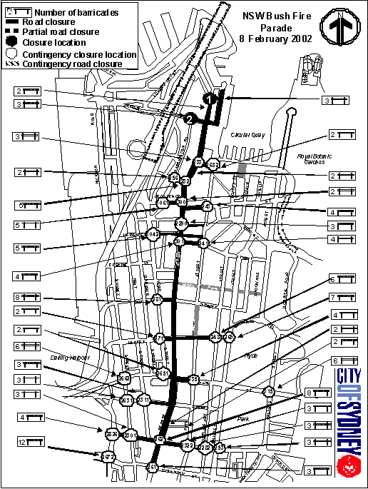
Equipment Location Plan, Sydney, Australia Parade
Source: Reference 20 (Chapter 6)