21st Century Operations Using 21st Century Technologies
| Office of Operations | 21st Century Operations Using 21st Century Technologies |
Complete Trip Data Factsheet
FHWA-HOP-22-066 August 2022 PDF Version [2 MB] BackgroundThe Moving Ahead for Progress in the 21st Century Act of 2012 (MAP-21) ushered in a performance-based approach to the Federal-Aid Highway Program. During the development of MAP-21 system performance measures (the third performance management rule, sometimes referred to as PM3 or 23 CFR 490.500-490.800), the Federal Highway Administration (FHWA) received thousands of comments, including some asking for multimodal measures that quantify person movements across all modes rather than vehicle movements. In response to these comments, FHWA completed the Multimodal System Performance Measures Research and Application study and produced an Innovation and Research Plan (FHWA-HOP-18-085). The fundamental finding of the research was that multimodal performance is difficult if not impossible to determine without complete person-trip information; i.e., data that tracks trips across the multimodal network from beginning to end. At the time of the original study, complete person-trip information was not available. Many years later, follow-on research completed by FHWA in the spring of 2022 found that complete person-trip data across all modes are now available from private vendors. Looking beyond performance measurement, the research also identifies potential applications for complete-trip data within transportation planning and management as well as operations. What is Complete Person Trip Data and Who Provides It?Complete trip data track individual trips across the network from the point of origin to the destination. Time stamped, geographically positioned “pings” from cell phones and GPS devices track the movement of devices carried by people over time. These pings are associated with transportation network segments (roads, sidewalks, bus-routes, rail lines, etc.) and organized into discrete trips. Figure 1 illustrates how raw data are organized for a complex auto, transit, and walking trip. 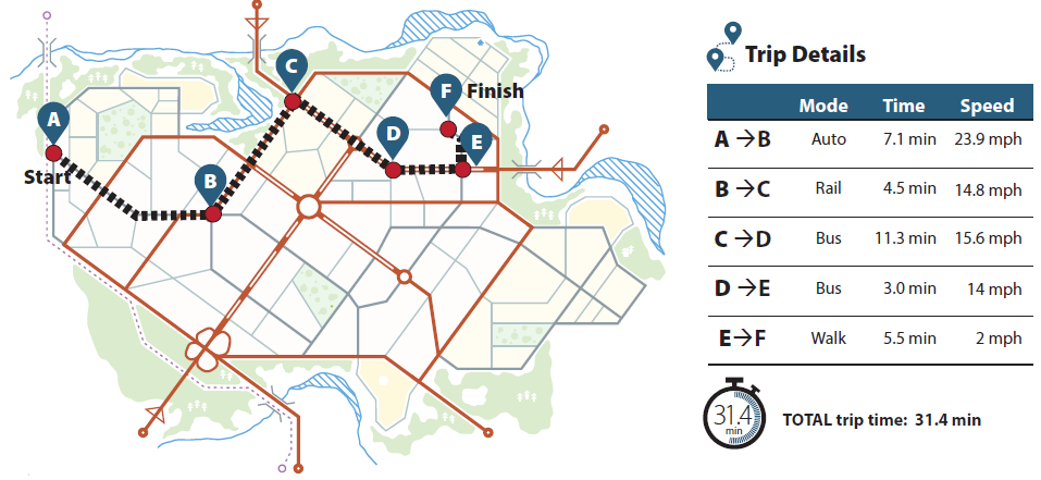
Source: FHWA. Figure 1. Illustration. Multimodal trip.
Agencies interested in acquiring complete trip data should consider including the following fields in a data requirements request (table 1), as well as requiring the data to be privacy protected and anonymized.
How Can Complete Person Trip Data be Summarized and Used?Based on surveys of private vendors, complete person trip data sets can provide a rich set of information on where trips begin and end, the times trips are made, and the paths they travel. The complete trip data as defined in this factsheet can provide insights into system performance monitoring (as envisioned by the original research), transportation planning, and transportation system management and operations. Examples include: 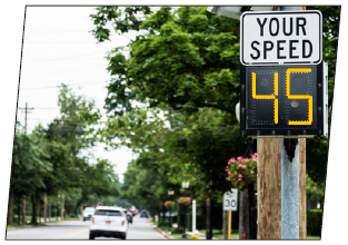 Source: Source: Getty Images, Inc. Transportation planning – contextualize the performance of network segments (e.g., how will lower speeds resulting from a complete street improvement impact door to door travel times across all trips currently using the segment?) 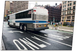 Source: Source: Getty Images, Inc. Corridor studies – evaluate network productivity trade-offs among modal options (e.g., how does converting an arterial lane to a dedicated bus rapid transit lane influence the overall productivity of the corridor?) 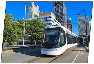 Source: Source: Getty Images, Inc. Transportation system management and operations – determine network resilienceacross modes (e.g., to whatextent do travelers takeadvantage of alternative travelpaths and/or modes when amajor roadway is closed duringpeak periods?) | |||||||||||||||||||||||||||||||||||||||||||||||||||||||||
|
United States Department of Transportation - Federal Highway Administration |
||