Measures of Effectiveness and Validation Guidance for Adaptive Signal Control Technologies
Appendix F. Additional Supporting Data from the Field Testing
Average Route Travel Time Comparisons
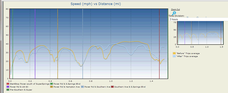
Figure 59. Line Graph. Comparison of Average Speed for Route 2.
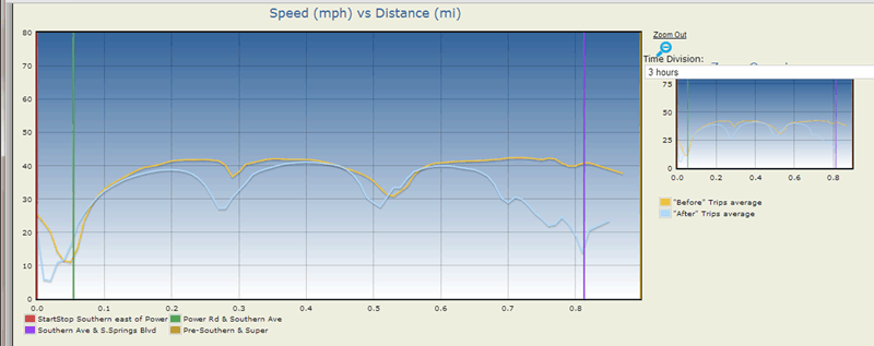
(Source: Kimley-Horn and Associates, Inc.)
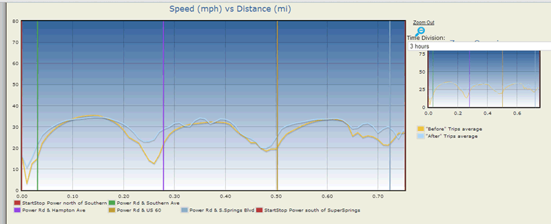
Figure 60. Line Graph. Comparison of Average Speed for Route 3.
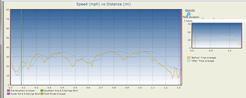
(Source: Kimley-Horn and Associates, Inc.)
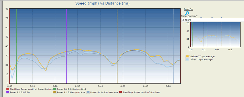
Figure 61. Line Graph. Comparison of Average Speed for Route 4.
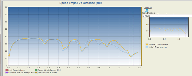
(Source: Kimley-Horn and Associates, Inc.)
Figure 62. Line Graph. Comparison of Average Speed for Route 5.
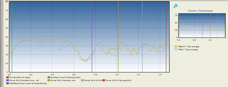
(Source: Kimley-Horn and Associates, Inc.)
Figure 63. Line Graph. Comparison of Average Speed for Route 6.
(Source: Kimley-Horn and Associates, Inc.)
Figure 64. Line Graph. Comparison of Average Speed for Route 7.
(Source: Kimley-Horn and Associates, Inc.)
Figure 65. Line Graph. Comparison of Average Speed for Route 8.
(Source: Kimley-Horn and Associates, Inc.)