Best Practices for Road Weather Management
Iowa DOT Weatherview Road Weather Traveler Information System
The Iowa Department of Transportation’s (Iowa DOT) “Weatherview” website is an example of real-time road weather information provided for the traveling public. “Weatherview’ was made available online in 1999. The current site was released in 2009. Subsequently, it has been updated to incorporate road cameras, traffic flow information, and maintenance tools like e-mail and mobile-text alerts triggered by certain weather events. Additionally, plow truck locations obtained via Global Positioning Satellites (GPS) are reported to personnel with Iowa DOT viewing permissions.
System Components: The “Weatherview” system consists of the following elements:
- A main map to display and overlay information from Road Weather Information System (RWIS) stations and information from Automated Weather Observation Systems (AWOS), as shown in Figure IA-2
- Site-specific forecasts to aid in road maintenance, along with historical weather graphs and charts
- Camera image gallery
- Rural traffic speed information
- Features that allow Iowa DOT-authorized personnel access to
- E-mail alert subscriptions based on site observations,
- GPS and Automated Vehicle Location (AVL) data showing current truck locations and plow/spreader information,
- Work status of winter maintenance crews around the state.
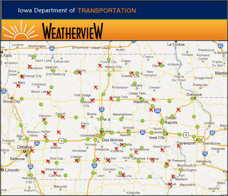
Figure IA-2. “Weatherview” website showing RWIS and AWOS site locations.
System Operations: The “Weatherview” site is hosted by Iowa DOT and retrieves current AWOS and RWIS information from the department’s databases. Google Maps software is used to manage map display functionality. The site retrieves Iowa DOT GPS and crew status map layers from Iowa DOT’s Geographic Information System (GIS) map services system.
Transportation Outcome(s): The “Weatherview” system enables easy access to real-time, useful weather information to travelers, Iowa DOT maintenance crews, local agency maintenance crews, and the general public. This information is used to make treatment decisions, is shared with airport commissions to help organize flight plans, helps to monitor road conditions and traffic flow in inclement weather, and aids in planning daily travel or activities.
Implementation Issues: The new “Weatherview” website contains more high-bandwidth products than the original, especially Google mapping and camera images. The site has required more server capacity in order to provide quick and reliable information to the thousands of users that access it during a storm. The additional advanced functionality also makes it more complicated than the original site, requiring more information technology support staff to maintain it.
Contact(s):
- Tina Greenfield, Iowa DOT RWIS Coordinator, 515-233-7746.
- Annette Dunn, Iowa DOT Winter Operations Administrator, 515-239-1355.
Reference(s):
Keywords: Road Weather Information, travelers, website, real-time, mapping.
previous | next