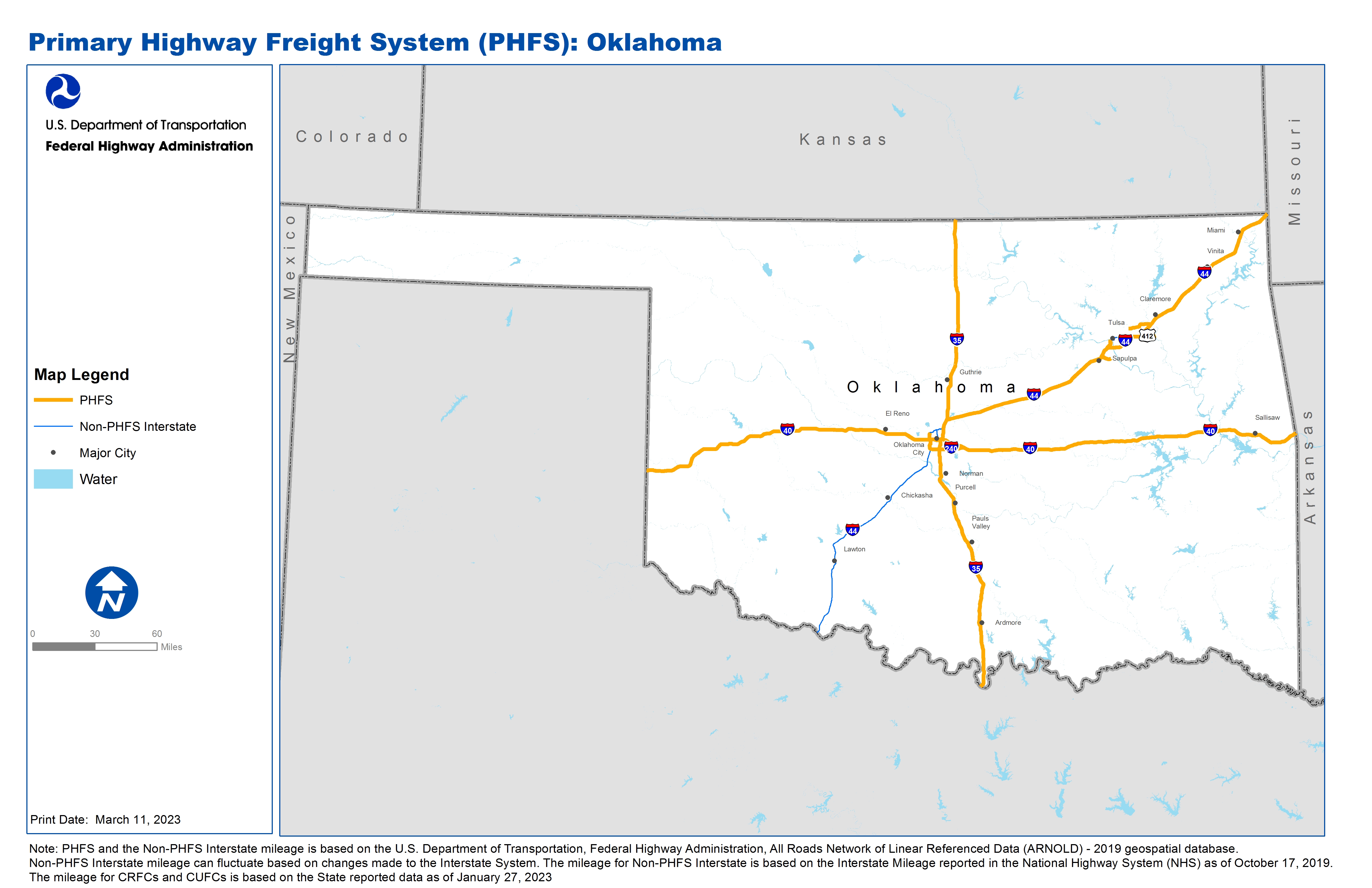
National Highway Freight Network Map and Tables for Oklahoma, 2022
High-Resolution Images
- JPG 2.4MB
Table of National Highway Freight Network Routes, 2022
State |
Route No/ Facility Name |
Start Point |
End Point |
Route/Facility Description |
Length (Miles) |
|---|---|---|---|---|---|
OK |
S364 (Creek Turnpike) |
I44 |
U75 |
S364 (Creek Turnpike) from I44 to U75 |
4.74 |
OK |
I240 |
I44 |
I40 |
I240 from I44 to I40 |
16.50 |
OK |
I244 |
OK3R |
I44 |
I244 from OK3R to I44 |
3.63 |
OK |
I35 |
TX/OK Line |
OK/KS Line |
I35 from TX/OK Line to OK/KS Line |
235.78 |
OK |
I40 |
TX/OK Line |
I35 |
I40 from TX/OK Line to I35 |
151.97 |
OK |
I40 |
I35 |
OK/AR Line |
I40 from I35 to OK/AR Line |
177.96 |
OK |
I44 |
I240 |
3.28 Miles North of I40 |
I44 from I240 to 3.28 Miles North of I40 |
8.02 |
OK |
I44 |
I35 |
OK/MO Line |
I44 from I35 to OK/MO Line |
194.58 |
OK |
U412 |
OK6P |
I44 |
U412 from OK6P to I44 |
5.33 |
OK |
OK2L - Williams Pipeline Station |
33rd Ave |
Williams Pipeline Station |
21st St (33rd W Ave to Burlington Northern RR at 23rd St) |
0.90 |
OK |
OK3R - Burlington Northern Railroad |
I244 |
Burlington Northern Railroad |
23rd St (BN Terminal to Southwest Ave), SW Ave (23rd St to I-244 Ramp) |
0.61 |
OK |
OK5P - Port of Catoosa |
U169 |
Port of Catoosa |
SR 266 (Port to US 169) |
11.50 |
OK |
OK6P - Johnston's Port 33 (Verdigris River near Muskogee) |
U412 |
Johnston's Port 33 (Verdigris River near Muskogee) |
From US 412/NS 414, 1.54 miles on S412P |
1.54 |
PHFS Total |
813.05 |
||||
State |
Route No/ Facility Name |
Start Point |
End Point |
Route/Facility Description |
Length (Miles) |
|---|---|---|---|---|---|
OK |
I235 |
I40 |
I44 |
I235 from I40 to I44 |
5.11 |
OK |
I244 |
S 21st St |
I44 |
I244 from S 21st St to I44 |
12.14 |
OK |
I44 |
TX/OK Line |
I240 |
I44 from TX/OK Line to I240 |
114.74 |
OK |
I44 |
0.35 Miles South of S66 |
I35 |
I44 from 0.35 Miles South of S66 to I35 |
7.67 |
OK |
I444 |
I244 (South) |
I244 (North) |
I444 from I244 (South) to I244 (North) |
2.82 |
INTERSTATE NON-PHFS Total |
142.47 |
||||
Note: PHFS and the Non-PHFS Interstate mileage is based on the U.S. Department of Transportation, Federal Highway Administration, All Roads Network of Linear Referenced Data (ARNOLD) - 2019 geospatial database. Non-PHFS Interstate mileage can fluctuate based on changes made to the Interstate System. The mileage for Non-PHFS Interstate is based on the Interstate Mileage reported in the National Highway System (NHS) as of October 17, 2019. The mileage for CRFCs and CUFCs is based on the State reported data as of January 27, 2023