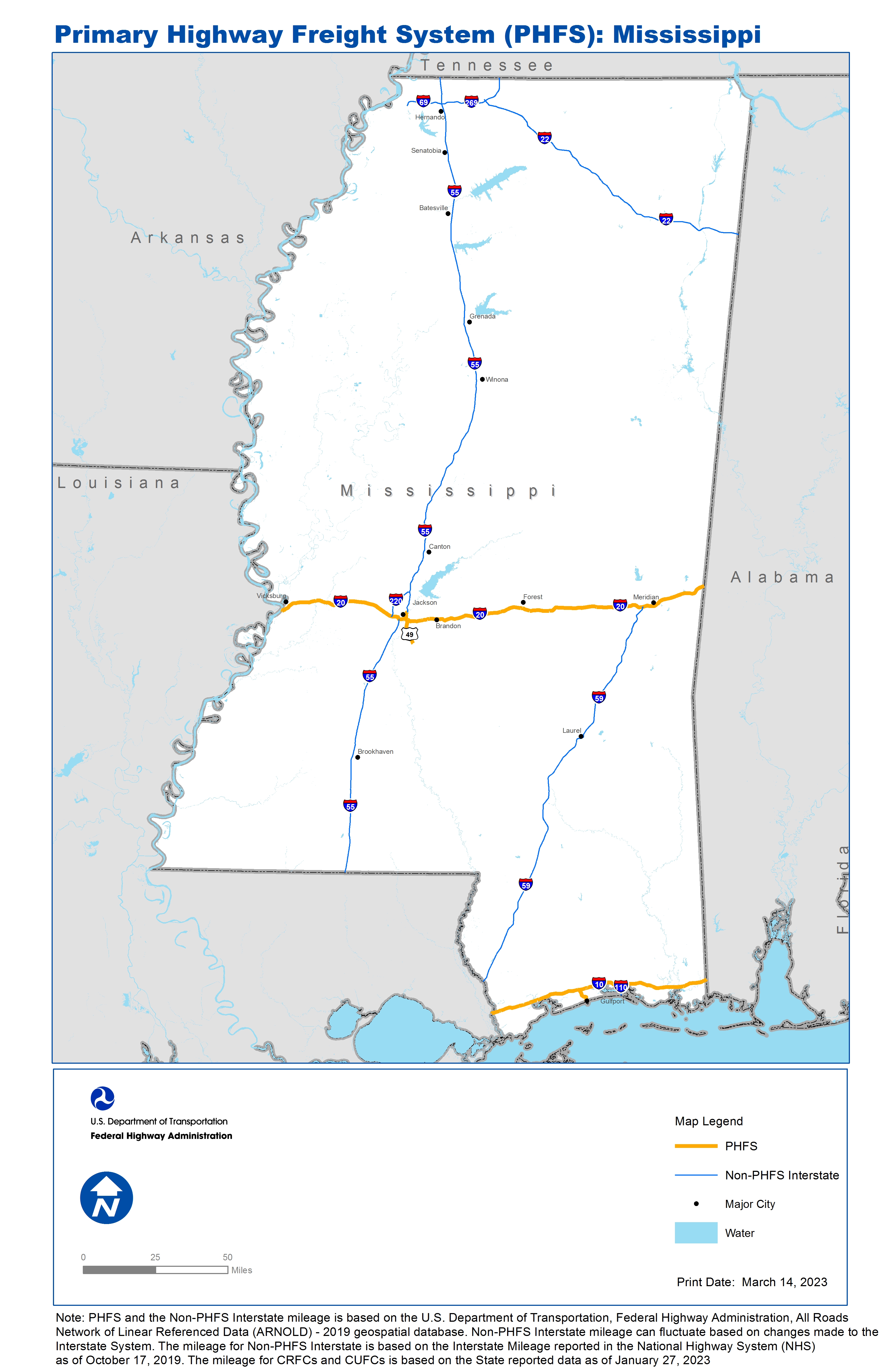
National Highway Freight Network Map and Tables for Mississippi, 2022

High-Resolution Images
- JPG 3.0MB
Table of Final Primary Freight Network Routes, 2022
State |
Route No/ Facility Name |
Start Point |
End Point |
Route/Facility Description |
Length (Miles) |
|---|---|---|---|---|---|
MS |
I10 |
LA/MS Line |
MS/AL Line |
I10 from LA/MS Line to MS/AL Line |
76.84 |
MS |
I20 |
LA/MS Line |
MS/AL Line |
I20 from LA/MS Line to MS/AL Line |
154.00 |
MS |
I55 |
Fortification St |
I20 |
I55 from Fortification St to I20 |
2.65 |
MS |
US49 |
I20 |
MS469 |
US49 from I20 to MS469 |
8.66 |
MS |
MS5P - Port of Gulfport |
I10 |
Port of Gulfport |
30th Ave to Proposed MS 601 to Canal Rd to I-10 |
5.38 |
PHFS Total |
|
|
|
|
247.53 |
State |
Route No/ Facility Name |
Start Point |
End Point |
Route/Facility Description |
Length (Miles) |
|---|---|---|---|---|---|
MS |
I110 |
U90 |
I10 |
I110 from U90 to I10 |
4.00 |
MS |
I220 |
I20 |
I55 |
I220 from I20 to I55 |
11.80 |
MS |
I55 |
LA/MS Line |
I20 |
I55 from LA/MS Line to I20 |
91.41 |
MS |
I55 |
Fortification Street |
MS/TN Line |
I55 from Fortification Street to MS/TN Line |
194.00 |
MS |
I59 |
LA/MS Line |
I20 |
I59 from LA/MS Line to I20 |
148.29 |
MS |
I22 |
0.66 Miles West of I269 |
AL/MS Line |
I22 from 0.66 Miles West of I269 to AL/MS Line |
106.62 |
MS |
I269 |
I55 |
TN/MS Line |
I269 from I55 to TN/MS Line |
26.08 |
MS |
I69 |
0.82 Miles South of Green River Rd |
0.037 Miles East of I55 |
I69 from 0.82 Miles south of Green River Rd to 0.037 Miles East of I55 |
13.12 |
INTERSTATE NON-PHFS Total |
595.32 |
Note: PHFS and the Non-PHFS Interstate mileage is based on the U.S. Department of Transportation, Federal Highway Administration, All Roads Network of Linear Referenced Data (ARNOLD) - 2019 geospatial database. Non-PHFS Interstate mileage can fluctuate based on changes made to the Interstate System. The mileage for Non-PHFS Interstate is based on the Interstate Mileage reported in the National Highway System (NHS) as of October 17, 2019. The mileage for CRFCs and CUFCs is based on the State reported data as of January 27, 2023
Sources
U.S. Department of Transportation, Federal Highway Administration, Freight Analysis Framework,
Version 4, 2015, Highway Performance Monitoring System 2012.