National Highway Freight Network Map and Tables for District of Columbia, 2022
High-Resolution Images
- JPG 1.9MB
Table of National Highway Freight Network Routes, 2022
|
State |
Route No/ Facility Name |
Start Point |
End Point |
Route/Facility Description |
Length (Miles) |
|---|---|---|---|---|---|
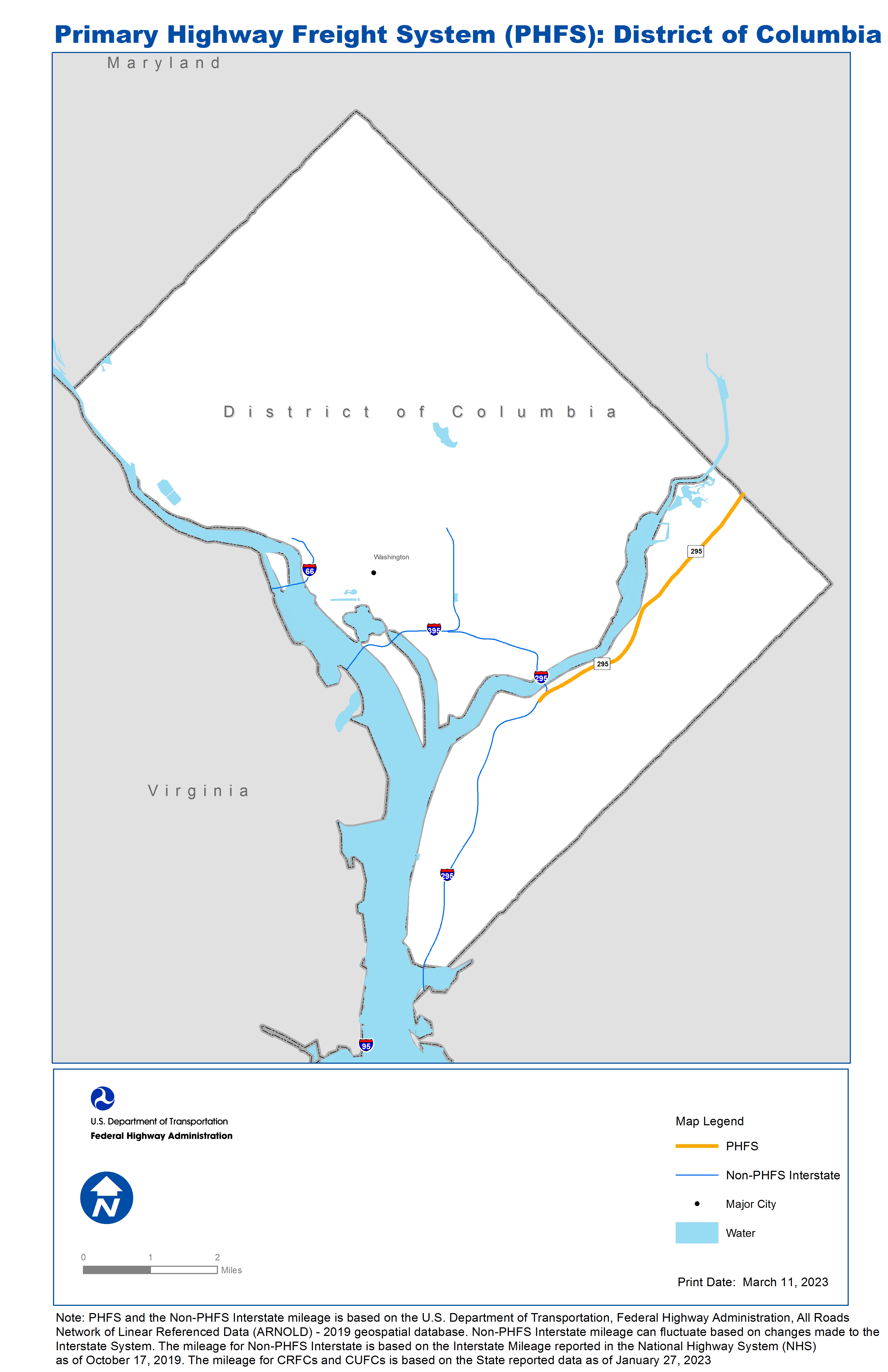
DC |
I95 |
VA/DC Line |
DC/MD Line |
I95 from VA/DC Line to DC/MD Line |
0.06 |
DC |
S295 |
I295 |
DC/MD Line |
S295 from I295 to DC/MD Line |
4.52 |
PHFS Total |
|
|
|
|
4.58 |
|
State |
Route No/ Facility Name |
Start Point |
End Point |
Route/Facility Description |
Length (Miles) |
|---|---|---|---|---|---|
DC |
I295 |
DC/MD Line |
I395 |
I295 from DC/MD Line to I395 |
7.12 |
DC |
I395 |
VA/DC Line |
U50 |
I395 from VA/DC Line to U50 |
3.47 |
DC |
I66 |
U29 |
U50 |
I66 from U29 to U50 |
0.88 |
INTERSTATE NON-PHFS Total |
|
|
|
|
11.48 |
Note: PHFS and the Non-PHFS Interstate mileage is based on the U.S. Department of Transportation, Federal Highway Administration, All Roads Network of Linear Referenced Data (ARNOLD) - 2019 geospatial database. Non-PHFS Interstate mileage can fluctuate based on changes made to the Interstate System. The mileage for Non-PHFS Interstate is based on the Interstate Mileage reported in the National Highway System (NHS) as of October 17, 2019. The mileage for CRFCs and CUFCs is based on the State reported data as of January 27, 2023
Sources
U.S. Department of Transportation, Federal Highway Administration, All Roads Network of Linear Referenced Data (ARNOLD) 2019.