National Highway Freight Network Map and Tables for Arizona, 2022
High-Resolution Images
- JPG 2.0MB
Table of National Highway Freight Network Routes, 2022
|
State |
Route No/ Facility Name |
Start Point |
End Point |
Route/Facility Description |
Length (Miles) |
|---|---|---|---|---|---|
AZ |
I10 |
CA/AZ Line |
AZ/NM Line |
I10 from CA/AZ Line to AZ/NM Line |
391.95 |
AZ |
I15 |
CA/AZ Line |
AZ/NV Line |
I15 from CA/AZ Line to AZ/NV Line |
29.42 |
AZ |
I17 |
I10 |
I40 |
I17 from I10 to I40 |
145.31 |
AZ |
I19 |
MX/AZ Line |
I10 |
I19 from MX/AZ Line to I10 |
63.14 |
AZ |
I40 |
CA/AZ Line |
AZ/NM Line |
I40 from CA/AZ Line to AZ/NM Line |
359.05 |
AZ |
S101 |
S202 |
Warner Rd |
S101 from S202 to Warner Rd |
6.85 |
AZ |
S202 |
I10 |
S101 |
S202 from I10 to S101 |
9.53 |
AZ |
Thomas Rd |
I17 |
U60 |
Thomas Rd from I17 to U60 |
0.23 |
AZ |
U60 |
I10 |
Gilbert Rd |
U60 from I10 to Gilbert Rd |
10.41 |
AZ |
AZ15R - Glendale Intermodal & Auto Yard |
I10 |
Glendale Intermodal & Auto Yard |
51st Ave (Grand Ave to I-10) |
4.27 |
AZ |
AZ16R - Phoenix Intermodal & Auto Yard |
I10 |
Phoenix Intermodal & Auto Yard |
7th St (I-10 to I-17). |
2.28 |
AZ |
AZ1A - Phoenix Sky Harbor International Airport |
I10 |
Phoenix Sky Harbor International Airport |
Sky Harbor Blvd between I-10 and SR 153 |
4.35 |
PHFS Total |
|
|
|
|
1,026.79 |
|
State |
Route No/ Facility Name |
Start Point |
End Point |
Route/Facility Description |
Length (Miles) |
|---|---|---|---|---|---|
AZ |
I8 |
CA/AZ Line |
I10 |
I8 from CA/AZ Line to I10 |
178.45 |
INTERSTATE NON-PHFS Total |
|
|
|
|
178.45 |
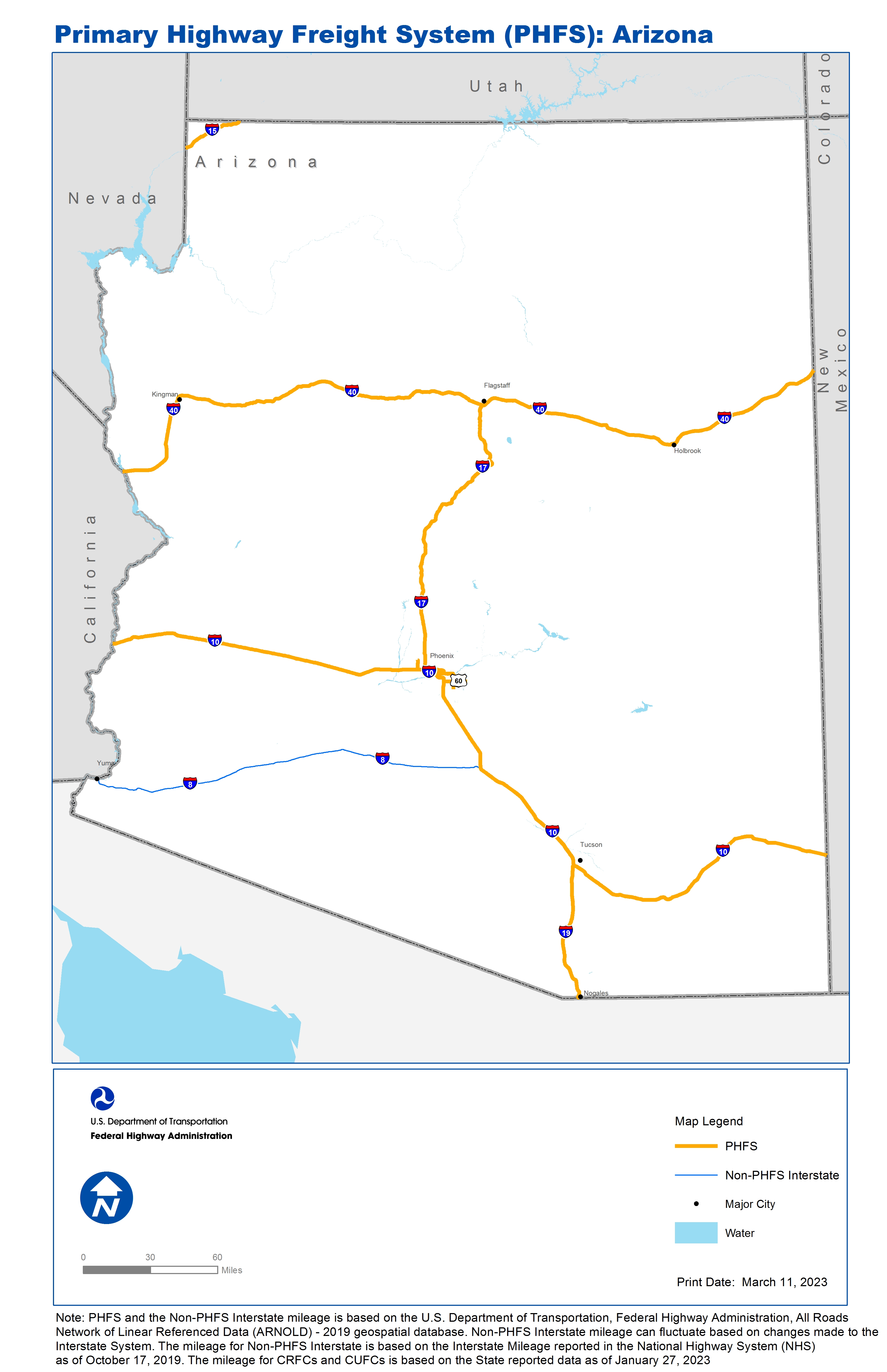
Note: PHFS and the Non-PHFS Interstate mileage is based on the U.S. Department of Transportation, Federal Highway Administration, All Roads Network of Linear Referenced Data (ARNOLD) - 2019 geospatial database. Non-PHFS Interstate mileage can fluctuate based on changes made to the Interstate System. The mileage for Non-PHFS Interstate is based on the Interstate Mileage reported in the National Highway System (NHS) as of October 17, 2019. The mileage for CRFCs and CUFCs is based on the State reported data as of January 27, 2023
Sources
U.S. Department of Transportation, Federal Highway Administration, All Roads Network of Linear Referenced Data (ARNOLD) 2019.