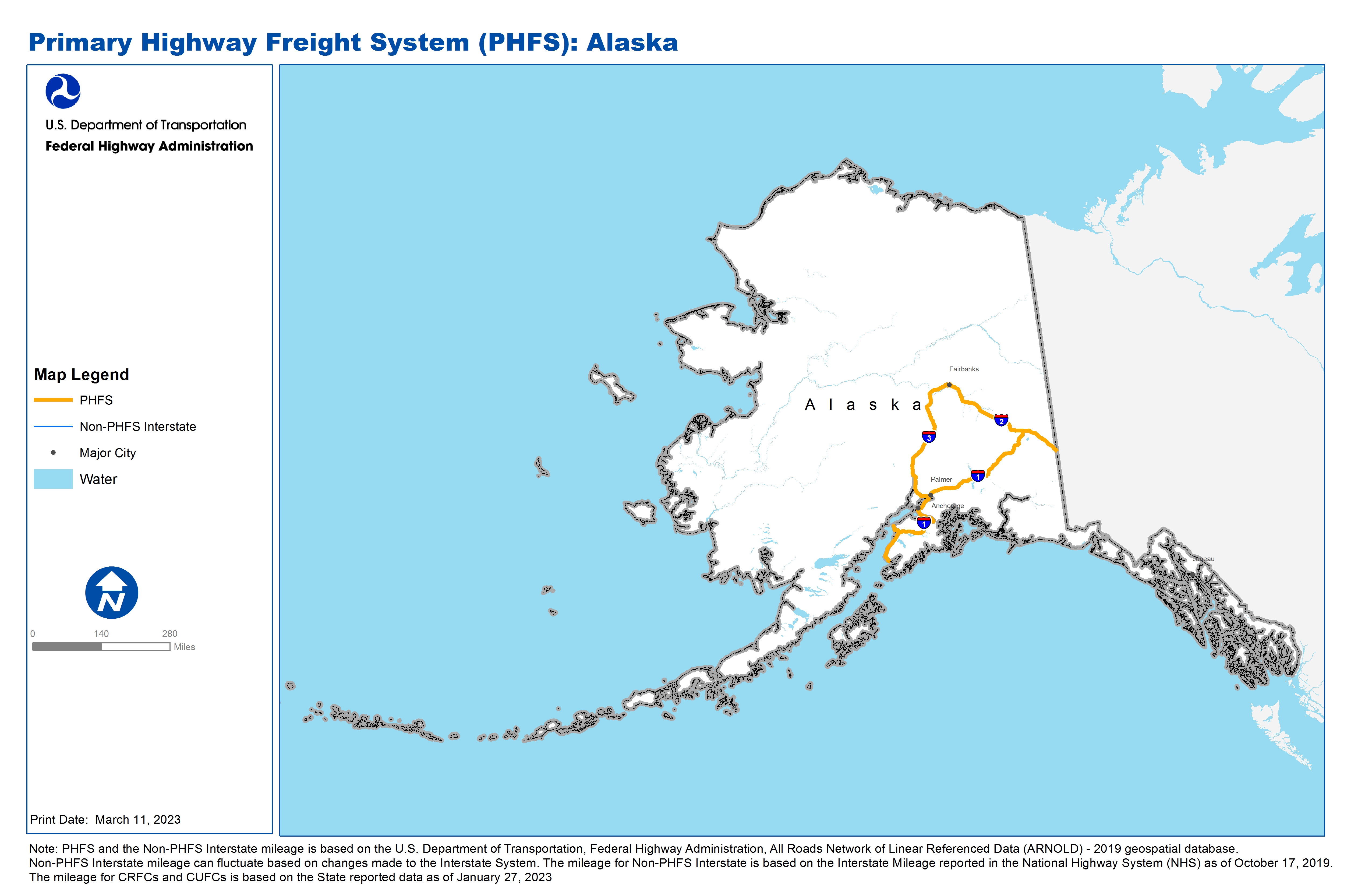
National Highway Freight Network Map and Tables for Alaska, 2022
High-Resolution Images
- JPG 2.4MB
Table of National Highway Freight Network Routes, 2022
| State | Route No/ Facility Name |
Start Point |
End Point |
Route/Facility Description |
Length (Miles) |
|---|---|---|---|---|---|
AK |
5th Ave |
L St |
S1 |
5th Ave from L St to S1 |
1.09 |
AK |
6th Ave |
L St |
S1 |
6th Ave from L St to S1 |
1.09 |
AK |
Airport Wy |
IA4 |
S2 |
Airport Wy from IA4 to S2 |
3.81 |
AK |
Geist Rd |
IA4 |
Johansen Expwy |
Geist Rd from IA4 to Johansen Expwy |
1.54 |
AK |
I St |
Minnesota Dr |
5th Ave |
I St from Minnesota Dr to 5th Ave |
0.68 |
AK |
IA1 |
S1 |
IA2 |
IA1 from S1 to IA2 |
466.15 |
AK |
IA2 |
S2 |
AK/YT Line |
IA2 from S2 to AK/YT Line |
292.29 |
AK |
IA3 |
IA1 |
IA2 |
IA3 from IA1 to IA2 |
323.50 |
AK |
Johansen Expwy |
Geist Rd |
S2 |
Johansen Expwy from Geist Rd to S2 |
4.19 |
AK |
L St |
Minnesota Dr |
5th Ave |
L St from Minnesota Dr to 5th Ave |
0.68 |
AK |
Minnesota Dr |
IA1 |
L St |
Minnesota Dr from IA1 to L St |
8.07 |
AK |
S1 |
IA1 |
Homer - Point Lions Ferry |
S1 from IA1 to Homer - Point Lions Ferry |
75.61 |
AK |
S2 |
IA2 |
Johansen Expwy |
S2 from IA2 to Johansen Expwy |
2.01 |
AK |
Tudor Rd |
Minnesota Dr |
IA1 |
Tudor Rd from Minnesota Dr to IA1 |
9.03 |
AK |
University Ave |
IA3 |
Airport Wy |
University Ave from IA3 to Airport Wy |
0.92 |
AK |
AK15P - Port of Nenana |
Parks Hwy |
Port of Nenana |
From Parks Hwy via 6th St, Nenana St, Front St, Dock Rd |
1.06 |
AK |
AK17A - Kenai Airport |
Sterling Hwy |
Kenai Airport |
Kenai Spur Rd from Sterling Hwy to AK18P |
10.56 |
AK |
AK18P - Port Nikiski - Kenai |
AK17A |
Port Nikiski - Kenai |
From Sterling Hwy via Kenai Spur Rd, Nikisha Beach Rd. |
11.92 |
AK |
AK1P - Port of Anchorage |
6th Ave |
Port of Anchorage |
From 6th Av via A St/C St couplet, C St, Ocean Dock Rd. |
1.38 |
AK |
AK2A - Anchorage International Airport |
Minnesota Dr. |
Anchorage International Airport |
From Minnesota Dr. via International Airport Rd, Airport arrival ramp, Airport departure ramp. |
1.77 |
AK |
AK3A - Fairbanks International Airport |
Parks Hwy |
Fairbanks International Airport |
From Parks Hwy via Airport Way, Wien Rd, Wein NB-Airport Way EB ramp. |
2.34 |
PHFS Total |
|
|
|
|
1,219.69 |
| State | Route No/ Facility Name |
Start Point |
End Point |
Route/Facility Description |
Length (Miles) |
|---|---|---|---|---|---|
INTERSTATE NON-PHFS Total |
|
|
|
|
0 |
Note: PHFS and the Non-PHFS Interstate mileage is based on the U.S. Department of Transportation, Federal Highway Administration, All Roads Network of Linear Referenced Data (ARNOLD) - 2019 geospatial database. Non-PHFS Interstate mileage can fluctuate based on changes made to the Interstate System. The mileage for Non-PHFS Interstate is based on the Interstate Mileage reported in the National Highway System (NHS) as of October 17, 2019. The mileage for CRFCs and CUFCs is based on the State reported data as of January 27, 2023
Sources
U.S. Department of Transportation, Federal Highway Administration, All Roads Network of Linear Referenced Data (ARNOLD) 2019.