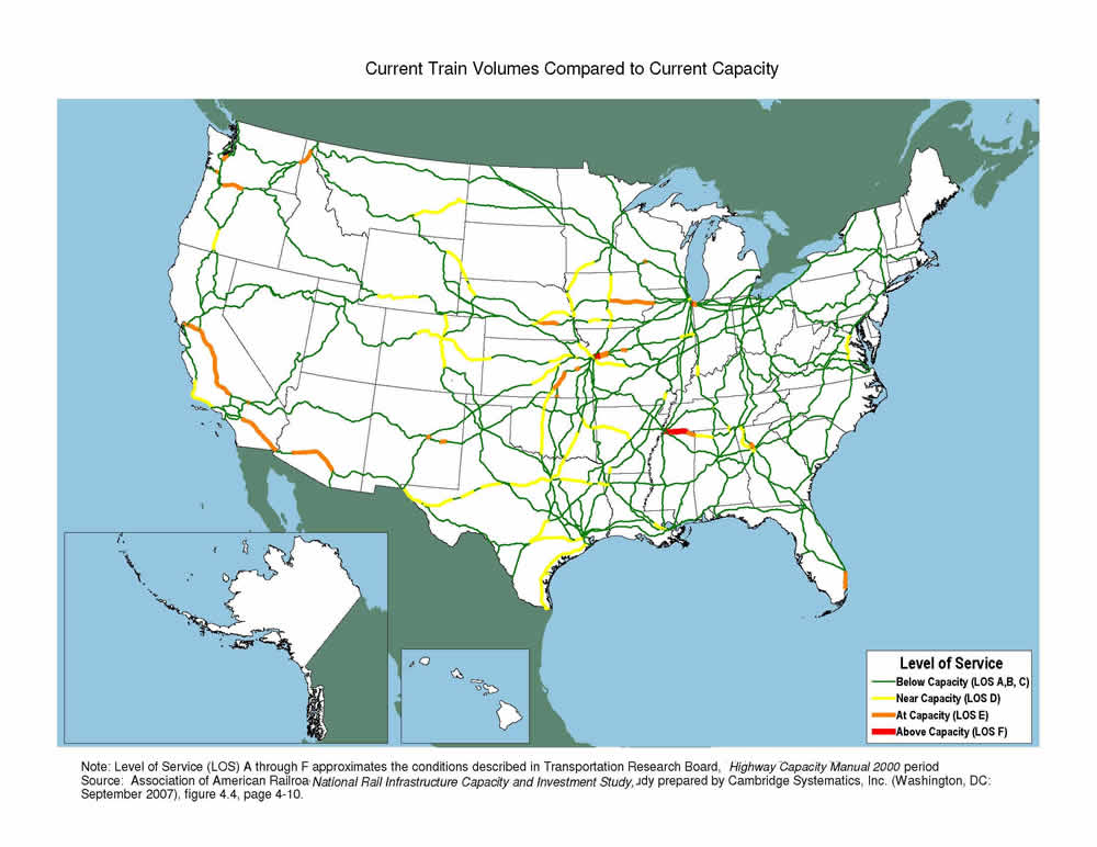
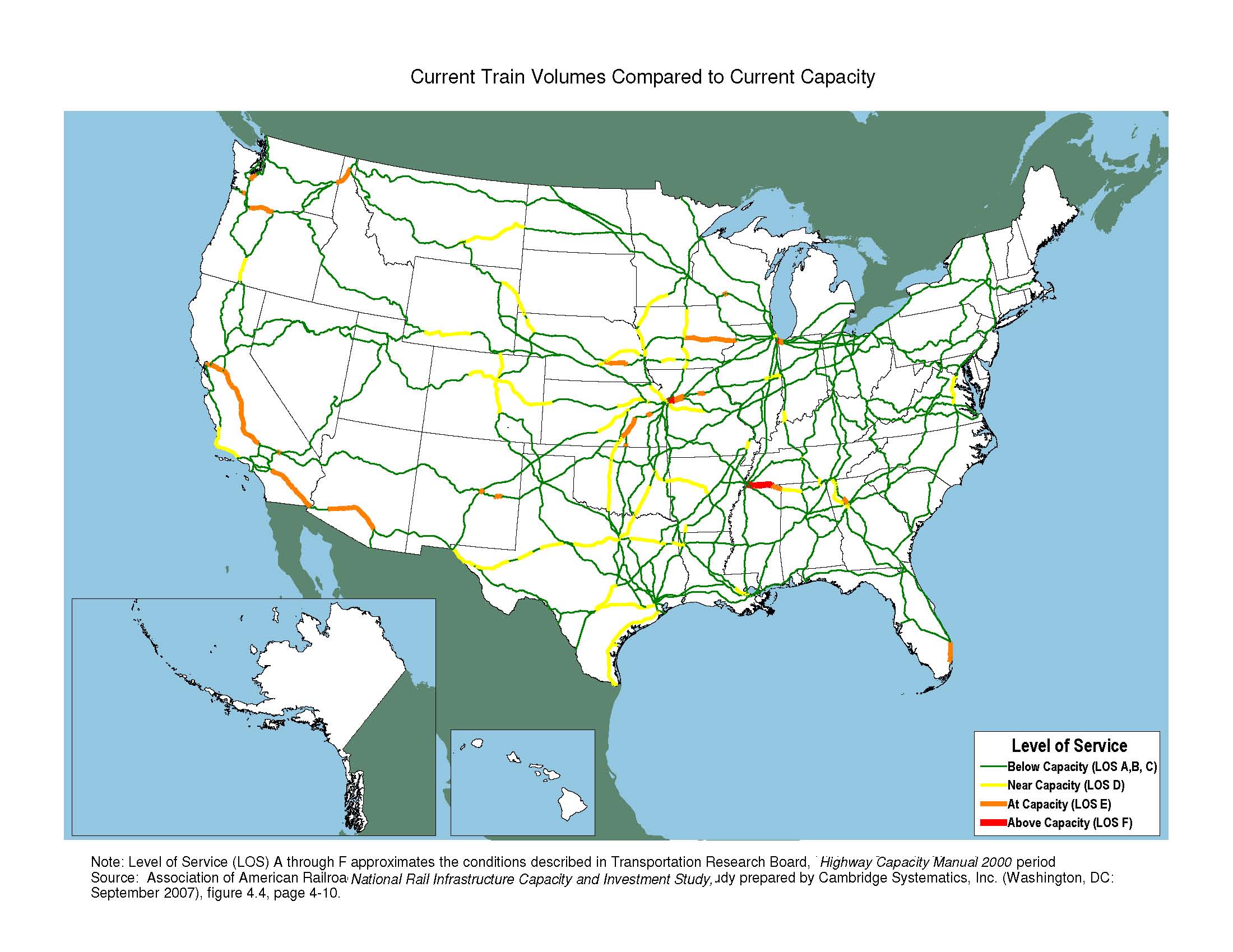
Current Train Volumes Compared to Current Capacity Map
High-Resolution Images
Note
Level of Service (LOS) A through F approximates the conditions described in Transportation Research Board, Highway Capacity Manual 2000.
Source
Association of American Railroads, National Rail Infrastructure Capacity and Investment Study, prepared by Cambridge Systematics, Inc. (Washington, DC: September 2007), figure 4.4, page 4-10.
![]() You will need the Adobe Reader to view the PDFs on this page.
You will need the Adobe Reader to view the PDFs on this page.