ATCMTD Proposal for Rural Integrated Corridor Management and Operations: Vol 1 - Technical Application
Project Description
Long rural transportation corridors are subject to management challenges and operational risks unlike those in more compact urban areas. Because of their extended geography, they are more exposed to severe weather and exceptional events. A single localized event can sever the continuity of the corridor, backing up traffic for tens or hundreds of miles. A weather system that moves along the corridor can tie up traffic and resources for many days. Small town and rural residents, farms, and businesses are highly dependent on highways for goods and services. Rural interstate highways have higher proportions of through travelers and freight traffic. Rural corridors are typically served by more limited maintenance and emergency resources at regional centers that serve large areas and long highway links.
These characteristics drive a need for management and operations tools, traveler information, infrastructure, and information assets to meet the particular challenges of the rural environment. Information assets and systems are widely distributed along those transportation corridors. The corridors may run through multiple jurisdictions, segmenting the essential assets among states and agencies. Operations along the corridor may be carried out by multiple local, state, and even federal agencies providing maintenance and emergency services. Traveler information has to serve the needs of local residents and businesses, as well as through travelers and freight traffic.
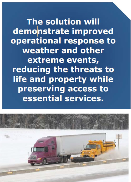
This proposal envisions a Rural Integrated Corridor Management (ICM) Operations solution stretching over 1000 miles along I-80 across Nebraska, Wyoming, and Utah. The solution will demonstrate improved operational response to weather and other extreme events, reducing the threats to life and property while preserving access to essential services. It will utilize extensible communications, data management and exchange, and traveler information systems to serve operators, travelers, and emergency services. It will create a model and applications for replicable deployments in rural settings across the U.S.
The proposed solution will deploy corridor operations decision support capabilities to mitigate the impacts of traffic and weather events. Led by the Nebraska Department of Roads (NDOR), the solution will expand NDOR communications capabilities along I-80, enhance traffic and road weather data collection, and deploy Wyoming DOT (WYDOT) Connected Vehicle (CV) Pilot applications into Nebraska. It will enhance and deploy the Utah DOT (UDOT) Citizen Reporting tool for weather and road conditions along the entire corridor. Data sharing capabilities among NDOT, WYDOT, and UDOT will be provided by new interfaces among their advanced transportation management and weather models for I-80 in Nebraska will be developed to extend awareness from known current conditions to potential future risks and to identify appropriate mitigation strategies. All these capabilities will then feed corridor decision support systems for rolling road closures and traffic storage in response to extreme weather and traffic events.
Our Team
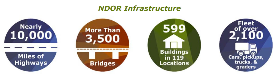
NDOR is the Applicant and Team Lead for this Grant Application, with WYDOT and UDOT as principal partners. NDOR is responsible for the planning, development, design, construction, maintenance, and administration of the state highway system. Its responsibilities are preserving the billions of dollars Nebraskans have invested in their state highway system, making the highways safe and efficient, and accomplishing this in a timely and cost-effective manner. NDOR is responsible for overseeing and maintaining an infrastructure network that includes:
Nebraska's state highway system is paid for completely by highway user taxes and fees. The three major sources of revenue are the motor fuel tax, motor vehicle registrations and related fees, and the sales tax on motor vehicles, trailers, and semi-trailers. It is important to remember that Nebraska's major highway user revenue is shared between the state, counties, and cities.
As the lead agency, NDOR will be responsible for key communication with the U.S. DOT. They will conduct the kickoff meeting at the U.S. DOT within two weeks after the award. They will also be responsible for preparing and submitting the quarterly project status reports and briefings and the final report. NDOR will provide direction for the day-to-day staffing for implementation and continuing oversight of the project. NDOR will ensure that tasks are completed on time, will be responsible for oversight, and will have the authority to make changes to project activities in consultation with the other project partners. NDOR will also have decision-making authority over major operational and administrative issues.
Project Advisory Board
Overall program management will be strengthened by the formation of an Advisory Board comprised of managers from each of NDOR, WYDOT, and UDOT. The advisory board is staffed with senior professionals within these organizations that have longevity, extensive background knowledge, and operational decision-making authority for of their state's systems. Their purpose is to provide the following:
Redacted
- focused input on particular aspects agency business
- drive commitment from the invested agencies
- reduce liability from program manager responsibilities
- serve as ambassadors for the program's mission
Wyoming Department of Transportation
WYDOT is a government agency charged with overseeing transportation infrastructure for the State of Wyoming. WYDOT's stated mission is to provide a safe, high quality, and efficient transportation system.
With more than 2,000 employees based in about 60 locations, WYDOT constitutes Wyoming's largest and most widespread state agency. The department is responsible for planning and implementing of road improvement projects, conducting road maintenance, managing driver licenses and motor vehicle programs, supporting airports and aviation, and supporting law enforcement via the with the Wyoming Highway Patrol.
WYDOT headquarters are located in northwest Cheyenne adjacent to the Central Avenue Interchange (exit 12) on I-25. In addition, road construction and maintenance operations are divided among five field districts, headquartered in Basin, Casper, Laramie, Rock Springs, and Sheridan.
Utah Department of Transportation
UDOT is the primary transportation agency of for the State of Utah. Headquartered in Taylorsville, Utah in the Salt Lake Valley, UDOT is charged with maintaining the more than 6,000 miles of roadway that constitute the network of state highways. Project priorities are set forth by the independent Utah Transportation Commission, which coordinates directly with the UDOT's executive director. The department's strategic goals include preserve infrastructure, optimize mobility, move toward zero fatalities, and strengthen the economy. While the agency has maintenance stations throughout the state, for organizational purposes they are grouped into four regions: Ogden, Salt Lake City, Orem, and Richfield.
The WYDOT and UDOT Agency Administrators will work closely together with the NDOR Program Manager to:
- make recommendations for participating agency's resource requirements
- assist in developing short- and long-range objectives
- track costs, milestones, and measures
- facilitate program needs
- help prepare grant briefing and reports
- monitor grant requirements to prevent violations
- coordinate deployments of software and hardware within their states
Redacted
Redacted
Redacted
Redacted
Redacted
Redacted
Redacted
Redacted
Redacted
Redacted
Redacted
Redacted
Redacted
Redacted
Redacted
Redacted
Redacted
Redacted
Redacted
Redacted
Redacted
Redacted
Redacted
Redacted
Redacted
Redacted
Redacted
Redacted
Redacted
Redacted
Redacted
Redacted
Redacted
Redacted
Redacted
Redacted
Redacted
Redacted
Redacted
Redacted
Redacted
Redacted
Redacted
Redacted
Redacted
Redacted
Redacted
Redacted
Redacted
Redacted
Redacted
Redacted
Redacted
Redacted
Redacted
Redacted
Redacted
Redacted
Our Project Setting
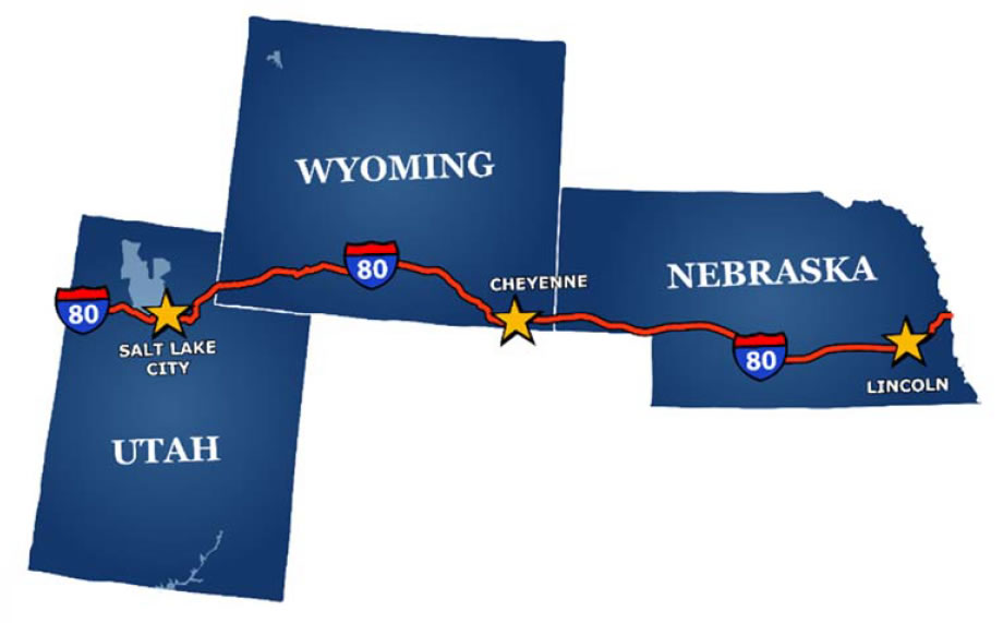
This solution will stretch along the 1000-mile I-80 corridor from the eastern border of Nebraska to the western border of Utah. According to the FHWA Office of Freight Management and Operations, the I-80 corridor from Omaha to Salt Lake City is one of the highest volume freight corridors in the western U.S. It also carries significant volumes of passenger vehicles for both through transcontinental and local travel.
The area is also subject to some of the most extreme weather conditions in the lower 48 states of the U.S. The high plains and mountain passes characteristic of Nebraska, Wyoming, and Utah can experience strong storms and high winds at any season of the year, but conditions are particularly dangerous in winter. These weather conditions and the associated increased risk of traffic incidents can shut down highways for long periods.
The Challenge
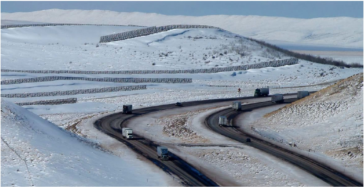
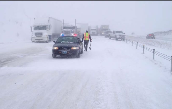
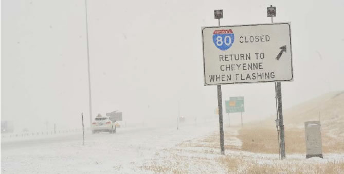
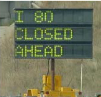
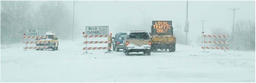
Heavy snow falls and high winds move from the mountain passes in Utah and Wyoming down to the plains many times each winter. I-80 is frequently closed in these poor travel conditions to protect the public and enable winter maintenance operations to efficiently restore service.
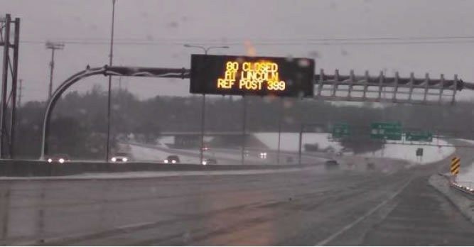
When these conditions occur, NDOR District 5 (Panhandle) receives notification that I-80 is closed in Wyoming. District 5 contacts the NDOR Statewide Operations Center (SOC) in Lincoln to post to messages on Dynamic Message Signs (DMS) and 511 that I-80 is closed at the Nebraska–Wyoming border.
The nearest services to the Nebraska–Wyoming border are in Kimball, NE, at Exit 20. The two small motels and sole truck stop rapidly fill up. The next town with a bit more capacity is Sidney, at Exit 59, so most westbound traffic stops there. To prevent traffic from piling up at Kimball, the I–80 closure in Nebraska is rolled back to Sidney in a very short time frame. With several hotels and many trucks stops at Sidney, the services and available parking are not immediately overwhelmed.
As the services in Sidney approach capacity, NDOR rolls the closure farther eastward. While there is a gas station in Chappell, at Exit 85, there is nothing on the scale to support extended truck parking or lodging. When Sidney is full, I–80 is closed at the I–76 system interchange, at Exit 102. This is a critical location because I–76 connects I–80 to Denver, Colorado, and much freight moves along I–76. The next services to the east are at Exit 107. There are two truck stops and one motel along I–80 at Big Springs as well as parking for well over 100 trucks. At this point, NDOR has lit up messages displayed on DMS as far to the east as Grand Island (Exit 312) that I–80 westbound is closed over 200 miles ahead, so truckers and motorist can adjust travel routes and travel plans.
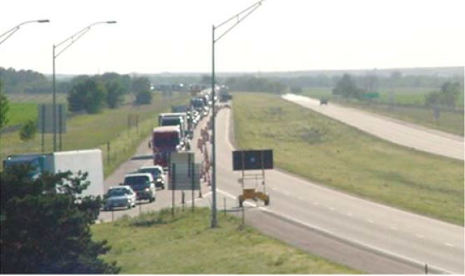
If I–80 in Wyoming has not re–opened after an additional period–of–time, NDOR rolls the closure east again, this time to Ogallala, at Exit 126. The services available at Ogallala include two large truck stops, several large hotels and motels, and many restaurants. The capacity of Ogallala provides a great buffer for westbound traffic.
When the mountain passes in Wyoming have been thoroughly pounded and several hours away from opening, the closure in Nebraska must be rolled back east, yet again, to North Platte at Exit 177. North Platte is the largest city in western Nebraska and has many trucks stops, hotels, motels, and parking.
At this point, 177 miles of I–80 is closed to all traffic in western Nebraska due to a snow event closing I–80 in Wyoming. On average, this scenario occurs five to six times every winter.
Some of the storms track in a manner where there is no snow fall in Nebraska. Westbound traffic cannot keep traveling westbound with no parking or services between where they are and where Freight cannot be moved, loaded, or unloaded. Sick people cannot get to medical care. Ranchers cannot feed their livestock. The impacts are real and far–reaching.
There are 455 miles of I–80 in Nebraska; a closure at North Platte represents a loss of over 30% of the length of the interstate. At North Platte, the ADT on I–80 is 22,000 vehicles, of which 65% (14,000) are trucks. When these closures occur, travel and commerce are halted. The impacts to safety, mobility, and the economy are significant.
Additionally, the level of effort and resources necessary to manage and implement these closures are significant.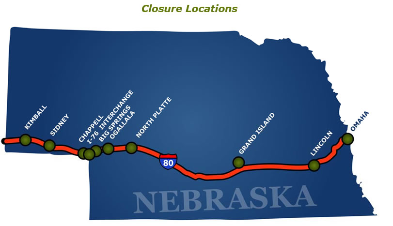
When I–80 is closed from the NE–WY border to North Platte, notification to motorists via DMS can extend as far east as Lincoln, over 200 miles from North Platte (and 400 miles from the border). Gates at the on–ramp terminals at every interchange between North Platte and the Wyoming border must be closed. In the past, this was a manual effort which required numerous NDOR maintenance staff and law enforcement officers to travel to each interchange and close the gates. NDOR is in the process of completing the installation of automated ramp gates at each interchange which can be closed and opened remotely. The installation of the automated gates provides a significant savings of human resources and time when closures are enacted and revoked. Also, motorists are notified upstream of the ramp with a regulatory sign and flashing beacons that "I–80 WEST RAMP CLOSED WHEN FLASHING".
Vision, Goals, and Objectives
NDOR, WYDOT, and UDOT have come together in this grant application with a vision for improving operations along their shared I–80 rural interstate corridor. The combination of relatively high vehicle and freight volumes with extreme weather events creates elevated risks of complex and severe events affecting operations along the entire route. These events can challenge public safety, mobility, and agency operations and maintenance, all of which increase agency costs and traveler anxiety.
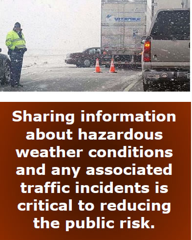
Severe weather conditions such as high winds and storms are an ever–present threat on the high plains and mountain passes. Sharing information about those hazardous weather conditions and any associated traffic incidents is critical to reducing the public risk. The agencies each want to provide early notification of potentially hazardous conditions and operational responses in adjacent jurisdictions. Having this information can then lead to a reduced likelihood of incidents by implementing strategies like (reduced) variable speed limits and reduced likelihood of being stranded on closed roadways by limiting access. The consequences of travel restrictions can then be further reduced by providing travelers with actionable information on parking and emergency facilities. This focus on protecting the health and safety of the public can be frustrating for travelers and commercial vehicle operations when the need for restrictions is not immediately apparent. Agencies would like to preserve and improve mobility during adverse weather and operational events as much as possible. To that end, they want to provide information on closures and alternative routes prior to and during events, to preserve access to roadways for local traffic when closed to through traffic, and to improve recovery time from events.
Achieving the public–facing objectives of management and operations during severe events creates a need for more complete and extensive situational awareness. Agencies want a more complete view of traffic and weather conditions along their roadways—in this case, the I–80 corridor—and in neighboring jurisdictions. Developing new data acquisition facilities and technologies can deepen that awareness, while facilitating real-time data exchange between agencies and their management and operations systems extends the awareness.
And finally, the ongoing pressure of new communications and vehicle technologies demands that agencies start deploying and operating with those technologies or risk being overwhelmed by them. UDOT and WYDOT have started deploying connected vehicle systems in pilot demonstrations that will be transitioning to operations. NDOR now has an opportunity to benefit the interests of its system users, itself, and the United States as a whole by creating the nation's longest continuous CV operations corridor in cooperation with WYDOT and UDOT. The lessons learned from its deployment and operations will then benefit similar projects across the country and jumpstart a national CV environment.
Our Concept
Neither traffic nor weather has any respect for state borders. Better support for management and operations decisions for the I–80 corridor must begin with providing regional awareness of road and weather conditions, while acknowledging and preserving local control of operations and assets. The agencies operating along the corridor have each deployed monitoring systems and acquired data for their own jurisdictions, but have come to understand that their field of view needs to extend beyond their own borders and that operations in one state can have consequences for others. Control over each state's systems remains within that state, but there is a need to share operational strategies, information, and tools more extensively along the corridor.
The monitoring and control of the transportation network is supported by intelligent transportation systems (ITS) that over time have been integrated within each state for its own management and operations purposes. Agencies deploy assets within their jurisdictions and are directly responsible for monitoring those assets. They also control assets in their jurisdictions, and need the means to execute those controls. They may also have decision support systems that assist in determining what actions need to be taken using those controls to affect the monitored conditions. These functions are typically wrapped into management systems for the deploying agency. An ATMS monitors conditions across a road network, presents a view of those conditions, supports (or makes) decisions as to what controls need to be modified, and provides interfaces to execute those controls. But an awareness of conditions outside their jurisdiction could lead to different control decisions. The ability to request control changes in other jurisdictions could help to manage conditions in their own jurisdictions. A logical deconstruction of ITS technologies, separating the monitoring, control and presentation functions, may be needed.
MODULE1 – RURAL INTEGRATED CORRIDOR MANAGEMENT AND OPERATIONS
The first component module of the proposed I–80 corridor management solution will enable sharing of information and operations support among NDOR, WYDOT, and UDOT. Their existing management and operations systems will be modified with interfaces to provide data to other systems. This will enable other jurisdictions to subscribe to and ingest their data, and to provide system views of data outside each agency's area of control. The states will also investigate a systematized exchange of requests for control actions between agencies and jurisdictions as part of their decision support systems (DSS). In the case of a major snowstorm along the corridor, for example, WYDOT might want to request that access gates in Nebraska be closed to limit the volume of freight vehicles heading into Wyoming to a number for which parking can be provided.
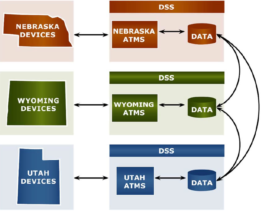
Operations data to be exchanged would include traffic, road condition, and ITS asset information such as traffic speed and volume, road surface condition, road closures, DMS messages, and other traveler information. Data exchange between the agency systems will be provided by Traffic Management Data Dictionary (TMDD) center–to–center (C2C) messages originating with the state ATMS and ATIS systems. NDOR and WYDOT use the IRIS open–source ATMS software originally developed by the Minnesota DOT; UDOT uses a customized version of the TransSuiteTM ATMS. The systems in each state are fed by a collection of field deployments of traffic sensors, cameras, environmental sensor stations (ESS) for road weather, and maintenance vehicle mobile applications.
In order to supplement its existing traffic monitoring capabilities, NDOR's IRIS ATMS system will also be enabled to ingest CV data from DSRC RSUs to be deployed in Module 2. These data would include Basic Safety Messages (BSM) and road weather information originating on equipped snow plow trucks, agency maintenance vehicles, and commercial vehicles. The data will be converted on V2I Hub devices at the roadside from the native DSRC to ITS–standard messages that can be input to the ATMS as if they were comparable ITS traffic sensor and ESS devices.
Redacted volunteers to report on road weather conditions along specific roadway segments. These citizen reports supplement eyewitness reports generated by plow crews and forecasts by meteorologists. Volunteers have included private citizens, agency employees (plow drivers and others), law enforcement, and truck drivers. Citizen Reporters in Utah are trained yearly on what to report and how to provide information accurately using an application for Android and Apple mobile devices.

The Rural Integrated Corridor management solution will extend the existing programs and make the Citizen Reporting available across the I–80 corridor through Utah, Wyoming, and Nebraska. This would be the first multi–state deployment of an interactive program of its kind. In addition, the UDOT app will be updated to provide a "hands–free" voice–responsive mode for report input. WYDOT and NDOR will assess their citizen reporting potential and demonstrate processes to recruit and train an initial cohort of volunteers. UDOT will expand their existing Citizen Reporting service to accommodate the additional citizen users. Once recruited, reporters will be able to initiate reports from anywhere along the corridor.
MODULE 2 –RURAL CORRIDOR TECHNOLOGIES
Although NDOR has continued to expand its deployment of ITS technologies in the Omaha and Lincoln metropolitan areas, that expansion has proceeded only slowly along the I–80 corridor to the west. An accelerated build–out of ITS and CV–supporting infrastructure and applications along the entire I–80 corridor is proposed for the second module of this grant application. The build–out will include communications, devices, and applications to extend control and enhance the existing ATMS and ATIS capabilities and to deploy CV applications demonstrated in the Wyoming CV Pilot.
Reliable monitoring of the road network begins with a foundation of quality traffic and weather sensors. NDOR proposes to deploy vehicle detection stations for speed, flow, and occupancy at key decision points along I–80. These stations will be capable of vehicle classification to get freight vehicle counts and facilitate modal traffic analysis. Existing third–party traffic data services will be used to fill the gaps between the new reference detector stations, and CV data will be used as it becomes available to supplement the sensors and third–party data.
Similarly, the existing distribution of environmental sensor stations along I–80 in Nebraska will be reviewed with the intent of using mobile weather sensors to fill the gaps between existing stations as input to the winter weather Maintenance Decision Support System (MDSS) and future road weather applications. NDOR is currently deploying automated vehicle location (AVL) technology using cellular connections to provide vehicle telematics information to the MDSS. New weather sensors would be added either as fixed ESS or to agency vehicles, as appropriate.
The largest component technology deployment for NDOR will be installing variable speed limit (VSL) sites along I–80. VSL has been demonstrated to be a key technology in reducing risk in severe weather conditions and can provide traffic smoothing and safety VSL deployments to take advantage of and be integrated with the other technological components of this project.
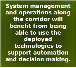
System management and operations along the corridor will benefit from being able to use the deployed technologies to support automation and decision making. NDOR is in the process of deploying automated access gates across the entire length of I–80 in the state, and will deploy variable speed limit (VSL) signage locations as part of this project. Deploying traffic sensors, weather sensors, and DSRC in this project will provide essential monitoring of traffic and weather conditions to feed speed limit and access control decision support algorithms. NDOR will investigate and plan for potential automation of VSL and gate control strategies to respond to events as those systems become available.
MODULE 3 – NEBRASKA RURAL CORRIDOR M&O DECISION SUPPORT
Real–time controls based on CV and traditional ITS systems monitoring significantly improve safety and mobility along the I–80 corridor. The best decisions; however, are many times driven as much by the anticipation of future conditions as they are by the current state. NDOR envisions going beyond real–time controls to anticipatory decisions. Winter weather MDSS have proven the concept in Nebraska and other states for many years now. NDOR proposes to use its developing CV and traffic and weather data sources in an integrated forecast of traffic and weather conditions. The integrated forecast would inform decisions about road closures that include considerations for downstream impacts on freight and traveler mobility, just as MDSS systems have improved winter road treatment, while reducing material usage and cost.
Redacted sponsored by the FHWA Office of Operations to provide Integrated Modeling for Road Condition Prediction (IMRCP). The IMRCP fuses traffic and weather condition information, incident reports, weather forecasts, and traffic demand models to feed traffic predictions using dynamic traffic assignment (DTA) and statistical models. The deployment of CV technologies, traffic, and weather sensors described in Module 2 provides a solid foundation for the forecast models and further leverages that investment. Team member Synesis Partners was the lead developer of the IMRCP.
Nebraska has also recently developed a statewide freight demand model which would feed an IMRCP model for the I–80 corridor. This model characterizes freight flows across the state and would use the real–time traffic data to provide system–wide demand estimates. This freight demand model would be complemented by developing a corresponding parking capacity inventory as part of this Module 3. Team member Quetica developed Nebraska's freight demand model and would develop the parking model.
The combination of the freight demand/capacity models with the IMRCP would enable NDOR to make road closure and other operational decisions that minimize the safety risks to the traveling public, while preserving mobility and reducing the societal costs of severe events. NDOR will demonstrate the predication capability over a year of operations and events to evaluate its potential. It is anticipated that the forecasts would be used to evaluate truck parking needs, optimize the timing of road closures and maintenance activities, and facilitate local access management during extended closures.
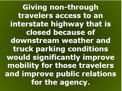
Giving non–through travelers access to an interstate highway that is closed because of downstream weather and truck parking conditions would significantly improve mobility for those travelers and improve public relations for the agency. NDOR proposes to evaluate the capabilities demonstrated with the IMRCP and freight models for their potential to inform local access management during those events. The evaluation will assess the stakeholder needs and access permitting alternatives to prototype a process and system for enabling highway under through closures.
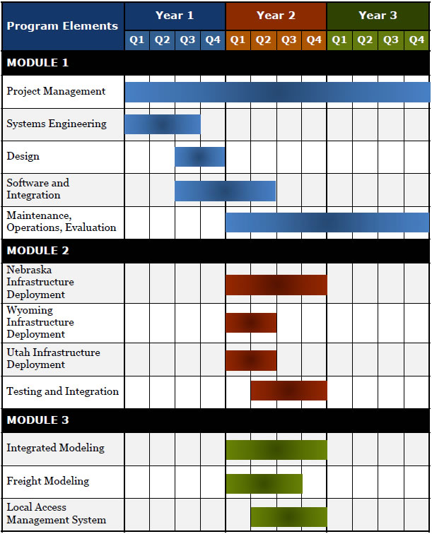
The following table lists the specific project systems and activities proposed for each module.
| Module | Description |
|---|---|
| Module 1 – Project Development, Management and Integration | |
| C2C interface for NE ATMS/ATIS | Implement a C2C interface for the NE IRIS and CARS systems and collectors for data from WY and UT |
| C2C interface for WY ATMS/ATIS | Implement a C2C interface for the WY IRIS system and collectors for data from NE and UT |
| C2C interface for UT ATMS/ATIS | Implement a C2C interface for the UT TransSuiteTM system and collectors for data from WY |
| Core Citizen Reporting Enhancements (UT) | Enhance the UT Citizen Reporting system: hands–free reporting; co–registration of reporters and collection of reports from multiple jurisdictions |
| Citizen Reporting for WY | Deploy the Citizen Reporting app in WY |
| Citizen Reporting for NE | Deploy the Citizen Reporting app in NE |
| Module 2 – Infrastructure for Communications and Situational Awareness | |
| I2V Situational Awareness | Deploy the WY CV Pilot I2VSA application |
| Work Zone Warning | Deploy the WY CV Pilot WZW application |
| Spot Weather Impact Warning | Deploy the WY CV Pilot SWIW application |
| DSRC RSUs | Deploy DSRC RSUs along I–80 |
| DSRC V2I Hubs | Deploy with DSRC RSUs |
| DSRC OBUs – Agency | Deploy DSRC OBUs in NDOR maintenance vehicles |
| Mobile Road Weather Sensors | Deploy mobile road weather sensors in NDOR maintenance vehicles |
| AVL System Enhancements | Upgrade AVL system to support mobile road weather sensor additions |
| DSRC OBUs for Agency Vehicles | Deploy DSRC OBUs in agency maintenance vehicles |
| Vehicle Detection Units | Deploy vehicle–class discriminating traffic sensors along I–80 |
| Remotely–actuated Access Gates | Leverage deployment of remote gates and supporting infrastructure at locations along I–80 |
| Variable Speed Limits | Deploy VSL signs and supporting infrastructure |
| WY DSRC RSUs and Hubs | Deploy 20 DSRC RSUs along I–80 |
| UT DSRC RSUs and Hubs | Deploy 6 DSRC RSUs along I–80 |
| Module 3 – Management and Operations Decision Support | |
| Real–time Freight Demand Modeling | Enhance the existing NE state–wide freight demand model to support real–time analysis |
| I–80 Corridor IMRCP | Develop and implement an IMRCP for the I–80 corridor across NE |
| Local Access Management System | Develop and deploy a local access permitting system |
Our Plan
The deployment and operations plan for this project will be based on lifecycle systems engineering processes focused on sustaining mobility along the I–80 multi–state corridor. It will utilize the ITS systems engineering processes typified in the U.S. DOT's Systems Engineering "Vee" Diagram to structure the flow of tasks and assure deliverables are met. The activities and deliverables; however, will be specific to each component solution within the overall program and to each state's interests, processes, and resources.

A Program Management Plan will be developed based on the principles and standards outlined by the Project Management Institute (PMI). Following the PMI structure, the program management approach encompasses the five stages project phases of initiation, planning, execution, monitoring and control, and closure.
The PMP will define process for technical planning and management, the systems engineering processes as applied to the project, the resulting deliverables, and institutional arrangements for its management and execution. It will specifically identify and describe the Concept of Operations, the Systems Requirements Specification and the Systems Validation and Verification Plan. It will also identify other plans and SE components that may be needed to successfully manage the deployment activities.
A Systems Validation and Verification Plan will be developed to define the processes and frameworks needed to assure that all project requirements are addressed and the deliverables fully comply with those requirements.
An Institutional Cooperation Framework will be developed to describe the relationships and commitments of the partnered state agencies working together on this project. It will also set a context for the operational arrangements that may be needed to fully take advantage of the deployed technologies
Concept Development
Based on the systems engineering process, a Concept of Operations will be developed for the rural integrated corridor management plan by gathering stakeholder input on existing operational problems and challenges, the impacts of these issues, and potential steps for improvements. A series of use cases will round out the concept by walking through multiple scenarios outlining how the system will be used. We will then analyze and describe the potential impacts and integrate all the material into a final Concept of Operations document.
Based on the requirements and operational scenarios outlined in the Concept of Operations, both high–level and detailed requirements will be developed to provide for the successful implementation of the project. These requirements will be contained in a Systems Requirements Specification (SRS). Applicable IEEE/ISO standards will be used to guide the documentation, and the requirements will be concise, specific, measurable, achievable, and traceable to the original user needs.
Design
The detailed project design effort is organized into the following three components:
- System Design – This design will provide for the detailed system needs and interfaces to provide for the overall functionality of this rural integrated corridor management solution.
- Data Plan Design – This design effort will take into account the various data elements included in the various ITS deployments and systems of each state and provide a detailed plan for the exchange and storage of the data.
- Redacted technologies for each state as determined in the Concept of Operations and System Requirements Specification.
Deployment and Testing
Oversight will be provided for the deployment of field–based technologies and system development. Acceptance testing will be conducted to verify all detailed requirements are met and the system is functioning in accordance with the system design requirements. Once each component of the rural integrated corridor management system has been tested, additional testing will be conducted to verify the overall operation readiness of the system.
Maintenance and Operation
A Rural Integrated Corridor Management Operations Plan will be developed to document to technologies, systems, procedures, inter–agency relationships, and communication protocols which have been integrated as part of this system. The plan will include or reference maintenance procedures for equipment, systems, and interconnections.
The data produced and collected by the systems and technologies be aggregated, archived, and used to monitor operations and derive system performance measures. Routine periodic reports will be provided to the sponsoring State and Federal agencies. Data will be provided to U.S. DOT CV and research data repositories, such as data.transportation.gov, as may be determined to be appropriate.
The overall deployment and operations experience will ultimately be documented in an Evaluation Report describing the rural integrated corridor management system's overall performance, user and operator experience, and opportunities for future technological and operational enhancements.
Project Challenges
Projects of this magnitude, complexity, and sweeping change come with some challenges along the way. Anticipating and preparing to overcome these challenges will help ensure project success in the short term, and facilitate the transition to operational changes and general acceptance in the long term. While several high–level challenges are described in this section, none are anticipated to be difficult to overcome.
Legislative / Regulatory
The first challenge is that speeds displayed via VSL are currently not enforceable under Nebraska State Code. Since NDOR has already been exploring the possibility of these systems, efforts have been made to make them enforceable. These efforts will be accelerated based on this project to make them enforceable by the time they are deployed.
Unlike VSL, the concept of classification–based permitting is relatively new to NDOR. An important component of this task will therefore be to explore the feasibility of such as system in Nebraska, including the development of a business case for NDOR and Redacted similar system will help in this effort.
Institutional
Much of the success of this project is contingent on achieving high–levels of buy–in from several different groups of stakeholders. Our experience has demonstrated that developing and following a stakeholder engagement plan as a component of the Project Management Plan is an effective tool to maximize this buy–in. Such a plan will identify an engagement strategy for each individual or group based on their role, needs, and influence. A few of the primary stakeholders include the freight community, media and traveler information services, state patrol, enforcement, and ITS maintenance groups, in addition to agency staff and management, and government leaders.
Technical
The various software and hardware elements proposed for this project, while being applied in an innovative and far–reaching application, are not overly complex. However, challenges often occur during efforts to interface these systems with each other due to differing implementations and data formats. This will apply specifically to the proposed regional data exchange between each of the three states' ATMS systems and the Citizen Reporting system. This challenge will be simplified for the data exchange because NDOR and WYDOT use the same ATMS software, and therefore the interface developed for one can easily be applied to both. Also, because NDOR does not yet have a Citizen Reporting system, the Utah interface will be extended into Nebraska, and will only require developing a single interface between the Wyoming and Utah systems.
Applicable Performance Measures
The variety of technologies and applications being proposed for deployment requires an initial set of performance measures as a basis for monitoring its success. Most of the measures are already in use by one or more of the three state agencies party to the proposal. The list is by no means complete, but provides a view to the states' priorities.
In NDOR's 2015 Annual Report the measures were identified for Rural Interstate 80 Reliability as the number of complete closures and average duration of the closure (in minutes). Statistics are kept for closures due to accidents and to weather, and NDOR's goal at that time was a 5% reduction in the rolling five–year average closure time. This will be a key performance measure for this program, with a target to be determined in the Concept of Operations. Virtually all of the applications and technologies proposed for deployment will contribute to the closure durations, and may contribute to reducing the number of closures.
In that same report, NDOR identified its I–80 Winter Operations performance measure by means of the time for highway speeds to recover to pre–storm values after a winter storm has ended. NDOR's ongoing deployment of MDSS will be key element in improving storm recovery times, but the weather–related technologies in this proposal can accelerate that improvement.Redacted of CV technologies and applications that will apply to their extension into Nebraska. Safety–related performance measures, in particular, will be impacted by the V2I safety applications proposed for deployment in this program. Crash rate reduction should be impacted by all of the V2I safety applications. More particularly, the extensive deployment of VSL sites in Nebraska should parallel the experience in Wyoming, for which speed adherence has been a key performance measure.
UDOT's Citizen Reporting app saw tremendous growth in its usage in just the first year after its release for public participation. The integration and expansion of Citizen Reporting along the three–state corridor will be monitored and measured by the number of participants and the number of reports.
Other performance measures to be considered in system development and monitored in deployment could include:
- Corridor travel time reliability, especially for commercial vehicle operations
- Travel delay hours as related to corridor operations and maintenance
- Vehicles stranded in winter weather events
- Truck parking utilization
- Reduction in weather–related crashes and fatalities
- Reduction in work zone crashes and fatalities
ANTICIPATED BENEFITS
The proposed corridor management solution provides benefits to safety, mobility, customer satisfaction, agency operations, and the environment. It improves safety along the entire corridor for travelers by combining features and devices to encourage speed harmonization, gather and distribute information more effectively, and get people where they need to go while keeping them safe. It helps agencies improve their operations through improved data collection and regional coordination. It combines, builds on, and expands emerging transportation technology in ways that will serve as a model to the rest of the nation for rural operations and regional cooperation, while building out a 1,000–mile corridor for connected vehicle safety applications. These benefits address many of the issues outlined in the Beyond Traffic 2045 report, including freight mobility, safety applications, and emerging technologies. These benefits are described in the following paragraphs, and are summarized in the table on the following page.
| System Components | Benefits |
||||
|---|---|---|---|---|---|
| Safety | Mobility | Customer Satisfaction | Agency Operational Costs | Environmental | |
VSL |
X |
|
|||
Local Access |
X |
X |
X |
X |
|
V2I Safety Apps |
X |
X |
|||
DSS |
X |
X |
X |
||
CRS |
X |
X |
X |
||
Regional Data Sharing |
X |
X |
X |
||
AVL/Weather Sensors |
X |
X |
|||
Safety
The proposed systems will help improve safety by expanding the management of the corridor across the region with better information and more precise access control during closure events; thereby, reducing the overall number of stranded motorists. The expansion of a VSL system throughout Nebraska will help to reduce the speed variance during weather or congestion events. A classification–based local–access permitting system will improve safety by allowing local traffic onto an otherwise closed freeway when the weather conditions requiring the closure have not impacted the local area.
Mobility
An improved corridor management system will improve mobility, in addition to safety, for many of the same reasons – primarily consisting of better information and more precise access control during closure events. Additionally, regional coordination and data sharing, including shared from the connected vehicle applications, will help drivers make more informed decisions and reduce delays and costs for freight operations and all travelers.
Environmental Impact
The positive environmental impacts realized through this project include those associated with winter weather maintenance operations and stranded traffic. The mobile RWIS and connected vehicle applications will provide better information to support roadway maintenance efforts, resulting in more efficient use of anti–icing and de–icing materials. Better corridor management during closure events will reduce overall delays, and therefore reduce fuel consumption and emissions.
Agency Operations
Many elements of the project will assist agency staff to improve overall operations along the corridor. These include having a common interface to the Citizen Reporting system to provide better information about the roadway conditions and hazards along with the increase of the number of sensors, including RSUs and mobile environmental sensor stations. The model proposed as part of this project will improve operations for both agency and the freight community by giving real–time decision support based on forecasted weather and traffic conditions.
Customer Experience
The Citizen Reporting System will improve the experience of many customers traveling along the corridor, by giving them a chance to communicate with their transportation agency and make a difference in helping to maintain the roadway. The local access control system will significantly improve customer satisfaction for those travelers who need local access, but are hampered by closures intended for through travelers only.
Partnerships
This project is proposed for implementation through a partnership between the Nebraska, Wyoming, and Utah departments of transportation committing to improved and integrated corridor operations along I–80. Each department brings along a large and diverse group of public and private partners that have a stake in the management and operations along the corridor. Not least among these are the trucking community partners already engaged with the Wyoming Connected Vehicle Pilot, who will now have a much larger test corridor to reap the benefits of this emerging technology. This list of partners extends to cities, counties, emergency response, and enforcement agencies who already work side–by–side each day with their respective state transportation agency. These lead partner agencies are also supported by a team of private sector experts and practitioners, who will provide the support, expertise, and capacity to see this project through to become a model for advanced regional corridor operations throughout the country.
Leveraging Existing Assets
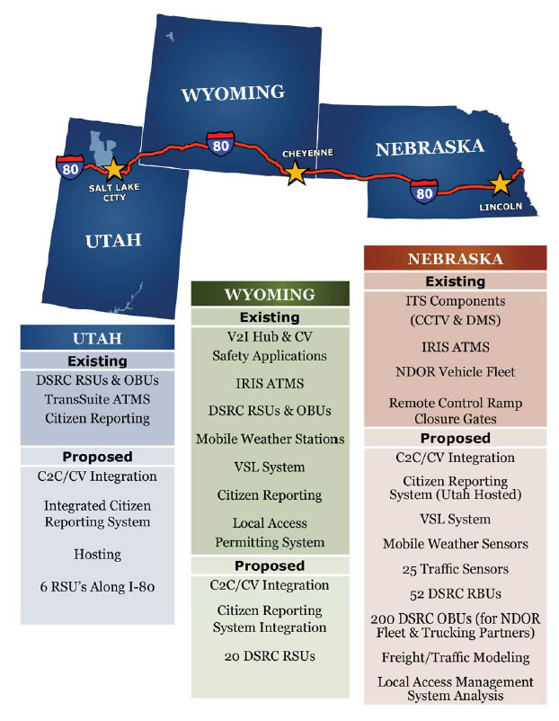
Each participating state has previously deployed technologies and systems that will support or be integrated into this rural integrated corridor management project as summarized and shown in the figure on the following page.
NDOR
NDOR has deployed some ITS technologies along I–80 across the state of Nebraska. Cameras, automated ramp gates, and fiber optic communications are being installed at interchanges to provide improved situational awareness and traffic management capabilities. DMSs are installed in advance of each I–80 planned closure point. NDOR utilizes the open–source IRIS ATMS.
WYDOT
As part of its CV Pilot deployment project, WYDOT has deployed DSRC RSUs along the I–80 corridor in Wyoming and OBUs in WYDOT maintenance vehicles (and in some commercial vehicles). Agency vehicles have also been equipped with mobile weather sensors that provide real–time weather and road condition information. V2I safety applications developed as part of the CV Pilot project will also be leveraged. VSL sites are also deployed at key locations. WYDOT has also developed the nation's first citizen reporting system for road conditions, which will be integrated with the neighboring states. In addition, WYDOT's experience implementing a limited access permitting system will be used as a basis for a similar system in Nebraska. Like NDOR, WYDOT also utilizes IRIS for ATMS capabilities.
UDOT
UDOT has deployed ITS technologies along I–80 across the State of Utah. These include cameras, several segments of traffic sensors, DMSs, and DSRC RSUs along arterials in the Salt Lake City metropolitan area. UDOT utilizes TransSuiteTM for ATMS capabilities. UDOT has also developed a Citizen Reporting system with an Android/IOS app and hosting services that will be enhanced and expanded as part of this integrated corridor project.
Schedule
Leveraging U.S. DOT Initiatives
As is always the case in complex technical projects, this proposal leverages the past results of federal and state programs and technology initiatives. The U.S. DOT has sponsored in particular a number of efforts in ITS and CV that have and are continuing to add to the transportation system body of knowledge.
The core of this proposal concerns the deployment of CV technologies in rural areas. The work performed under the CV Pilot in Wyoming is, as such, essential to the proposed deployment. NDOR, UDOT, and WYDOT are teamed on this proposal specifically to assure that the technologies developed and the lessons learned on that project are translated in whole to the new deployment areas.
To that end, the proposal will make extensive use of resources from the U.S. DOT's Open Source Application Development Portal (OSADP). Software and documentation developed for the applications in the Wyoming CV Pilot will be published to and sourced for this project from the OSADP. Other project components that will be downloaded and/or developed around material from the OSADP include the V2I Hub and the IMRCP. The project team is furthermore committed to open source development and will be working with other open source methods and systems (for example, the IRIS ATMS package used in Nebraska and Wyoming)
whenever appropriate.
Many of the potential system management and operations applications relevant to this project have already been the subject of studies in the ICM initiative. The team fully expects that ICM references and resources will be drawn into the systems engineering process of more fully defining the project specifications and design.
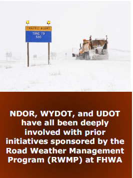
Much of the project is also concerned with road weather management concerns. NDOR, WYDOT, and UDOT have all been deeply involved with prior initiatives sponsored by the Road Weather Management Program (RWMP) at FHWA and the Joint Program Office (JPO). Many of the project elements have their roots in one or more RWMP initiatives such as Weather Responsive Traffic Management (WRTM), Integrated Mobile Observations (IMO), or IMRCP.