Alameda County Transportation Commission
(Alameda CTC) - GoPort Freight Intelligence Transportation System
3. GEOGRAPHIC SCOPE
The project focuses on the Port and roadways that provide access to Port facilities within
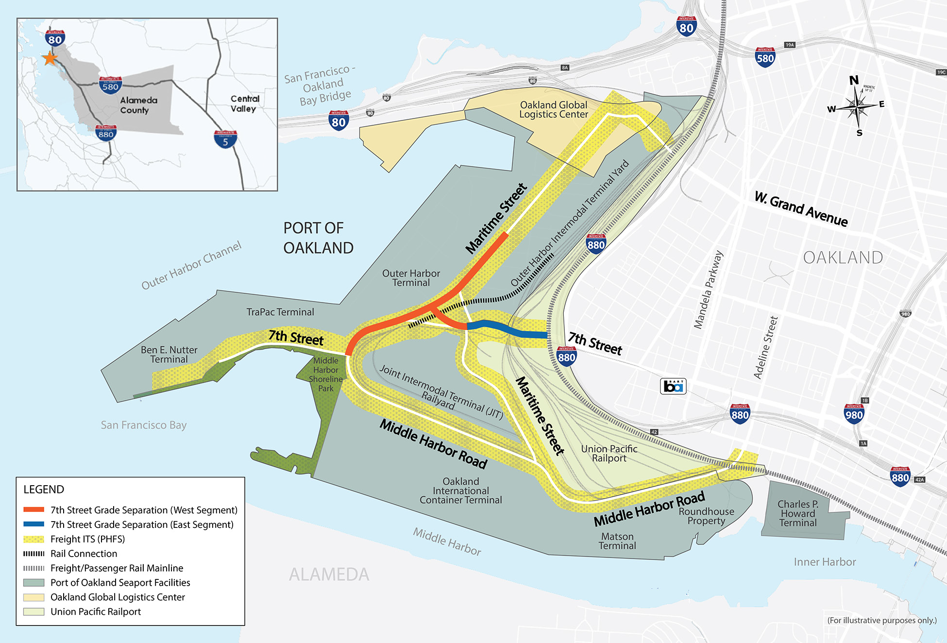
Alameda County. Figure 4 illustrates the area in and around the Port, which is the focus of the
project, while also showing in the insert the broader regional range of this project.
The Port links the Northern California Mega-region (a population of 12.2 million), and the interior U.S. to the Pacific Rim and the broader world, providing access to global markets and opportunities for increased trade. A substantial share of cargo moving to and from the Port comes from the Central Valley, including agricultural exports and imports moving to inland regional distribution centers. The volume of rail container traffic to the mid-west and southwest regions of the U.S. is also increasing.
The Port is served by multiple PHFS routes on the NHFN that provides connections into and out of the Bay Area, including I-80, I-580 and I-880. Three last-mile gateway connector roadways along the two (Facility ID CA32P Port of Oakland and Facility ID CA62R Oakland Rail Yard)PHFS intermodal connectors link the interstate network to the Port: West Grand Avenue, 7th Street and Adeline Street/Middle Harbor Road.
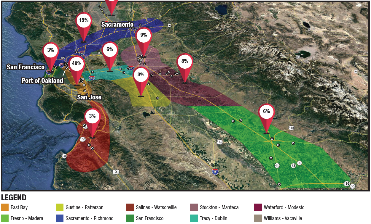
Figure 5 illustrates where the trucking fleet users of GoPort are based and highlights the regional origins from which trucking fleets access the Port on the regional roadway network. The largest number of truck origins (e.g. warehouses, distribution centers, factories, rail facilities) is found within the San Francisco East Bay Area near the Port making up 40 percent of trucking industry traffic. Additionally, 20 percent to 30 percent of the origins are generated in the Central Valley which consists largely of agricultural products.