
Best Practices for Road Weather Management Version 2.0
Title:
The FHWA Clarus Initiative: Nationwide Surface Transportation Weather Observing and Forecasting System
Abstract:
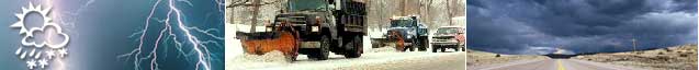
Transportation managers use data from Environmental Sensor Stations (ESS) to support a wide range of operational decisions. In addition, transportation mangers and road users rely on a wide variety of tailored road weather information products (based on these sensor observations) to make safer and more efficient decisions. In mid 2004, the U.S. Department of Transportation (DOT) Federal Highway Administration (FHWA) began a five-year initiative called Clarus, the Nationwide Surface Transportation Weather Observing and Forecasting System, to improve operations and enhance these road weather information products by collecting all ESS data from State DOT observing networks. In near real-time, the Clarus system will integrate, quality-control, database and archive the nation's ESS data assets. The resulting information will be made available to a broad range of users through an Internet portal. The Clarus initiative will also contribute to technological advances, promoting new research, creating new business opportunities and facilitating inter-federal cooperation.
Source(s):
2005 ITS World Congress, FHWA Road Weather Management Program and Mitretek Systems
http://www.ops.fhwa.dot.gov/weather/resources/publications/fhwa/ite2005_clarus_final.doc
Date: 2005
Author:
Pisano, et al
Keywords:
Road Weather Information System (RWIS)
Weather information
Internet/web site
PDF files can be viewed with the Acrobat® Reader®.
