Third Senior Executive Transportation and Public Safety Summit: Final Report10. Improving Traffic Incident Management Through TechnologyTechnology has and will continue to increase operations efficiency, introduce new opportunities, and improve safety throughout society. Vehicle and infrastructure technologies are making cars and roadways smarter, particularly in the ways that they communicate with each other. A wealth of data is moving across systems, platforms, and agencies to the benefit of traffic incident management detection, response, and clearance. And the ways that traffic professionals do their jobs and collect data are rapidly evolving to contribute to the new data and technology paradigm. Understanding the potential of technology as it relates to traffic incident management can help traffic professionals envision a future where they detect, respond to, and clear traffic incidents more safely and quickly. Additionally, traffic professionals may prevent secondary crashes from taking place by reducing the duration and distractions of primary incidents. This session discussed underutilized and emerging technologies to improve traffic incident management (TIM). Federal Highway Administration (FHWA) Office of Operations Automated Vehicle Program Manager John Corbin moderated this session and put forth a preamble on multidisciplinary TIM and the need to collaborate to amplify trust, training, plans, practice, and performance. He suggested that now may the time to refresh the TIM National Unified Goal (NUG) for responder safety; safe, quick clearance; and prompt, reliable, interoperable communications. He also spoke to the research underway on automated vehicles and responder use cases. 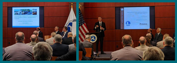 Figure 24. Photos. Participants learn about computer-aided dispatch integration (left) and unmanned aerial systems (right). Source: Federal Highway Administration Panelists for this session included Captain Robert Hainje from the Tippecanoe County, Indiana Sheriff's Office, Dr. Grady Carrick from Enforcement Engineering consulting group, and Jason Siwula, Assistant State Highway Engineer at the Kentucky Transportation Cabinet (KYTC). At the conclusion of the presentations in this session the panelists and participants discussed the growing role of technology in advancing TIM. Captain Robert Hainje shared their efficiency and safety gains using unmanned aerial system (UAS) scene mapping technology. Their agency has reduced on-scene time to collect crash positioning and image data from hours to minutes by using UAS technology. A shorter crash reconstruction time in turn reduces duration of roadway closures and lane restriction, reduces queues and secondary crashes, and reduces law enforcement exposure to traffic. Captain Hainje showed how the UAS captures scene elements ranging from the first evidence of braking, all involved vehicles, as well as post-impact locations (Figure 25). He noted that their agency worked with Purdue University and the Indiana Criminal Justice Institute to establish an image processing center that standardizes mosaic image reconstruction, eliminates the need for software purchases, and expedites the image processing time with completion typically within two to three days rather than weeks. Panelists later discussed the use of tethered UAS for better real-time incident situational awareness with transportation response such as Safety Service Patrol. 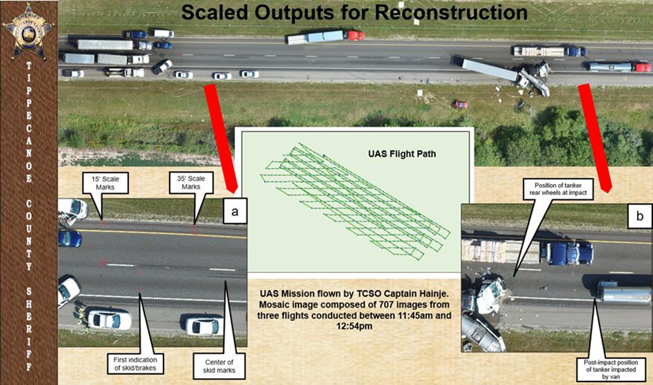 Figure 25. Screenshot. Unmanned aerial system scaled outputs for reconstruction. Source: Captain Hainje Summit Presentation Dr. Grady Carrick from Enforcement Engineering, a Florida-based consulting group, explained that because incidents are typically first reported through 911, public safety agencies are an essential source for real-time incident data for traffic management centers (TMC). Computer-aided dispatch (CAD) incident data helps TMCs more quickly and effectively mobilize response resources. CAD integration also increases officer safety during incident response and reduces coordination time for dispatch/communications centers. CAD information also can be shared with travelers to make them aware of incidents, prompting them to take actions on whether to slow down and move over, or to shift to a different route. The FHWA TIM program has clarified four levels of computer-aided dispatch traffic management center (CAD-TMC) integration, as illustrated in Figure 26 , and estimates that one-half of all States has some level of access to law enforcement CAD.  Figure 26. Map. Levels of Computer-aided dispatch integration. Source: Grady Carrick Summit Presentation Dr. Carrick shared case studies that support integrating public safety CAD with advanced traffic management systems (ATMS):
Assistant State Highway Engineer at the KYTC Jason Siwula presented their agency's innovative development of a real-time Big Data environment that uses crowdsourced and many other data sources to improve TIM and many other transportation systems management and operations functions. KYTC strives to reduce the number of fatalities and injuries on the road and approaches this goal in part through data. Mr. Siwula shared how the agency integrates HERE, Waze, automated vehicle location (AVL), and many other real-time data to detect incidents more quickly and understand the nature of the incident to formulate a more effective response. Their system alerts TMC operators by email when data indicates the presence of an incident. Mr. Siwula also spoke to how this data also supports TIM training and after-action reviews. He closed with a broader touchpoint on the need for greater flexibility in safety funding so that States can better direct funds to safety initiatives that best shift the safety needle for their constituents. 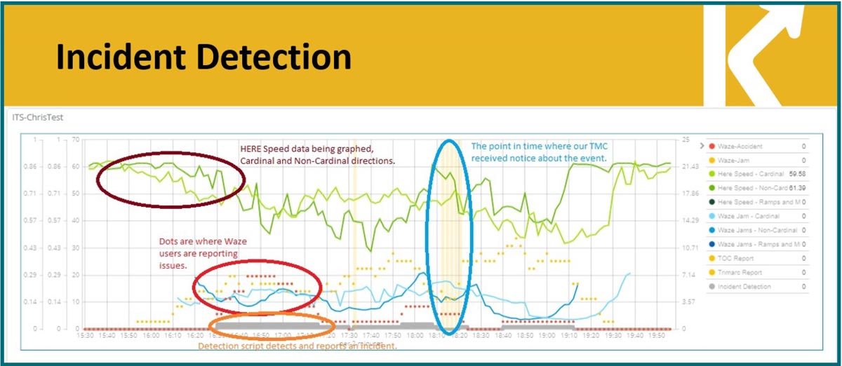 Figure 27. Chart. Integration of HERE, Waze jams, and Waze alert data. Source: Jason Siwula Summit Presentation 8 I-95 Corridor Coalition. CAD and TMS Integration Workshop Summary Report (April 2018)."What Agencies Need to Do to Integrate Data from Computer-Aided Dispatch into Traffic Information Management Systems." [Return to note 8] |
|
United States Department of Transportation - Federal Highway Administration |
||