Tonnage on Highways, Railroads, and Inland Waterways: 2011- 2012 Map
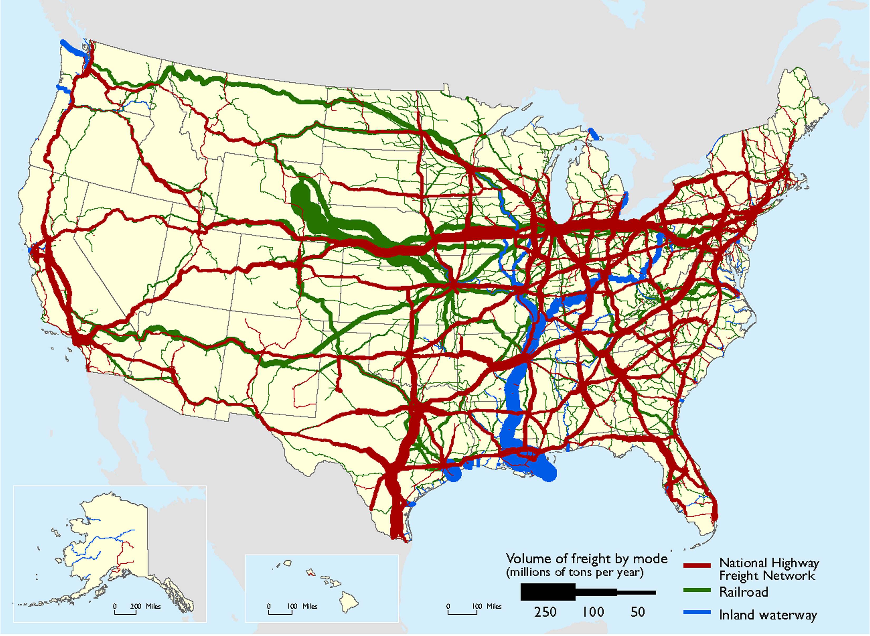
 U.S. map showing truck tonnage on National Highway Freight Network (NHFN) throughout the country, while rail volume is concentrated between the Powder River Basin in Wyoming and the Midwest, and inland waterway volume is concentrated along the Lower Mississippi River.
High-Resolution Images
Sources
Highways: U.S. Department of Transportation, Federal Highway Administration, Freight Analysis Framework, Version 4.2, 2016; Rail: Federal Rail Administration, 2013 Annual Carload Waybill Sample; Inland Waterways: U.S. Army Corps of Engineers, Navigation Data Center, Waterborne Commerce Statistics Center, 2012 Waterway Network Link Commodity Data.
PDF files can be viewed with the Acrobat® Reader®