Efficient Use of Highway Capacity Summary
Report to Congress
Chapter 2: Context and Findings
Congestion in urban areas in the United States is increasing. It occurs on more roads during longer parts of the day, delaying more travelers every year. (6) The "rush hour" grows longer and costs Americans dearly in the form of delay, increased fuel consumption, lost productivity, and related crashes. Congestion interferes with daily life, and any method to alleviate it, such as managed lanes projects, can help reduce its impact on productivity. Another reality of improving the transportation infrastructure today is that agencies must function within environmental constraints. Agencies must consider the environment in the planning of transportation projects, minimize the negative impacts of construction, and work to reduce transportation-related pollution in the process. They must demonstrate environmental stewardship and improve the environmental quality of their transportation decision making. (7)
Congestion Management and Mitigation
Congestion management is a primary operational strategy that U.S. agencies use to operate their facilities. As illustrated in Figure 3, a variety of factors, both recurring and non-recurring in nature, cause congestion for American travelers. Thus, FHWA has designated congestion mitigation as one of its top priorities and is targeting resources on developing and sustaining regional partnerships to address all aspects of congestion. (8)
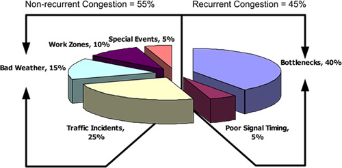
Figure 3. Graph. Causes of Congestion in the United States. (8)
Various operational and management strategies and methods exist for mitigating congestion and its impact on roadway users. For example, to combat recurring congestion in the highway environment, which accounts for approximately 45 percent of all congestion in the United States, agencies undertake freeway management and traffic operations through policies, strategies, and actions to enhance mobility on highway and freeway facilities. (8) These strategies include but are not limited to roadway improvements such as widening and bottleneck removal, operational improvements, ramp management and control, managed lanes, and ATM. Mitigation techniques for non-recurring congestion include incident management, work zone management, road weather management, and planned special events management. (8) All of these strategies center around the theme of increasing the efficient use of existing facilities. The following sections highlight two major categories of operational strategies that can be considered for deployment in shoulder use situations where capacity increases are not possible: managed lanes and ATM.
Managed Lanes
The term "managed lanes" refers to an array of lane management strategies. These lanes are managed through the application of pricing, vehicle eligibility, or access control to expedite the flow in that lane. Figure 4 illustrates the potential lane management strategies that fall into this broad definition of managed lanes. On the left of the diagram are the applications of a single managed lanes operational strategy—pricing, vehicle eligibility, or access control. In the middle of the diagram are the more complicated managed lanes facilities that combine more than one of the strategies. The multifaceted facilities on the far right of the diagram are those that incorporate or combine multiple lane management strategies.
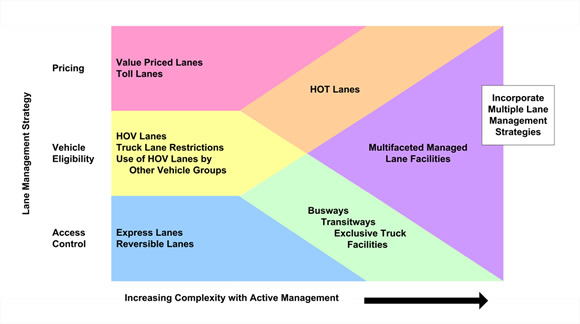
Figure 4. Graph. Lane Management Operational Strategies. (9)
According to FHWA, the distinction between managed lanes and other traditional forms of freeway lane management is the operating philosophy of "active management," where the operating agency proactively manages demand and available capacity on the facility by applying new strategies or modifying existing strategies to meet pre-defined performance thresholds. (10) It is important to note that this definition does not preclude active management on other lanes in the roadway network.
Active Traffic Management
A 2006 FHWA-sponsored International Scan Tour of Europe (FHWA Scan Tour) examined the congestion management programs, policies, and experiences of other countries that are either in the planning stages, have been implemented, or are operating on freeway facilities. This scan sought information on how agencies approach highway congestion and how they are planning for and designing managed lanes at the system, corridor, and project or facility level. The FHWA Scan Tour revealed a complete package of strategies that make up the broader concept of active traffic management. This approach to congestion management is a more holistic approach and is considered the next step in congestion management of freeway corridors.
The FHWA Scan Tour defined ATM as the ability to dynamically manage recurrent and non-recurrent congestion based on prevailing traffic conditions. (1) Similarly, the Transportation Research Board Joint Subcommittee on ATM defines it as the ability to dynamically manage traffic flow based on prevailing traffic conditions. (11) Focusing on trip reliability, the goal is to maximize the effectiveness and efficiency of the facility under both recurring and non-recurring congestion as well as during capacity reductions involving incidents or road work. Through the flexible use of the roadway, ATM aims to increase system performance as well as traveler throughput and safety through the use of strategies that actively regulate the flow of traffic on a facility. (11) ATM strategies can be automated, combined, and integrated to fully optimize the existing infrastructure and provide measurable benefits to the transportation network and the motoring public. Typical ATM strategies within the freeway context include bus operation on roadway shoulders, temporary shoulder use on freeways by general traffic or high occupancy vehicle s (HOV), speed harmonization, queue warning, dynamic rerouting, ramp metering, and interchange junction control. This report focuses on the first two of these strategies.
Shoulder Use—The European Experience
In Europe, part-time shoulder use is a congestion management strategy typically deployed in conjunction with complementary traffic management strategies – such as variable speed limits (speed harmonization) and/or ramp metering – to address capacity bottlenecks on the freeway network. European implementers include The Netherlands, Germany, and Great Britain. The strategy provides additional vehicle-moving capacity during times of congestion and reduced travel speeds. The use of the exterior shoulder during peak travel periods has been used in Germany since the 1990s as illustrated in Figure 5. (12) When travel speeds are reduced, dynamic signs over or next to the shoulder indicate that travel on the shoulder is permitted.
A complete series of traffic signs indicate operations related to temporary shoulder use, including one with a supplemental speed limit indication (used when overhead gantries are not present). These signs and the overhead lane messages are blank when travel on the shoulder is not permitted. Temporary shoulder use is permitted only when speed harmonization is active and speed limits are reduced, thus providing an operating environment only when speeds are managed below posted levels.
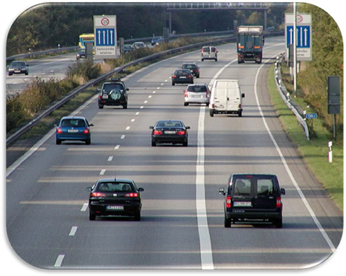
Figure 5. Photo. Temporary Shoulder Use—Germany (13)
Generally, implementation of temporary shoulder use is at the discretion of the traffic management center operator, although traffic volumes help determine the need for the strategy. A typical installation in Europe incorporates a number of unique roadway features, which can include:
- Lightweight gantries.
- Lane control signals.
- Dynamic speed limit signals.
- Dynamic message signs.
- Automated enforcement technology.
- Closed-circuit television cameras.
- Enhanced lighting.
- Roadway sensors.
- Emergency roadside telephones.
- Advanced incident detection.
- Intensified incident management.
- Emergency refuge areas or pull-outs beyond the shoulder. (1)
Operation of the system is handled by the regional control center, with operators on hand to monitor the system and initiate the modified operations as necessary. Specifically, operators use closed-circuit television cameras (CCTVs) mounted on lightweight sign gantries or separately to check for incidents and stalled vehicles in the shoulder before activating the system.
In Great Britain, the first deployment of temporary shoulder use was part of a comprehensive traffic management system that also involved speed harmonization. Figure 6 shows the installation of the temporary shoulder use including a critical component, which is the installation of emergency refuge areas at 500-meter (m) intervals along the shoulder, each equipped with an emergency call box.
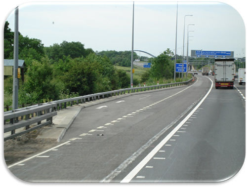
Figure 6. Photo. Shoulder Use with Emergency Refuge Area—Great Britain. (1)
Plus Lane
The Netherlands, in addition to allowing temporary use of the right shoulder, also deploys temporary use of the left shoulder under congested conditions, as shown in Figure 7. The left lane, or plus lane, is opened for travel use when traffic volumes reach levels that indicate congestion is growing. As in Germany, temporary use of the left lane is allowed only when speed harmonization is in effect. Additional facilities implemented to mitigate any adverse safety consequences of temporary shoulder use include overhead lane signs, emergency refuge areas with automatic vehicle detection, speed reduction, variable route signs at junctions, advanced incident detection, CCTV surveillance, incident management, and public lighting. (14)
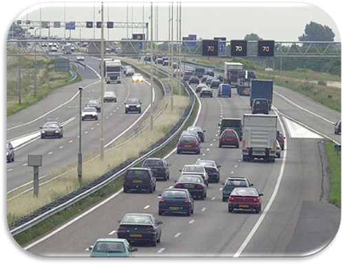
Figure 7. Photo. Plus Lane—The Netherlands. (1)
Junction Control
A variation of temporary shoulder use deployed in Germany is junction control, a combination of ramp metering and lane control at on-ramps. (15) Typically, the concept is applied at entrance ramps or merge points where the number of downstream lanes is fewer than upstream lanes. A graphic illustrating the concept is shown in Figure 8.
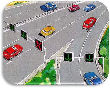
Figure 8. Graphic. Junction Control Schematic in Germany. (16)
In Europe, these strategies for managing recurrent congestion work to improve traffic flow and safety. The following is a summary of the three countries that are the main users of this strategy in Europe.
The Netherlands
The Netherlands implemented temporary right shoulder use—also known as hard shoulder running or the rush hour lane—in 2003 as part of a larger program to improve use of the existing infrastructure. Operated by the National Traffic Control Center (NTCC) and regional control centers since 1981, temporary shoulder use is utilized on more than 1,000 km (620 mi) across The Netherlands. Typically, a gantry with lane control signals indicates when the shoulder is available for use. Where a shoulder lane passes through a junction and at the end of a hard shoulder running section, guidance information will change according to lane use. (14) In addition to allowing temporary use of the right shoulder, the Dutch also deploy the use of traveling on a dynamic lane on the median side of the roadway. This treatment—also known as the plus lane—is a narrowed extra lane provided by reconstructing the existing roadway while keeping the hard shoulder and is opened for travel use when traffic volumes reach levels that indicate congestion is growing. Deployment is automated based on field data and is initiated automatically based on an assessment algorithm, requiring no intervention by an operator. It only operates during time periods of congestion or when incidents occur along instrumented roadways.
Germany
Since 1996, Germany has deployed temporary shoulder use—also known as hard shoulder use—to provide additional capacity during times of congestion and reduced travel speeds. Operated by the Federal Ministry of Transport and regional traffic management center on more than 200 km of roadways across the country, temporary shoulder use is only deployed in conjunction with speed harmonization (also known as line control) when maximum allowable speeds are 100 km/hr (62 mph) and if dynamic message signs are used for lane control. The deployment of the variable speed limits is automated based on field data and is initiated automatically based on an assessment algorithm, requiring no intervention by an operator.
Great Britain
Temporary shoulder use in Great Britain is deployed as part of an overall operational ATM scheme. Operated by the Highways Agency since 2006, temporary shoulder use is only deployed in conjunction with variable speed limits and when speeds are reduced (initially to 50 mph). Deployment of variable speed limits is automated based on field data and is initiated automatically based on an assessment algorithm, requiring no intervention by an operator. It only operates during time periods of congestion or when incidents occur along instrumented roadways, and between junctions, requiring users to exit at each junction and reenter the roadway beyond.
Shoulder Lanes—The American Experience
In the United States, the primary use of shoulders has been as a safety refuge area. The limited shoulder use as a travel lane has been primarily reserved for special users of the roadway system, most often transit vehicles. Some shoulder use dates back to the 1970s, and many installations have been in operation for more than 10 years to address congestion on urban corridors. (17) Agencies have seen bus use of shoulders as a low-cost and quick strategy to improve bus operations and reliability without having to acquire additional right-of-way and invest additional large sums of money into the infrastructure. The length of these deployments varies depending on location, ranging from a more than 290-mi comprehensive network in the Minneapolis-St. Paul metropolitan area to deployments less than 1 mi in length used to serve as a queue jump for transit in Delaware. The operational strategies often depend on the congestion on the general purpose lanes and often require speed restrictions of the transit vehicles using the shoulders. (17) Overall, experience using shoulders for interim use has been positive in the United States, and more agencies are considering the strategy to address growing congestion on their urban freeway networks. In fact, several States have deployed temporary shoulder use for all vehicles on congested corridors with success. Another application that is much more difficult to research and document is the number of locations where an existing shoulder has been narrowed or taken away to allow for widening with an extra permanent travel lane. This method is more commonly used in roadway work zones to maintain the existing number of travel lanes during construction. However, it has been applied in some permanent forms as well. The following sections briefly describe the shoulder use treatments deployed in the United States and provide summary details about the deployments of those treatments in specific States.
Bus on Shoulders
Bus on shoulders (BOS) programs, generally considered special-use applications of dedicated shoulder lanes, are most often implemented as a means of increasing the reliability of transit service in congested corridors in order to encourage increased use by the public. The BOS programs are operational on over 290 mi of freeways and arterials in the Minneapolis metropolitan area. Shown in Figure 9, this operational strategy is generally a low-cost and quickly implemented solution that does not require costly expansion of highway right-of-way. It may be implemented on both highway and arterial corridors, but arterial BOS applications must often rely on additional operational treatments such as signal prioritization in order to maintain a time advantage over automobile travel. In addition to Minneapolis, BOS programs are operational in the States of Virginia, Maryland, Washington, New Jersey, Georgia, Delaware, Florida, and California; in Canada (Vancouver, Toronto, and Ottawa); and in Ireland and New Zealand. (17)
Besides stand-alone BOS operations, BOS may also be implemented in conjunction with a separated managed lane facility. Bus lines running a station-stopping operation along a median HOV or high occupancy/toll (HOT) lane may benefit greatly from the implementation of a BOS program. Such routes often make frequent stops at intervals of less than a mile between successive stops, which can pose significant problems with regards to weaving into and out of the HOV or HOT lane facility they access. This weaving can cause backups and disruptions on both the interior managed lane facility as well as the adjacent general purpose lanes. A BOS program ensures that buses can achieve significant travel time savings without the need to enter the interior managed lane facility and weave through general purpose traffic to enter or exit an interior managed lane. The following sections summarize the deployments of BOS in operation across the United States.
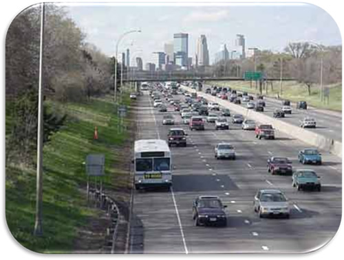
Figure 9. Photo. Bus on Shoulders—Mn/DOT (Photo courtesy of Mn/DOT).
California
In San Diego along I-805/SR 52, transit vehicles may use the freeway shoulder during congested periods. Initiated in 2005, this application was intended to increase transit speeds and to improve schedule reliability. Operating agencies are the California Department of Transportation (CALTRANS) and the San Diego Association of Governments. Transit vehicles may use the shoulder when general purpose lane traffic slows to 30 mph or lower. They may travel no more than 10 mph faster than traffic in general traffic lanes. The cross-section of the shoulder is at least 10-ft wide throughout the deployment area. Pavement markings to indicate the operational strategy include text indicating "Transit Lane Authorized Buses Only." (17)
Delaware
Along US 202 in Wilmington, Delaware, buses are allowed to use an arterial shoulder. Operational for many years, this treatment is intended to provide a southbound queue jump along a 1,500-ft-long section of the facility, which includes an intermediate signal. The application provides priority for transit vehicles bound for I-95. Operational 24/7, the treatment is denoted with the diamond symbol on the pavement and lane control signals over the shoulder. (17)
Florida
The Florida Department of Transportation, Miami Dade Transit, and the Miami Dade Expressway Authority operate several shoulder use applications in the Miami region. Along the Florida Turnpike, SR 826, and SR 836, buses are allowed to use the shoulder when the freeway is congested. Implemented in 2005, the program stipulates that buses may travel no faster than 35 mph on the shoulder when open to transit. The typical cross-section is a minimum 10-ft width with a 12-ft width in high volume areas and cross slopes of 2 percent to 6 percent. Pavement markings indicate "Watch for Buses on Shoulder." (17)
Georgia
Alpharetta, Georgia (suburban Atlanta), is another location where shoulder use is available to transit. On GA 400, buses are allowed to use the freeway shoulder in an effort to provide access between a Metropolitan Atlanta Rapid Transit Authority rail station at North Springs and a park-and-ride lot at Mansell Road. In operation since 2005, the 12-mi facility allows transit vehicles to save between 5 and 25 minutes during heavily congested periods. The Georgia Regional Transportation Authority and Georgia Department of Transportation operate the facility, which is functional whenever traffic slows to 35 mph or slower. Buses can travel no more than 15 mph faster than general purpose lane traffic and are required to reenter general traffic lanes before interchanges. The installation cost 2.8 million dollars in order to widen the shoulder by 2 ft and to provide reinforcement of the shoulder pavement. (17)
Maryland
Two shoulder use applications are in operation in Maryland. The first, along US 29 in Burtonsville, is an arterial shoulder application in both the southbound and northbound directions of the corridor. The 4-mi arterial highway segment provides shoulder use queue jumps at several signalized junctions for transit users. Operational for years, the treatment operates Monday–Friday from 6:00 a.m. until 9:00 a.m. in the southbound direction and from 3:00 p.m. until 8:00 p.m. in the northbound direction. The second treatment, in Bethesda, provides buses with a shoulder queue jump in the northbound direction of I-495 at the I-270 interchange. This queue jump is about 3 mi in length and has been operational for years. The intent of the treatment is to allow transit vehicles to bypass congestion at the I-270 interchange. Hours of operation are Monday–Friday, 6:00 a.m.–9:00 a.m. and 3:00 p.m.–7:00 p.m. The maximum allowed speed on the shoulder is 55 mph. (17)
Minnesota
The Minneapolis-St. Paul region has a comprehensive network consisting of over 290 mi of BOS operations on freeways and arterials, on sections with ramp meters, and in rural and urban areas. The BOS deployments are along segments as small as 0.3 mi to up to 9 mi in length. Initially deployed in 1992 and still being expanded, these deployments are intended to encourage transit use and to fully utilize the capacity of the metropolitan highway system. The operational partners of these facilities include the Minnesota Department of Transportation (Mn/DOT), Metro Transit and other transit agencies in the region, charter bus companies, Minnesota State Patrol, and local police departments. The operational strategy is considered interim, and some deployments have been removed since their inception. When operational, buses must yield to any vehicle entering, merging, or exiting through the shoulder. Buses must reenter the main lanes when the shoulder is obstructed. Typically, buses may use the shoulder any time that traffic in the adjacent mainlines is moving at less than 35 mph. Buses may travel no more than 15 mph faster than mainline traffic with a 35 mph maximum allowed speed on the shoulder. The typical cross-section is 10-ft minimum, 11.5-ft minimum at bridges, and 12-ft minimum on new construction. Typically, buses travel through the entrance and exit ramps; where queues are long at ramps with metering, buses typically merge with traffic on the ramp and return to the shoulder after the ramp. (18)
New Jersey
In Mountainside, New Jersey, along Route 22, buses are allowed to use the shoulder of the arterial in the eastbound direction during congested periods. Operational for years, this shoulder use treatment was intended to allow transit vehicles to save travel time along the corridor toward Perth Amboy for about 1 mi. The facility is operated by the New Jersey Department of Transportation, and pavement markings indicate "Buses May Use Shoulder." (17)
Virginia
The Dulles Access Highway (Route 267) in Falls Church, Virginia, provides buses with an eastbound queue jump along a 1.3-mi segment. Operational for years, the treatment helps ease congestion for buses during the evening commute and facilitates bus access to the West Falls Church Metrorail station. Operated by the Virginia State Police, the Metropolitan Washington Airports Authority, and the Virginia Department of Transportation (VDOT), the shoulder treatment is available Monday–Friday from 4:00 p.m. until 8:00 p.m. The maximum allowed speed for buses on the shoulder is 25 mph. (17)
Washington
Along SR 520 in the Seattle, Washington, region, buses and carpools of at least three people may use the freeway shoulder in the westbound direction from I-405 to the Evergreen Bridge over Lake Washington. Operational since the 1970s, this 2.7-mi application operates 24 hours a day, 7 days a week. Buses can travel at the same speed as other general purpose lanes, but must merge with regular traffic at interchanges. The typical cross-section of the shoulder is 13-14 ft. (17)
Dedicated Shoulder Lanes
Since the 1950 publication of the Highway Capacity Manual and 1957 AASHTO Red Book, 12-ft shoulders have been the interstate design standard for urban freeways. (19) Furthermore, a minimum of 4.5-ft lateral clearance is required, with 6–8 ft recommended in the vicinity of pier structures. However, by the 1980s, in response to rising levels of congestion and a lack of right-of-way for contemporary expansion of capacity, many States adopted the use of dedicated shoulder lanes, sometimes in conjunction with or instead of narrowed lane widths. (20) By the 1990s, only four States had chosen to extensively use shoulders and/or narrow lanes on freeways: California (Los Angeles and Bay Area), Texas (Houston), Virginia (Fairfax County), and Washington (Seattle). Figure 10 shows a converted shoulder lane in California.
Figure 10. Photo. Converted Shoulders on I-5—California (Photo Courtesy of CALTRANS).
In dedicated shoulder-lane operations, either general purpose or HOV-specific capacity has been added through the permanent conversion of shoulders. Most HOV applications use the interior lane for HOV operations, while the exterior shoulder is used for general purpose traffic so as to maintain the same number of general purpose lanes that existed prior to implementation. A typical HOV application would convert a three-lane freeway with 12-ft lanes, 10-ft exterior shoulder, and 8-ft interior shoulder to 11-ft general purpose lanes, 14-ft (including buffer striping) HOV lane, 5-ft exterior shoulder, and 2-ft interior shoulder. (21)
In addition to HOV and general purpose capacity, additional existing uses of shoulders include auxiliary lanes, either between interchanges or in merge zones (particularly those that impede upstream traffic on the mainline); lane balancing requirements through bottlenecks; and creation of uniform lane widths. (19)
In most of the above conditions, the shoulders have been converted to general purpose capacity, at least for a short distance. However, in a few applications, the implementing agency has attempted to recover use of the shoulder for refuge purposes during some portions of the day. On Massachusetts State Route 3 and I-93 and I-95 in the Boston area, all vehicles are permitted on shoulders in the peak periods only. Similarly, in Virginia on I-66 (as shown in Figure 11), the shoulder carries general purpose traffic from 5:30 a.m. –11:00 a.m. (eastbound) and 2:00 p.m.–8:00 p.m. (westbound); however, during this time, the interior general purpose lane is open to HOV traffic only. I-66 uses extensive traffic signals and signage in order to communicate the active times of service. In the Seattle area, the right shoulder on the US 2 trestle near Everett is opened to all traffic in the eastbound direction during the afternoon peak period. A similar operation is provided on H1 in Honolulu in the morning peak on the right shoulder. The following sections provide a summary of those States where temporary shoulder use is available for all vehicles during congested periods.
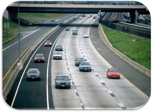
Figure 11. Photo. I-66 HOV/Shoulder Lane Adaptation—Virginia (Photo Courtesy of VDOT).
Florida
As part of an Urban Partnership Agreement project, the Florida Department of Transportation (FDOT), the Miami-Dade MPO, the Broward MPO, Miami-Dade Transit, Broward County Transit, the Miami-Dade Expressway Authority, and the Florida Turnpike Enterprise have incorporated a shoulder into the I-95 Express lanes in Miami. (22) The objective of the project is to provide free-flowing conditions on the managed-lane network and to provide a network of managed lanes throughout the congested region. Between I-395 and I-595, FDOT converted the existing single- lane HOV lane to a two-lane HOT facility by reducing multiple general purpose and HOT lane widths to 11 ft and narrowing the shoulder. The new lanes allow registered vanpools, registered carpools of three people, registered hybrid vehicles, motorcycles, and buses to travel at no charge. All other vehicles with the exception of trucks with three or more axles may pay a toll to use the lanes. With initial sections opening in 2008, the facility uses variable pricing based on demand, and maximum allowed speeds are 55 mph. Operational regulations and toll rates are displayed on overhead electronic signs. The overall cost of the project is 43.4 million dollars. Florida's Turnpike Enterprise enforces toll violations using license plate photographs. The Florida Highway Patrol enforces occupancy requirements using visual inspection. Incident management is handled by the Road Rangers motorist assistance patrol and the Florida Highway Patrol. Outreach efforts for the project include project Web sites, public meetings, media campaigns, and the production of videos.
Hawaii
In Honolulu, Hawaii, the Hawaii Department of Transportation deploys temporary shoulder use on H1 in the morning peak. The intent is to provide congestion relief and added capacity during the morning rush hour in the eastbound direction.
Massachusetts
Various facilities in the Boston area utilize temporary shoulder use during peak travel periods. (23) On I-93, SR 3, and I-95, all vehicles except heavy trucks may use the freeway shoulder during either the morning and/or evening peak depending on the facility. The objective of these treatments is to increase capacity. When the treatment was initiated, congestion on these facilities was to the point where traffic during the peak period was at a standstill and drivers were already using the shoulders. The Massachusetts Department of Transportation (MassDOT), Massachusetts State Police, and Commerce Insurance Courtesy Patrol all assist with the operation of the facility. With each deployment, MassDOT sought approval from FHWA to seek implementation as a temporary measure until funding and approval is obtained for widening. However, each project when constructed was treated as a traditional widening with drainage being moved to the new edge of the pavement and guardrails and fixed object shielding being moved accordingly as well. The typical design is a 10-ft minimum width and a 12-ft desirable width. Rumble strips were removed and scored concrete and block pavers removed as well. Emergency pull-outs are located approximately every ½ mi along the deployment sections.
Minnesota
In Minneapolis along I-94, the freeway shoulder was opened to all traffic in 2007 in response to the bridge collapse on I-35 W. (24) All vehicles were allowed to use the shoulder, which was originally only available to transit vehicles during peak periods. The objective of the treatment was to reduce congestion levels to pre-bridge collapse conditions by providing additional capacity through utilization of existing shoulders. Operational at all times, the shoulder provides an 11-ft travel lane with no additional shoulder on the right side. Traditional lane skip stripe and right shoulder markings are installed, and the existing BOS signs were removed. Incident response along the facility is handled by the Freeway Incident Response Safety Team (FIRST) led by Mn/DOT. Patrols were increased in the area once all vehicles were allowed to use the shoulders.
Virginia
In the suburban Washington, D.C., area, all vehicles are allowed to use the right shoulder on I-66 during peak periods. (25) Originally opened in 1992, the VDOT allows vehicles to use the eastbound shoulder from 5:30 a.m. until 11:00 a.m. and the westbound shoulder from 2:00 p.m. until 8:00 p.m. The treatment was initially installed as a stop-gap measure to add capacity because of the opening of the HOV lane, where the left lane was taken. However, it has become a long-term strategy because of funding shortfalls. Maximum allowed speeds are 55 mph, and the shoulder provides a 12-ft travel lane. An overhead lane control system is operational to indicate to motorists that the shoulder is open. Post-mounted signs also provide notification and termination of restricted use and indicate the presence of emergency pull-off areas. The VDOT hires a contractor for general maintenance of the facility, while VDOT maintains the Intelligent Transportation System (ITS) installation. Incident clearance time is within 90 minutes 90 percent of the time, as typical for the region.
Washington
Along US 2 in Seattle, the Washington State Department of Transportation (WSDOT) opened the freeway shoulder to all traffic in the eastbound direction of the trestle. (26) The objective of the treatment was to improve travel times on the trestle, to reduce impacts of bottlenecks, and to relieve congestion at a critical interchange. The restriping along the 1.55-mi segment allows three different movements to remain in their own lanes when shoulder use is allowed. It also minimizes weaving so that each destination from the trestle (SR 204, 20th St SE, and US2 eastbound) can be reached from a separate lane when shoulder use is allowed. The WSDOT considers the application permanent for the near future as it should be able to accommodate traffic growth over the next few years. Hours of operation are Monday–Friday, 3:00 p.m. to 7:00 p.m. Maximum allowed speeds are 60 mph. The trestle was restriped with a 2-ft left shoulder, two 11-ft lanes, and one 14-ft right shoulder.
Priced Dynamic Shoulder Lanes
A unique combination of strategies is operational on I-35W in Minneapolis where a segment has the left shoulder open during the peak periods. Known as priced dynamic shoulder lanes (PDSL), transit and carpools use the shoulder for free and MnPASS customers can use the shoulder for a fee. As shown in Figure 12, Figure 13, and Figure 14, the left shoulder is open to traffic, with overhead sign gantries indicating its operational status. When the general purpose lanes become congested, the shoulder is opened and the speed limit on the general purpose lanes is reduced.
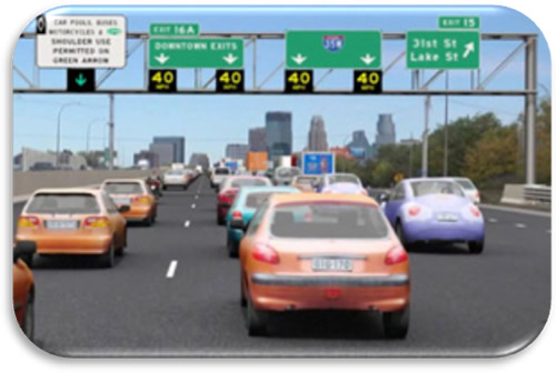
Figure 12. Graphic. Open Priced Dynamic Shoulder Lane—Minneapolis, Minnesota. (27)
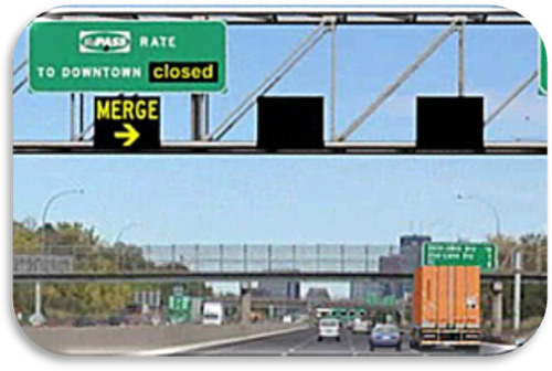
Figure 13. Graphic. Closing Priced Dynamic Shoulder Lane—Minneapolis, Minnesota. (27)
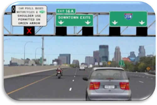
Figure 14. Graphic. Closed Priced Dynamic Shoulder Lane—Minneapolis, Minnesota. (27)
Minnesota
In Minneapolis, Mn/DOT converted a segment of the left shoulder on I-35W from BOS operations to a priced dynamic shoulder lane open to all vehicles. Opened in 2009 as part of Mn/DOT's Urban Partnership Agreement project, the section of I-35 between 42nd Street and downtown Minneapolis is open to buses, carpoolers, and MnPASS users during certain times when traffic is congested. (27) The objective of the project is to improve traffic flow using transit and tolling. The shoulder treatment was also deployed with variable speed limits on the general purpose lanes. Maximum allowed speeds are free-flow freeway speeds on the facility. The shoulder width varies from 17 ft to 19 ft between the barrier and the edgeline striping. Overhead gantries are spaced every ½ mi and include static signs and dynamic message sign (DMS) inserts indicating price and lane control signals. The cost of the deployment was 13 million dollars and included new pavement surface on all lanes in the area. The Minnesota State Patrol enforces the facility through visual inspection. The Mn/DOT is responsible for maintenance, and incident management response is primarily handled by the Minnesota State Patrol. Emergency pull-outs were installed along the right shoulder to facilitate emergency use. In terms of heavy vehicles, only two-axle trucks weighing less than 26,000 lbs can use the MnPASS Express Lanes.
Hurricane Evacuation Routes
Florida and Texas have incorporated the use of certain freeway shoulder lanes into Hurricane Evacuation Routes. These lanes are included in the Evacuation Route planning documents for full scale evacuations.
Complementary ATM Strategies
European applications of the use of shoulder lanes are typically accompanied by one or more ATM operational strategies for a more comprehensive control of the capacity. When these strategies are implemented in concert with temporary shoulder lanes, they fully optimize the existing infrastructure and provide measurable benefits to the transportation network and the motoring public. The more frequently used complementary strategies include speed harmonization and junction control. The following sections discuss these strategies to provide a framework for their impact on shoulder use for travel lanes.
Speed Harmonization
Speed harmonization helps manage traffic by posting speed limits on a roadway or over each lane on an advisory or regulatory basis in real time, sometimes referred to as variable speed limits in the U.S. This approach has been in use in Germany since the 1970s and is oriented toward improving traffic flow based on prevailing conditions. Similar installations are in operation in The Netherlands and Great Britain on various roadway sections with high traffic volumes. A typical installation of speed harmonization monitors traffic volumes and weather conditions along the roadway. If sudden disturbances occur in the traffic flow–such as with an incident or building congestion—the system modifies the speed limits upstream accordingly, providing users with the quickest possible warning that roadway conditions are changing. (28)
Figure 15 shows a typical installation of speed harmonization in The Netherlands. The deployment of the speed harmonization is automatic and begins immediately upstream of the congestion point; it does not require remote operator intervention. The system incrementally decreases speeds upstream in a cascading manner often in increments of 10 to 20 km/h to smooth the deceleration of the traffic and help ensure more uniform flow to offset what would otherwise be sudden queues emanating from the incident. When deployed with temporary shoulder use, this strategy works to minimize the speed differential between vehicles in the general purpose lanes and those on the shoulders. Such a combined operation helps to increase the uniformity of traffic flows and reduce the possibility of incidents due to erratic maneuvers and unpredictable driver behavior.
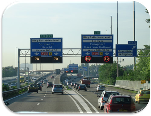
Figure 15. Photo. Speed Harmonization—The Netherlands.
Junction Control
A variation of temporary shoulder use—known as junction control in Germany—involves dynamic lane assignment. Typically, the concept is applied at entrance ramps or merge points where the number of downstream lanes is fewer than upstream lanes. (15) The typical U.S. application to this geometric condition would be a lane drop for one of the outside lanes or a forced merge of two lanes, both of which are static treatments. (29) The German dynamic solution is to install lane control signals over both upstream approaches before the merge (as shown previously in Figure 8), and provide downstream lane priority to the higher volume and dynamically post a lane drop to the lesser volume roadway or approach. This is particularly effective when implemented with temporary shoulder use at on-ramp locations where bottlenecks frequently form.
Chapter Summary
Many urban corridors in most large cities have been expanded to the extent feasible from subsequent widening projects, leaving few options to improving performance and efficiency other than ATM strategies. Limited resources require investments in strategies that generate greater efficiencies without requisite environmental or safety impacts. The current fiscal and physical environment lends itself to greater reliance on these strategies. Identifying potential active management projects and planning for them is a complicated process that involves numerous stakeholder groups. Addressing the interrelationships associated with these projects in the planning and development process is critical to their successful implementation and operation.
The summary of shoulder use applications provides a stark contrast between European and U.S. applications. Part-time shoulder use in Europe is exclusively done as part of a broad application of active traffic management strategies. The domestic applications have tended to be more ad-hoc and have much less consistency from one application to the next. The one exception is the PDSL in Minnesota, which has an active traffic management design.
(6) Schrank, D. and Lomax, T. The 2005 Urban Mobility Report. College Station, TX : Texas Transportation Institute, Texas A&M University System, 2005. Return to footnote 6.
(7) Federal Highway Administration. Fiscal Year 2003 Performance Plan. [Online] September 2002. https://www.fhwa.dot.gov/reports/2003plan/index.htm#natneed6. Return to footnote 7.
(8) —. Congestion Mitigation. [Online] U.S. Department of Transportation. https://ops.fhwa.dot.gov/congestionmitigation/congestionmitigation.htm. Return to footnote 8.
(9) Collier, T. and Goodin, G. Managed Lanes: A Cross-Cutting Study. College Station, TX : Texas Transportation Institute, Texas A&M University System, 2004. FHWA-OP-05-037. Return to footnote 9.
(10) FHWA Freeway Management Program, Office of Operations. Managed Lanes Initiative. [Online] U.S. Department of Transportation. https://ops.fhwa.dot.gov/freewaymgmt/managed_lanes.htm. Return to footnote 10.
(11) Transportation Research Board Joint Subcommittee on Active Traffic Management – AHB20(5). Definition of ATM. s.l.: Unpublished Committee Document, 2009. Return to footnote 11.
(12) BBC News World Edition. Creative ways to beat congestion. [Online] November 2004. http://news.bbc.co.uk/2/hi/uk_news/magazine/4044803.stm. Return to footnote 12.
(13) TLemke, K. and Irzik, M. Temporary Use of Hard Shoulders-Experiences and Economic Assessment. Bergisch Gladbach, Germany: Federal Highway Research Institute, Traffic Planning, Highway Design, and Safety Analyses Section, June 2006. Original photos courtesy of Autobahndirektion Sudbayern (South Bavaria). Presentation to Planning for Congestion Management Scan Team. Return to footnote 13.
(14) Helleman, B. Hard Shoulder Running (HSR) in The Netherlands. AVV Transport Research Centre, Rotterdam, The Netherlands: Ministry of Transport, Public Works, and Water Management, Directorate-General of Public Workds and Water Management, June 2006. Presentation to Planning for Congestion Management Scan Team. Return to footnote 14.
(15) Differt, D., et al. Managing Travel Demand: Applying European Perspectives to U.S. Practice. Alexandria, VA: American Trade Initiatives, 2006. FHWA-PL-06-015. Return to footnote 15.
(16) Bolte, F. Transport Policy Objectives: Traffic Management as Suitable Tool. Bergisch Gladback, Germany: Federal Highway Research Institute (BASt), June 2006. Presentation to Planning for Congestion Management Scan Team. Return to footnote 16.
(17) Martin, P. Bus Use of Shoulders. Washington, D.C.: Transportation Research Board, 2006. TCRP Synthesis 64. Return to footnote 17.
(18) Kuhn, B. Personal Interview with Mn/DOT Staff, Mn/DOT Metro District. 2009. Return to footnote 18.
(19) American Association of State Highway and Transportation Officials. A Policy on Geometric Design of Highways and Streets. 4th Edition. Washington, D.C.: AASHTO, 2004. Return to footnote 19.
(20) Urbanik, T. and Bonilla, C. R. California Experience with Inside Shoulder Removals. Transportation Research Record 1122. 1987. Return to footnote 20.
(21) McCasland, W. R. Use of Freeway Shoulders to Increase Capacity. Transportation Research Record 666. 1978. Return to footnote 21.
(22) I-95 Express Website. [Online] Florida Department of Transportation. http://www.95express.com. Return to footnote 22.
(23) Kuhn, B. Personal Interview with MassDOT Staff. 2009. Return to footnote 23.
(24) —. Personal Interview with Mn/DOT Staff, Regional Transportation Management Center. 2009. Return to footnote 24.
(25) —. Personal Interview with VDOT Staff. 2009. Return to footnote 25.
(26) —. Personal Interview with WSDOT Staff. [Online] October 2009. Return to footnote 26.
(27) Mn/DOT Urban Partnership Agreement Website. [Online] Minnesota Department of Transportation. http://www.dot.state.mn.us/upa/managed.html. Return to footnote 27.
(28) Hessen Road and Traffic Authority. Traffic Control Hessen, Hessen Road and Traffic Authority. Weisbaden, Germany: s.n., 2006. Return to footnote 28.
(29) Tignor, S., et al. Innovative Traffic Control Technology and Practice in Europe. Alexandria, VA: American Trade Initiatives, 1999. FHWA-PL-00-021. Return to footnote 29.