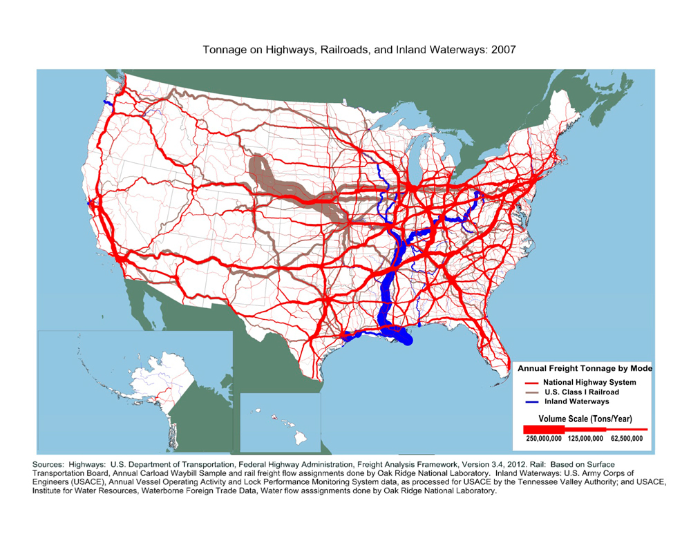
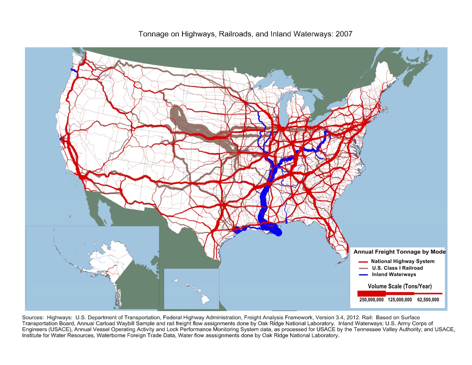
Tonnage on Highways, Railroads, and Inland Waterways: 2007 Map
High-Resolution Images
Sources
Highways: U.S. Department of Transportation, Federal Highway Administration, Freight Analysis Framework, Version 3.4, 2012. Rail: Based on Surface
Transportation Board, Annual Carload Waybill Sample and rail freight flow assignments done by Oak Ridge National Laboratory. Inland Waterways: U.S. Army Corps of Engineers (USAGE), Annual Vessel Operating Activity and Lock Performance Monitoring System data, as processed for USAGE by the Tennessee Valley Authority; and USAGE, Institute for Water Resources, Waterborne Foreign Trade Data, Water flow asssignments done by Oak Ridge National Laboratory.
![]() You will need the Adobe Reader to view the PDFs on this page.
You will need the Adobe Reader to view the PDFs on this page.