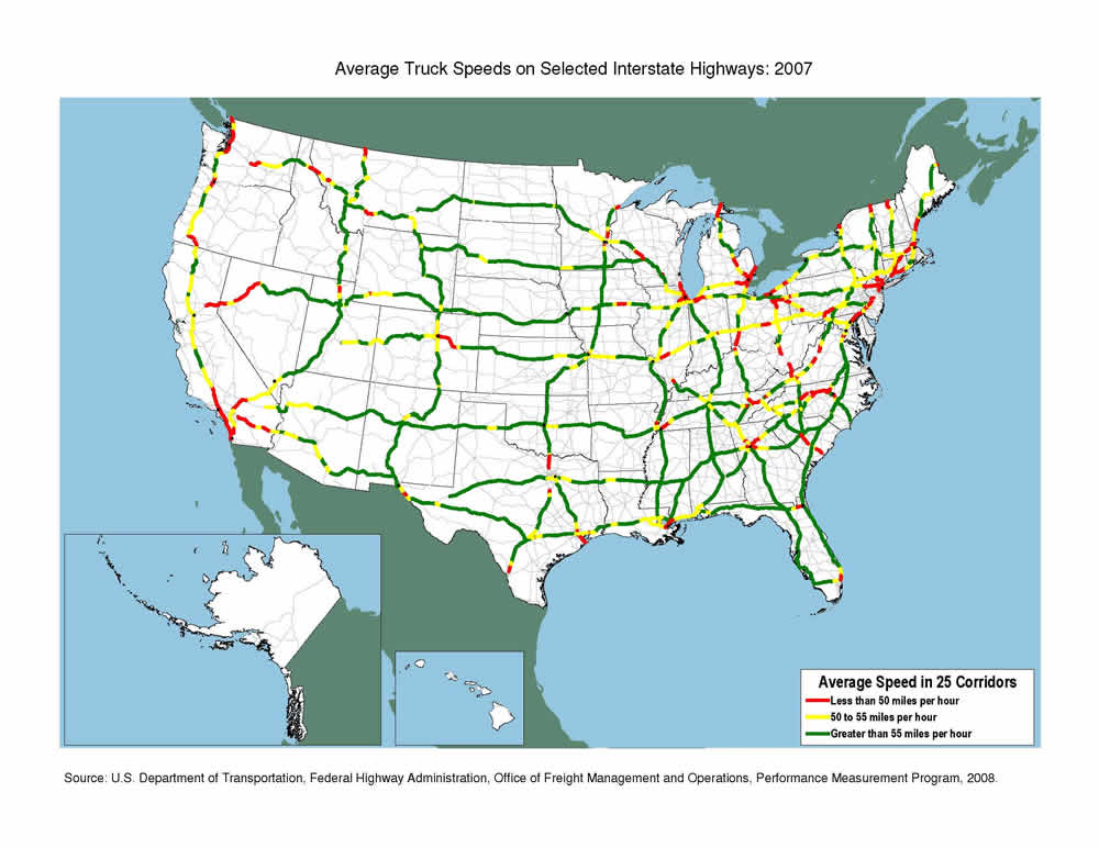
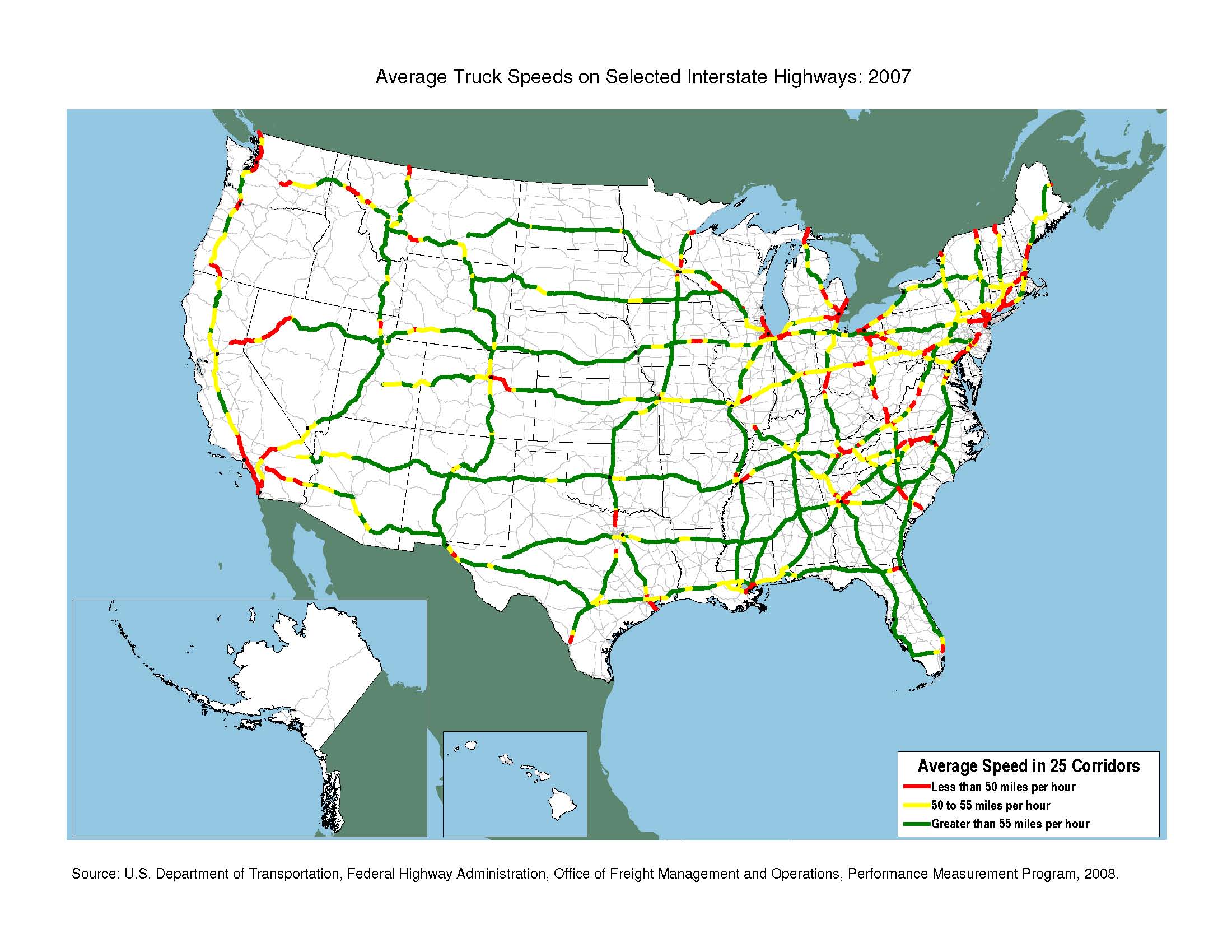
Average Truck Speeds on Selected Interstate Highways: 2007 Map
High-Resolution Images
Source
U.S. Department of Transportation, Federal Highway Administration, Office of Freight Management and Operations, Performance Measurement Program, 2008.
![]() You will need the Adobe Reader to view the PDFs on this page.
You will need the Adobe Reader to view the PDFs on this page.